
Search for another town


Free U.S. delivery 7 to 10 days after you order
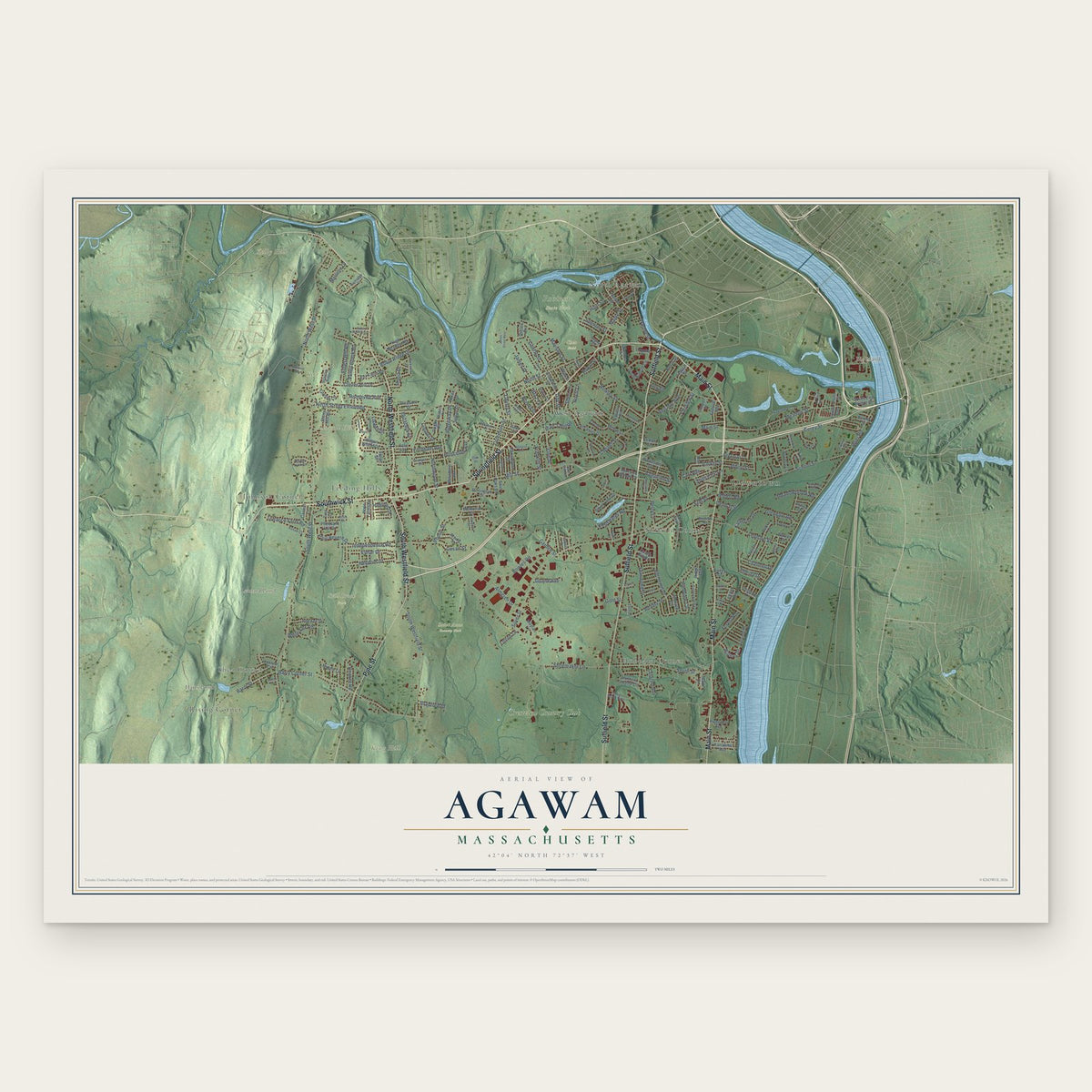
Agawam, Massachusetts Map Art
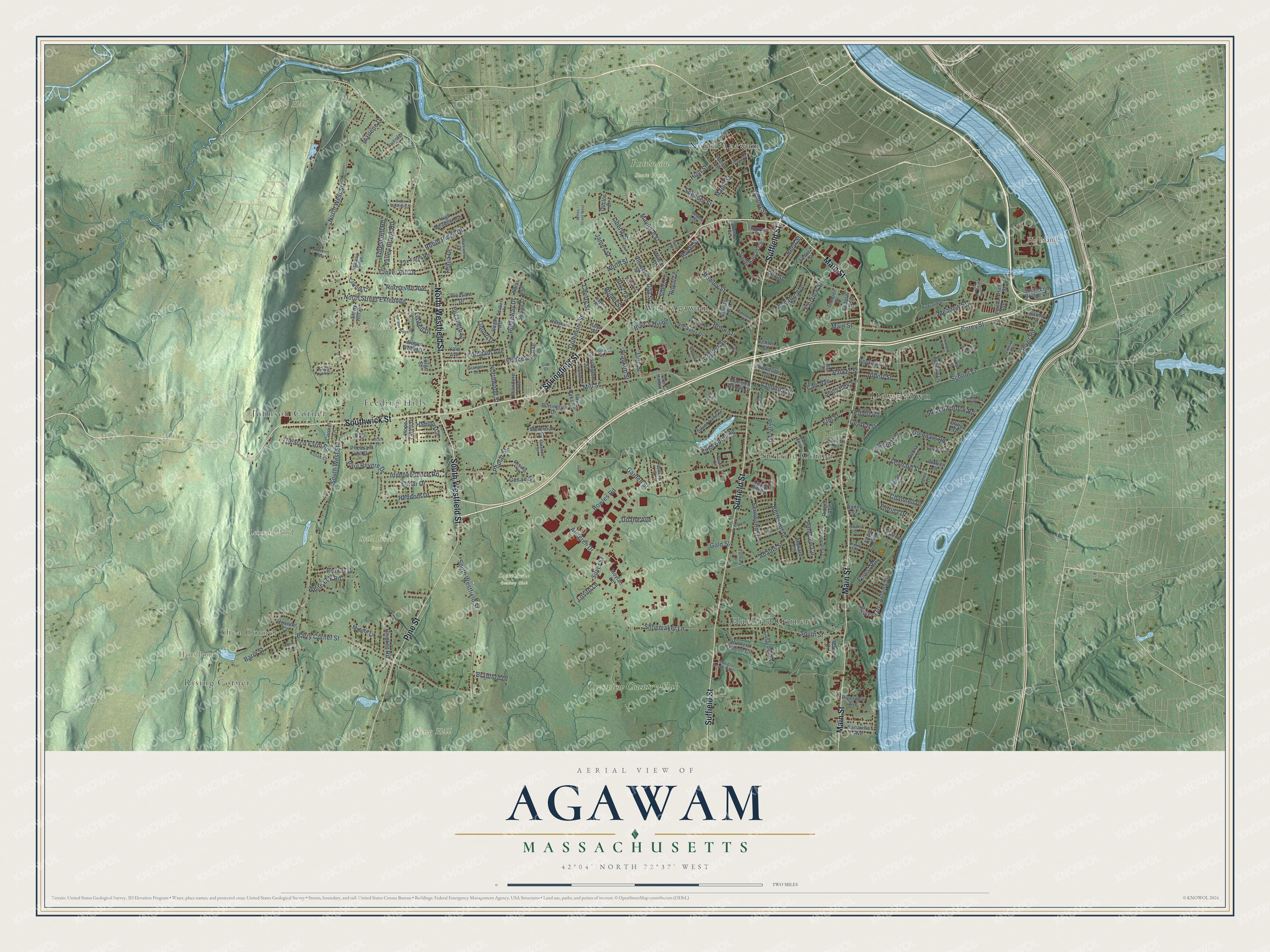
Building by building, with labeled streets and shaded relief.
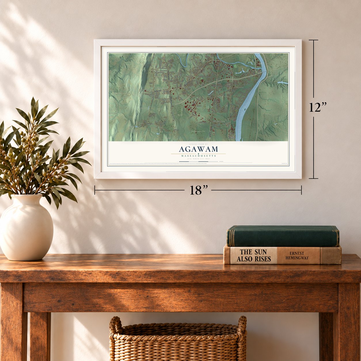
12" x 18" Archival Matte Print
A Map of Home. A Work of Art.
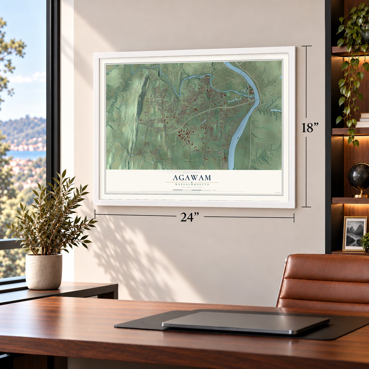
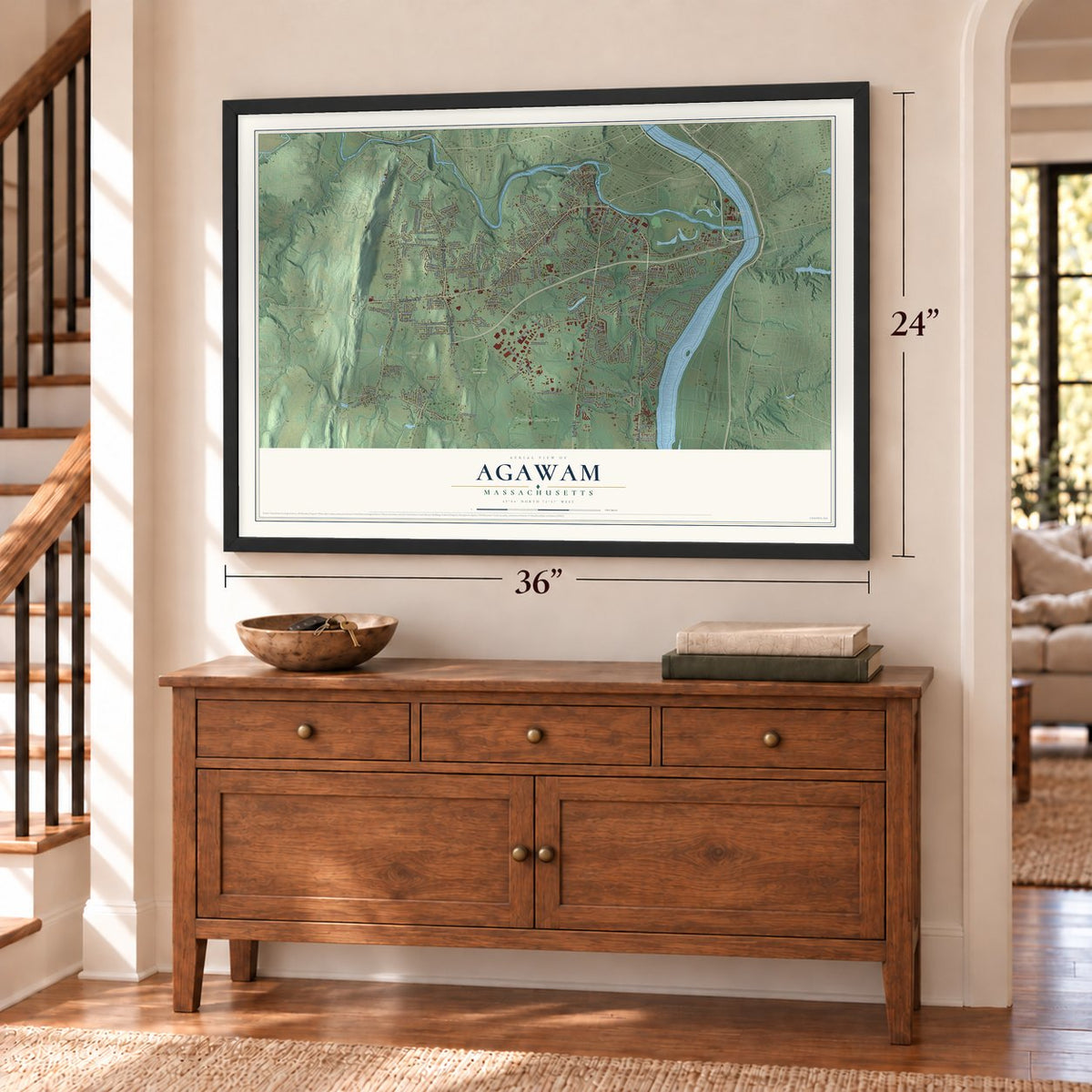
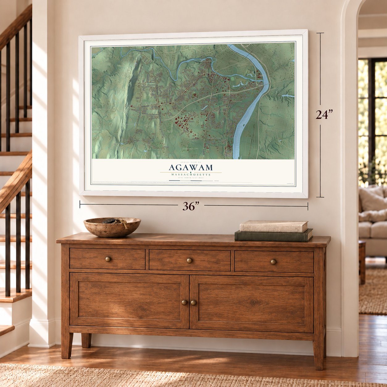
Explore Agawam, Massachusetts from a whole new perspective. Created using aerial imagery and detailed geographic data, this map captures Agawam building by building, with labeled streets, familiar landmarks, and shaded topographical relief that highlights the natural contours of the landscape.
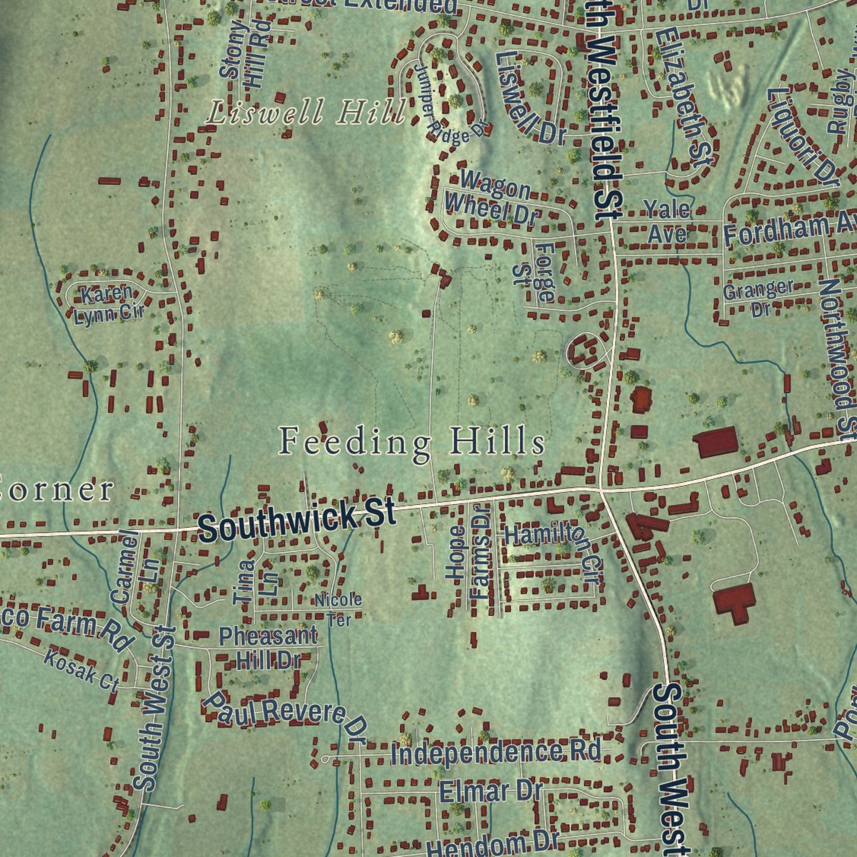
Combining modern data with the timeless character of a vintage atlas, this map is just as interesting up close as it is beautiful on the wall. Whether you grew up in Agawam, spent memorable years there, or call it home today, this unique map is a great way to celebrate a place that means something to you. Zoom in on the preview to look for your street, and then order a print to put your memories on the wall.
Three ways to hang it
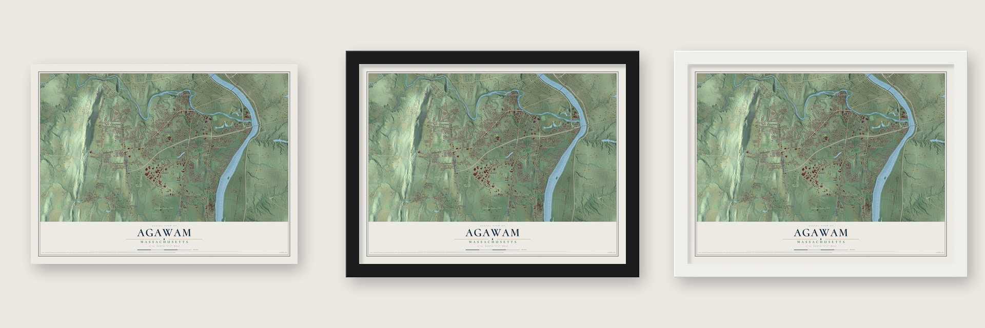
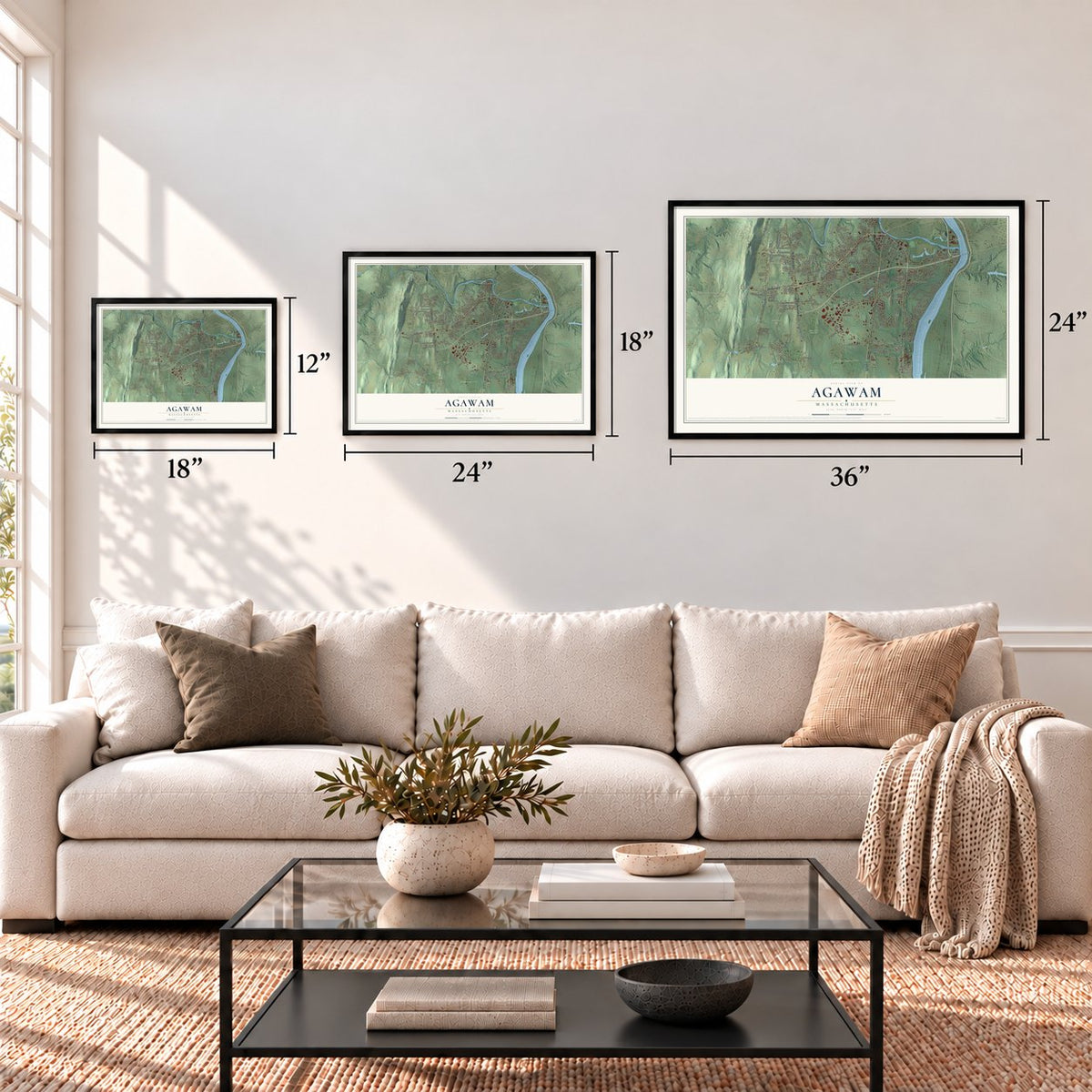
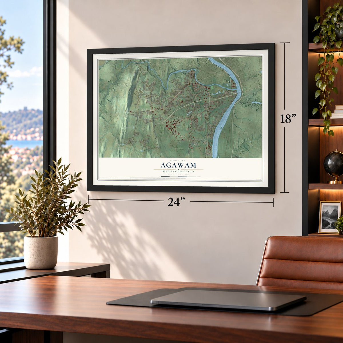
Unframed archival matte, a black wood frame or a white wood frame.
Up close
Geography Worth Displaying
This map was created using accurate cartographic data and authoritative geographic sources, including the U.S. Geological Survey (USGS) and FEMA. The map brings together terrain, waterways, roads, and building detail. The majority of the streets are labeled, houses are accurately depicted, and the topography is derived from government sources. Combining local data with carefully composed color and shading leads to this beautifully detailed Agawam artwork for your wall.
Rather than simply showing street outlines, we’ve included as many of the street names as we could reasonably fit on the map while keeping their names legible. Zoom in on the high resolution preview to see exactly what’s on the map. We truly set out to create a statement piece for anyone who loves Agawam. So whether it’s for you, or a gift for someone you love, we hope this map of Agawam brings back fond memories.
Explore the full map of Agawam, Massachusetts and read about the local places it shows.
Find your street
Names on the Agawam map
Every name below is printed on this map. Look for your street, your school, the park where you played, or the pond down the road.
Places and landmarks21
- Downtown
- Shea Corner
- Big Island
- Kelly Hill
- King Hill
- Liswell Hill
- Harts Pond
- Leonard Pond
- Kerr
- Robinson State Park
- Saint Anne Country Club
- Shea Field
Show all 21 places
- Still Brook Park
- Hubbard Corner
- Suffield Corner
- Johnson Corner
- West Agawam
- North Agawam
- Feeding Hills
- Rising Corner
- Crestview Country Club
Streets and roads215
- Main Street
- Suffield Street
- Springfield Street
- Southwick Street
- South Westfield Street
- North Westfield Street
- Pine Street
- Valentine Street
- North West Street
- Barry Street
- Barry Corner Street
- Perry Lane
- River Road
- Shoemaker Lane
- North Street
- Silver Street
- South West Street
- Mill Street
- Cooper Street
- Meadow Street
- School Street
- Adams Street
- Corey Street
- Garden Street
- South Street
- Poplar Street
- Bowles Road
- Rowley Street
- North Street Extended
- Leonard Street
Show all 215 streets
- Walnut Street
- High Street
- Elm Street
- Colemore Street
- Maynard Street
- Maple Street
- James Street
- Paul Revere Drive
- Hendom Drive
- Line Street
- Valley Brook Road
- Pineview Circle
- Elmar Drive
- Clover Hill Drive
- Robin Ridge Drive
- Independence Road
- Franklin Street
- Tobacco Farm Road
- Edgewater Road
- Fernwood Drive
- Forest Hill Road
- Florida Drive
- Thalia Drive
- White Fox Road
- Meadowbrook Road
- Senator Avenue
- Northwood Street
- Liberty Street
- Cherry Street
- Almgren Drive
- Glendale Road
- Roosevelt Avenue
- Parker Street
- Channell Drive
- Butternut Drive
- Blair's Hill Road
- Brien Street
- Homer Street
- Katherine Drive
- Elizabeth Street
- Riviera Drive
- Royal Lane
- Reed Street
- Princeton Avenue
- Ridgeway Drive
- Albert Street
- Carr Avenue
- Fairview Street
- Spencer Street
- Fordham Avenue
- Bradford Drive
- Elbert Road
- Gold Street
- Cricket Road
- Doane Avenue
- Liswell Drive
- Broz Terrace
- Sheri Lane
- Marlene Drive
- Central Street
- Forest Road
- Losito Lane
- Liquori Drive
- Royal Street
- Cesan Street
- Day Street
- Ley Street
- Beekman Drive
- South End Bridge Circle
- Coyote Circle
- Castle Hill Road
- Wagon Wheel Drive
- Lancaster Drive
- Silver Lake Drive
- Riverview Avenue
- Mallard Circle
- Country Road
- Red Fox Drive
- South Ramah Circle
- South Park Terrace
- Kensington Street
- Moore Street
- Hunters Greene Circle
- Alfred Circle
- Autumn Street
- Cosgrove Avenue
- Federal Street
- Pheasant Hill Drive
- Rising Street
- Hamilton Circle
- Fox Farm Road
- Kanawha Avenue
- Twin Oaks Road
- High Meadow Road
- Chestnut Lane
- Sylvan Lane
- Pleasant Drive
- Memorial Drive
- Moylan Lane
- Burlington Drive
- Cleveland Street
- Stony Hill Road
- Belvidere Avenue
- Carmel Lane
- Beverly Lane
- Woodside Drive
- Federal Avenue
- Peros Drive
- Joanne Circle
- Yale Avenue
- Mansion Woods Drive
- Hope Farms Drive
- Duclos Drive
- Tina Lane
- Debra Lane
- Middle Lane
- Ridge Avenue
- Coooer Street
- Warren Street
- Center Street
- Wilson Street
- Rugby Road
- Nolan Lane
- Tiny Lane
- Editha Avenue
- Bailey Street
- Barney Street
- Mark Drive
- Clifton Drive
- Hunt Street
- Forge Street
- Parkedge Drive
- Parkview Drive
- Kirkland Street
- Hemlock Ridge
- Karen Lynn Circle
- Kosak Court
- Granger Drive
- Shopping Court
- Cottonwood Lane
- Simpson Circle
- Horsham Place
- Cecile Street
- Jennie Circle
- Hayes Avenue
- Emerson Road
- Columbus Street
- Long Brook Ests
- Danny Lane
- Oak Street
- Shibley Court
- Porter Drive
- Wilbert Terrace
- Orlando Street
- Trinity Terrace
- Vadnais Street
- Zachary Lane
- Begley Street
- Old Mill Road
- Ralph Street
- Allen Street
- Juniper Ridge Drive
- Regency Park Drive
- Oak Lane
- Birch Hill Road
- James Street West
- Highland Street
- Poinsetta Street
- Greenacre Lane
- Amherst Avenue
- Alexander Drive
- Ottawa Street
- Provin Mountain Drive
- Nicole Terrace
- Hampden Lane
- Arbor Lane
- Tracy Drive
- Charles Street
- Wrenwood Lane
- Plumtree Way
- Liberty Avenue
- Family Lane
- Doloris Lane
- Denise Lane
- Grant Street
Names are listed as they appear on the printed map. Zoom into the product photos to find them.
About Agawam, Massachusetts
Agawam is a town of 28,692 people in Hampden County, on the west bank of the Connecticut River facing Springfield. William Pynchon's party had not yet arrived in 1635 when two of his men, John Cable and John Woodcock, went ahead to build a house on low ground south of the Agawam River. They planted crops that summer, but Native neighbors warned that high floods covered the meadow, so the settlers moved across the Connecticut to Springfield. The ground kept the name House Meadow.
On May 15, 1636, Pynchon purchased the land at Agawam, paying 10 fathoms of wampum along with 10 each of coats, hoes, hatchets and knives. Agawam joined West Springfield in breaking away from Springfield as a parish in 1757, parted from it in 1800, and became a town of its own on May 17, 1855.
- Two villages, two hallsAgawam Center by the river and Feeding Hills to the west have long shared one name, with Line Street between them. From 1821 the Rev. Reuben S. Hazen served both churches, preaching in each village on alternate Sundays. In 1874 voters couldn't settle on a site for a town hall, so they built one in each village: brick schools with meeting rooms upstairs. Agawam's cost $15,000 and was done in 1875.
- Peppermint, potatoes and ginJohn Porter settled in Agawam in 1771 and started a distillery in 1780. A 1926 history says the business began with peppermint, moved on to whiskey from potatoes, and then made gin from rye and corn, as much as 312 gallons a day. His grandson Harry ran it as the H. Porter Distilling Company. Prohibition turned the plant to potato chips and cider, and it shut for good in 1938.
- Helen Keller's teacherAnne Sullivan was born in Feeding Hills in 1866. An eye disease left her nearly blind at five, and after schooling at the Perkins School for the Blind she taught Helen Keller and stayed by her side for life. A statue and marker in her memory stand at Springfield and South Westfield streets.
- Seabiscuit's record in 1935A pari-mutuel race track with a grandstand and stables went up next to Bowles Agawam Airport, where 100 Army Air Corps biplanes visited in 1931. Seabiscuit set a track record there winning the Springfield Handicap in October 1935. Hampden County voters outlawed the betting in November 1938, which closed the track. The airport flew on until 1982, and both sites became an industrial park in the late 1980s.
- The captain's Federal innCapt. Charles Leonard, a militia captain remembered as the farmer who went to Harvard, built his house on Main Street in 1805 and kept an inn there until 1814. Credited to Asher Benjamin and called the finest Federal building in Agawam, it was restored after 1938 and now holds a community center and local history museum. It joined the National Register in 1975.
Keep exploring Massachusetts
Agawam is one of 461 Massachusetts towns we've mapped. Every dot on the map is a print of its own.
The search covers every state, Massachusetts first.
Near Agawam
Order 2 or more town maps and save 10%. Shown in the size and finish you picked above, so they hang as a set.
- West Springfield 12" x 18" / Archival Matte Print $39.99
- Longmeadow 12" x 18" / Archival Matte Print $39.99
- Springfield 12" x 18" / Archival Matte Print $39.99


More maps nearby: Southwick, Westfield, East Longmeadow, Chicopee and Holyoke.
The art of mapping a place
How This Map Was Made
Real places. Remarkable detail. Discover the layers that turn geographic data into a map of home.

The view from above
Aerial imagery reveals the character of the land: woodland, open fields, and the patterns of a place.

The shape of the land
Elevation data brings hills, valleys, and subtle changes in the landscape into view.

The details of home
Roads, waterways, and building footprints come together to make the map feel unmistakably local.

Geography becomes art
Considered color, shading, and typography bring the layers together in a map made for your wall.


Process illustrated with Mendon, Massachusetts. Aerial imagery: USDA NAIP. Terrain: USGS 3D Elevation Program. Map details and finished artwork: KNOWOL.
The Details
About This Print
Choose an archival matte print, or a black or white Ayous wood frame. The archival matte print is unframed.
Select your size and finish above to see the matching product image and price.
Materials & Craftsmanship
A contemporary map with the character of a classic atlas, printed on archival matte paper. Optional frames are made from Ayous wood.
Your printed map does not include the watermark shown in the full-map preview.
Shipping & Delivery
Free shipping within the United States. Every print is made to order in the USA.
Buying a gift? Add a note in your cart and we'll include it. We never put prices in the package.
Prints ship within 2 to 3 business days. Allow 7 to 10 days total from ordering for delivery. Timing may vary during holidays or periods of high order volume.
Read our shipping policy.
Returns and damaged prints
Each print is made to order. Change-of-mind refunds are not available after production.
If your print arrives damaged, misprinted or incorrect, contact support@knowol.com within 30 days of receiving it. Include your order number, photos and a description of the issue.
Read our full refund and replacement policy. For questions about your order, email support@knowol.com.