
Search for another town




Free U.S. delivery 7 to 10 days after you order
Darien, Connecticut Map Art
Building by building, with labeled streets and shaded relief.
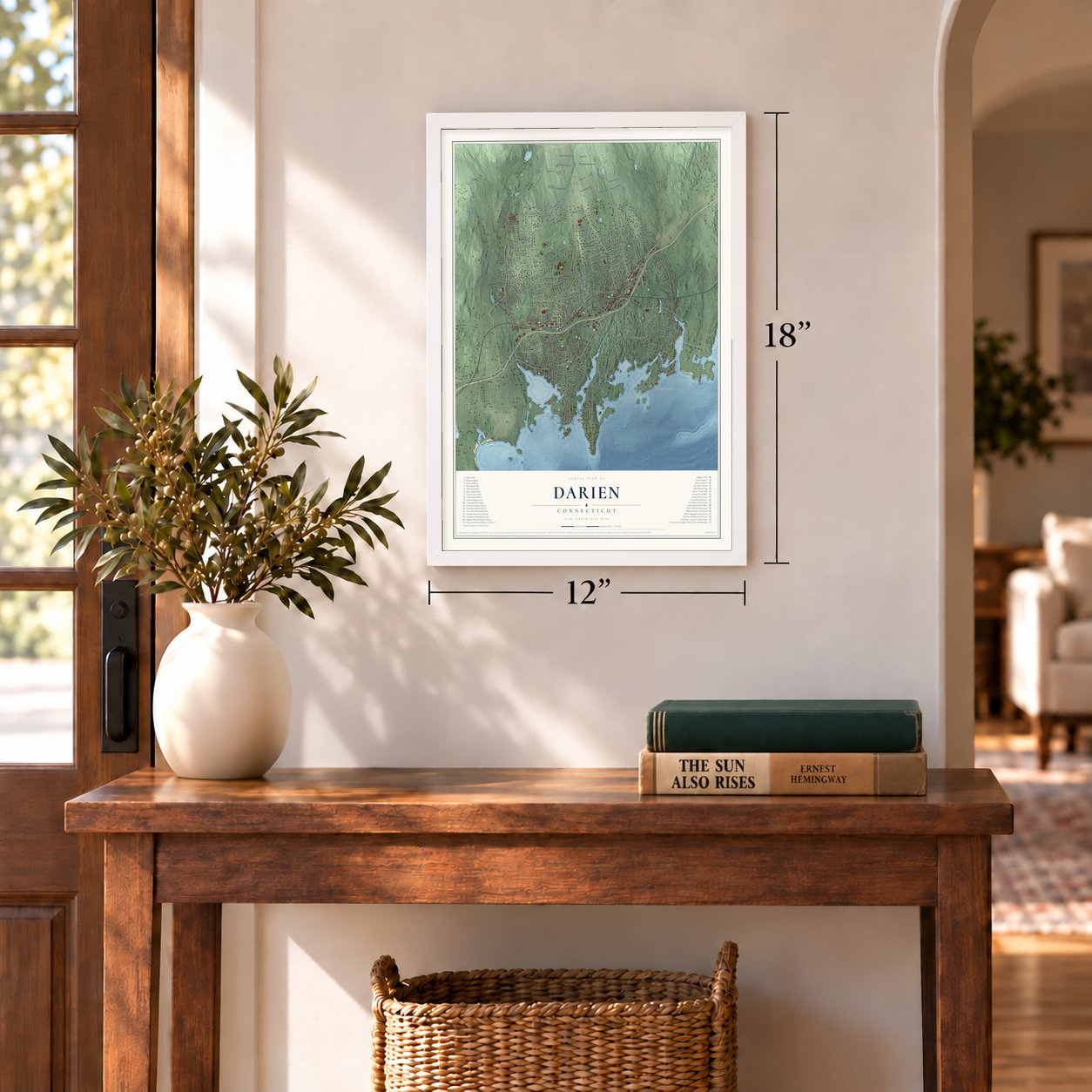
12" x 18" Archival Matte Print
A Map of Home. A Work of Art.
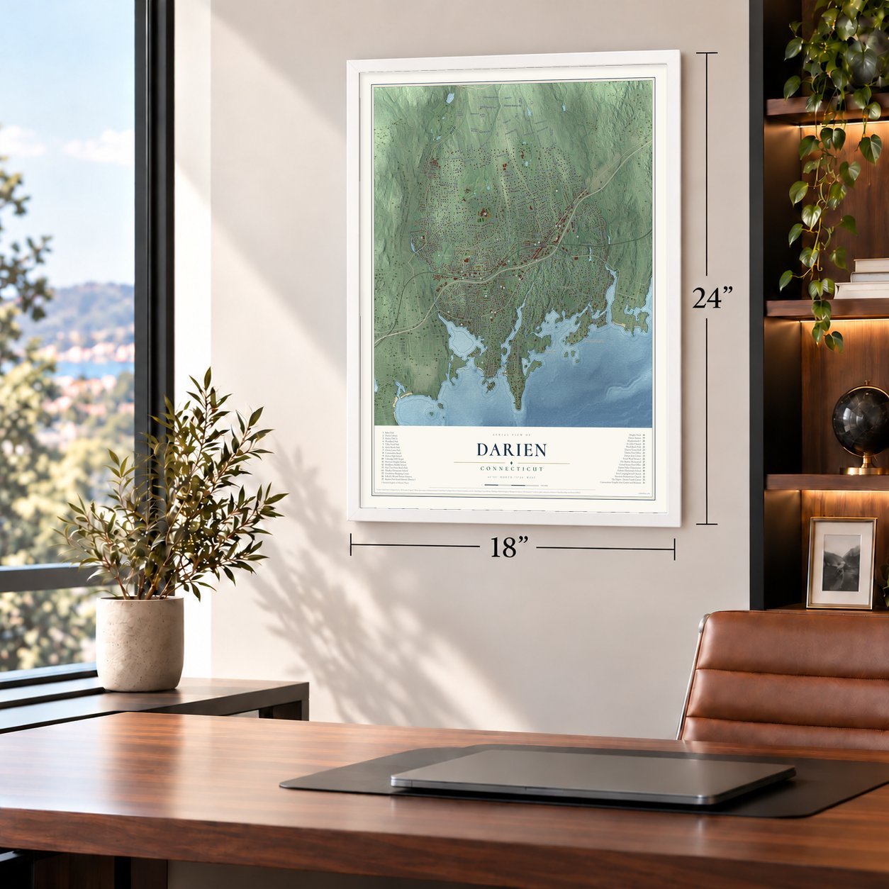
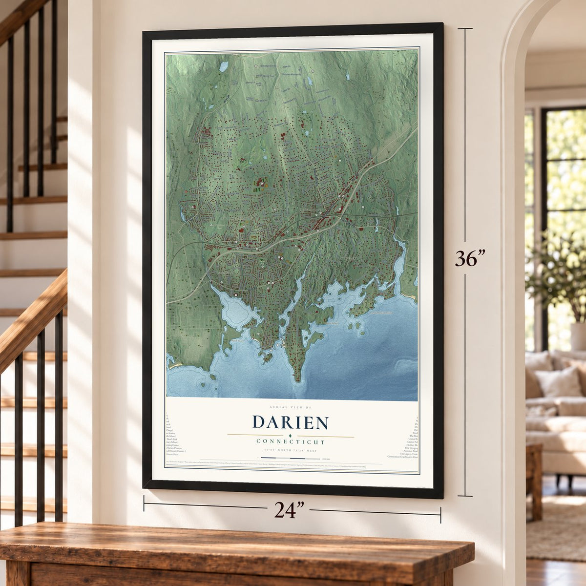
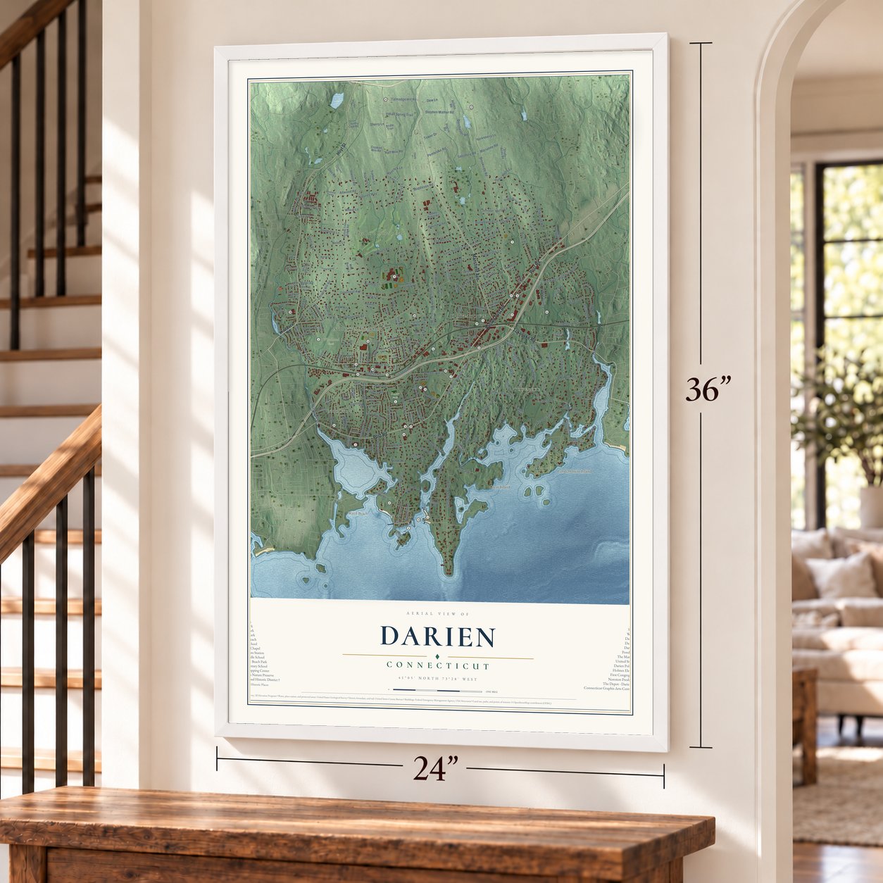
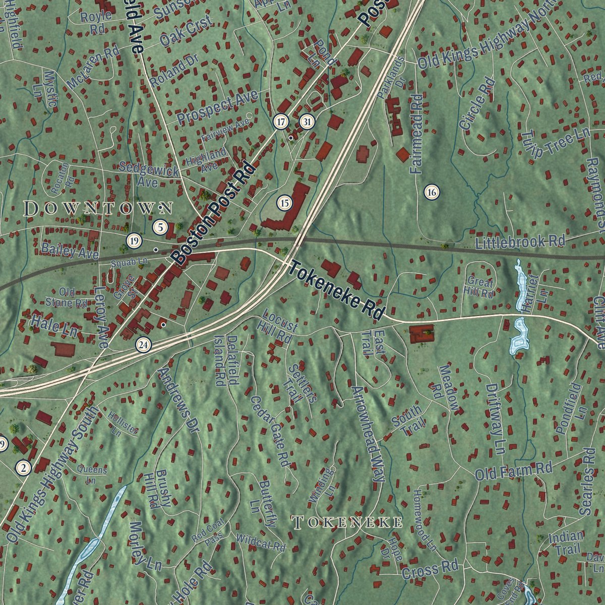
Explore Darien, Connecticut from a whole new perspective. Created using aerial imagery and detailed geographic data, this map captures Darien building by building, with labeled streets, familiar landmarks, and shaded topographical relief that highlights the natural contours of the landscape.
Combining modern data with the timeless character of a vintage atlas, this map is just as interesting up close as it is beautiful on the wall. Whether you grew up in Darien, spent memorable years there, or call it home today, this unique map is a great way to celebrate a place that means something to you. Zoom in on the preview to look for your street, and then order a print to put your memories on the wall.

Three ways to hang it
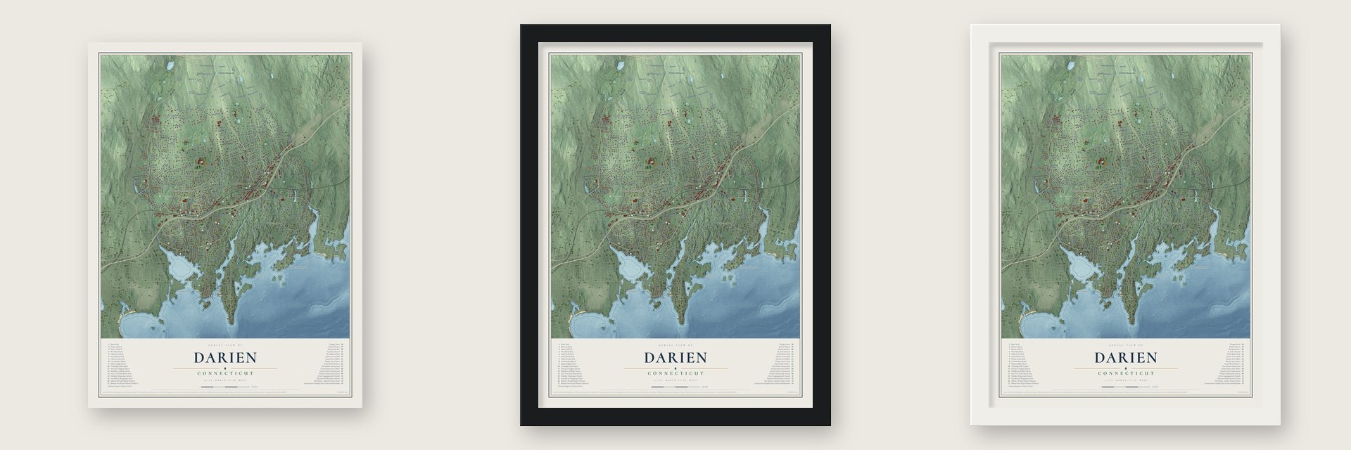
Unframed archival matte, a black wood frame or a white wood frame.
Up close
Geography Worth Displaying
This map was created using accurate cartographic data and authoritative geographic sources, including the U.S. Geological Survey (USGS) and FEMA. The map brings together terrain, waterways, roads, and building detail. The majority of the streets are labeled, houses are accurately depicted, and the topography is derived from government sources. Combining local data with carefully composed color and shading leads to this beautifully detailed Darien artwork for your wall.
Rather than simply showing street outlines, we’ve included as many of the street names as we could reasonably fit on the map while keeping their names legible. Zoom in on the high resolution preview to see exactly what’s on the map. We truly set out to create a statement piece for anyone who loves Darien. So whether it’s for you, or a gift for someone you love, we hope this map of Darien brings back fond memories.
Explore the full map of Darien, Connecticut and read about the local places it shows.
Find your street
Names on the Darien map
Every name below is printed on this map. Look for your street, your school, the park where you played, or the pond down the road.
Places and landmarks10
- Weed Beach
- Contentment Island
- Downtown
- Noroton
- Noroton Heights
- Tokeneke
- Great Island
- Baker Park
- Woodland Park
- Wee Burn Country Club
Streets and roads261
- Tokeneke Road
- Hoyt Street
- Boston Post Road
- Post Road
- Mansfield Avenue
- Old Kings Highway North
- Arrowhead Way
- Tokeneke Trail
- Cross Road
- Maple Street
- Middlesex Road
- Stanton Road
- Maywood Road
- Fairmead Road
- Brookside Road
- West Avenue
- Long Neck Point Road
- Noroton Avenue
- Old Kings Highway South
- Leroy Avenue
- Nearwater Lane
- Raymond Street
- Five Mile River Road
- Goodwives River Road
- Christie Hill Road
- Pear Tree Point Road
- Ledge Road
- Old Farm Road
- Contentment Island Road
- Holly Lane
Show all 261 streets
- Hanson Road
- Hecker Avenue
- Camp Avenue
- Gardiner Street
- Gardner Street
- Searles Road
- Stephen Mather Road
- Blueberry Lane
- Pembroke Road
- Holmes Avenue
- Birch Road
- Edgerton Street
- Allwood Road
- Stony Brook Road
- Old Parish Road
- Fitch Avenue
- Rings End Road
- Inwood Road
- Half Mile Road
- Tulip Tree Lane
- Driftway Lane
- Pasture Lane
- Greenleaf Avenue
- Dubois Street
- Buttonwood Lane
- Nolen Lane
- Deepwood Road
- Dorchester Road
- Salisbury Road
- Raiders Lane
- Harbor Road
- Andrews Drive
- Lake Drive
- Tory Hole Road
- Talmadge Hill Road
- Heights Road
- Saint Nicholas Road
- Coachlamp Lane
- Three Wells Lane
- Circle Road
- Hamilton Lane
- Great Is
- Sunset Road
- Stephanie Lane
- Indian Spring Trail
- Outlook Drive
- Fox Hill Lane
- Knollwood Lane
- Beach Drive
- Littlebrook Road
- Greenwood Avenue
- Overbrook Lane
- Natures Way
- Brookside Drive
- Fairfield Avenue
- Prospect Avenue
- Swifts Lane
- Marianne Road
- Hancock Lane
- Herman Avenue
- Plymouth Road
- Intervale Road
- Waverly Road
- Wakemore Street
- Sherry Lane
- Salt Box Lane
- Libby Lane
- Hillcrest Avenue
- Hale Lane
- Laforge Road
- Dew Lane
- Oak Crst
- North Road
- Devon Road
- Morley Lane
- Sylvan Road
- Tower Drive
- Nutmeg Lane
- Wheat Lane
- Cliff Avenue
- Miller Road
- Timber Lane
- Echo Drive
- Cherry Street
- Molly Lane
- Elm Street
- Dorr Road
- Salem Straits
- Hollow Tree Ridge Road
- Delafield Island Road
- Ridge Acres Road
- Sunswyck Road
- Locust Hill Road
- Colony Road
- Peach Hill Road
- Phillips Lane
- Briar Brae Road
- Sedgewick Avenue
- Cedar Gate Road
- Country Club Road
- Walmsley Road
- Relihan Road
- Brushy Hill Road
- Shields Road
- Crooked Mile Road
- Hillside Avenue
- Georgian Lane
- Brush Island Road
- Butlers Island Road
- Old Oak Road
- Juniper Road
- Dickinson Road
- Butterfly Lane
- East Trail
- Wilson Ridge Road
- Pilgrim Road
- Settlers Trail
- Park Place
- Bridle Trail
- Shady Acres Road
- Hickory Lane
- Huckleberry Lane
- Miles Road
- McLaren Road
- Royle Road
- Saddle Ridge Road
- Lynn Court
- Woodland Drive
- Bailey Avenue
- Nickerson Lane
- Crane Road
- High School Lane
- Pondfield Lane
- Renshaw Road
- Tokeneke Beach Drive
- Rockwell Lane
- Bittersweet Lane
- South Trail
- Highfield Lane
- Parsons Walk
- West Norwalk Road
- Whaling Road
- Heather Lane
- Hillsley Road
- Chestnut Street
- Patton Drive
- Appletree Lane
- Oak Park Avenue
- Roland Drive
- Midbrook Lane
- Canoe Trail
- Henry Street
- Hilton Street
- Kerry Lane
- Edmond Street
- Wee Burn Lane
- Pratt Island
- Rose Lane
- Indian Trail
- Meadow Road
- Hoyt Court
- Harriet Lane
- Kona Road
- Haskell Lane
- Weeds Landing
- Mystic Lane
- Victory Drive
- Hazel Street
- Pond Lane
- Berry Lane
- Kensett Lane
- Ox Ridge Lane
- Great Hill Road
- Homewood Lane
- Linda Lane
- Red Rose Circle
- Winding Lane
- Parklands Drive
- Peabody Lane
- Pleasant Street
- Chasmars Pond Road
- Wildcat Road
- Anthony Lane
- Revere Road
- Oakshade Avenue
- Stony Brook Road South
- Hope Drive
- Echo Drive North
- Garden City Road
- Ironwood Lane
- Old Stone Road
- Abbey Road
- Stonewall Lane
- Highland Avenue
- Mansfield Place
- Ridgeley Street
- Chester Road
- Davis Lane
- Laurel Lane
- Scofield Farms
- Catalpa Terrace
- Grove Street
- Short Lane
- Pine Street
- Squab Lane
- Leeuwarden Road
- Richmond Drive
- Rocaton Road
- Red Coat Pass
- Baywater Drive
- Fairview Avenue
- Edgehill Drive
- Barringer Road
- Patricia Lane
- Highview Road
- Allen Oneill Drive
- Lighthouse Way
- Linden Avenue
- West Elm Street
- Tinywood Road
- Edgewood Road
- Hollister Lane
- Queens Lane
- Concord Lane
- Watch Tower Road
- Glenvale Avenue
- Coves End Road
- Scout Trail
- Cloudy Lane
- Palmer Lane
- Althea Lane
Names are listed as they appear on the printed map. Zoom into the product photos to find them.
About Darien, Connecticut
Darien is a Fairfield County town of 21,499 people, set on Long Island Sound where it lies between Stamford and Norwalk. Around 1641 the first land here was cleared by men from Norwalk and from the New Haven and Wethersfield colonies, but for almost two centuries this shore belonged to Stamford. Winters made the long trip to church in Stamford dangerous, so in 1737 the Legislature set off the ground from the Noroton River east to the Five Mile River as a separate parish called Middlesex. Its society first met in 1739 and voted to build a meetinghouse fifty feet by thirty.
The church was organized in 1744 with Moses Mather as pastor, and he led it until his death in 1806. In 1820 Middlesex Parish was incorporated as a town, but the neighbors could not agree on a new name, since many families wanted the honor for themselves. Thaddeus Bell, a Revolutionary War veteran, turned down "Belleville" and backed a sailor's idea instead: Darien, after the Isthmus of Darien he had visited. The old church society adopted the name too, in 1858.
“I think that more than half of those who compose my congregation on the Sabbath, and nearly our whole choir of singers are his (Dr Mather's) descendants.”
- The Sunday raid of 1781Loyalists surrounded the meetinghouse on July 22, 1781, while Moses Mather was preaching. A few young men got out through the windows. The raiders tied the rest in pairs and marched them to the shore behind their minister, taking about forty horses too; one history counts 48 worshipers seized. They were shipped across the Sound to New York's Provost prison, and Peter St. John's poem says that of the 25 held longest, only 19 were alive by late December.
- The Half-Way HouseNathaniel Pond, a Branford blacksmith, bought land near the Noroton River in 1696, and the saltbox he built is thought to be the oldest building in Darien. In 1716 he sold it to Nathaniel Weed, also a blacksmith. Sitting on the Post Road, halfway along the route from Stamford to Norwalk, it served travelers as a tavern in the 1700s. Weeds owned it until 1926, and the Pond-Weed House joined the National Register in 1978.
- Fitch's Home for SoldiersDarien's Benjamin Fitch funded a home for disabled soldiers, chartered in 1864, with a gift of about one hundred thousand dollars. Few veterans needed it yet, so in February 1865 it opened as a home and school for children of men killed or disabled in the war. The state took it over in 1887 and ran it at Noroton Heights as a home for aging veterans; on June 30, 1903, it had 526 men on its rolls.
- Sloops before the railroadDarien first faced the water, and its earliest shops were at Ring's End. George Gorham, who got a license in 1727 to take his sloop to Barbados, made his home at the landing where the Goodwives River meets the water. Holly Bell sailed a sloop to New York City until the tracks arrived in 1848, then spent years as Darien's station agent.
- A grocer's farm, remadeFrank Green, a New York grocer, built a Victorian farmhouse on Middlesex Road in 1876 and kept cattle, chickens and fruit trees there. During the 1930s the house was remade in the Georgian Revival style, and Ellen Biddle Shipman designed its gardens. Since 1950 Meadowlands has been home to the Darien Community Association, and it joined the National Register in 1987.
Keep exploring Connecticut
Darien is one of 382 Connecticut towns we've mapped. Every dot on the map is a print of its own.
The search covers every state, Connecticut first.
Near Darien
Order 2 or more town maps and save 10%. Shown in the size and finish you picked above, so they hang as a set.
- Noroton 12" x 18" / Archival Matte Print $39.99
- Tokeneke 12" x 18" / Archival Matte Print $39.99
- Noroton Heights 12" x 18" / Archival Matte Print $39.99


More maps nearby: Darien Downtown, Stamford, Norwalk, Old Greenwich and North Mianus.
The art of mapping a place
How This Map Was Made
Real places. Remarkable detail. Discover the layers that turn geographic data into a map of home.

The view from above
Aerial imagery reveals the character of the land: woodland, open fields, and the patterns of a place.

The shape of the land
Elevation data brings hills, valleys, and subtle changes in the landscape into view.

The details of home
Roads, waterways, and building footprints come together to make the map feel unmistakably local.

Geography becomes art
Considered color, shading, and typography bring the layers together in a map made for your wall.


Process illustrated with Mendon, Massachusetts. Aerial imagery: USDA NAIP. Terrain: USGS 3D Elevation Program. Map details and finished artwork: KNOWOL.
The Details
About This Print
Choose an archival matte print, or a black or white Ayous wood frame. The archival matte print is unframed.
Select your size and finish above to see the matching product image and price.
Materials & Craftsmanship
A contemporary map with the character of a classic atlas, printed on archival matte paper. Optional frames are made from Ayous wood.
Your printed map does not include the watermark shown in the full-map preview.
Shipping & Delivery
Free shipping within the United States. Every print is made to order in the USA.
Buying a gift? Add a note in your cart and we'll include it. We never put prices in the package.
Prints ship within 2 to 3 business days. Allow 7 to 10 days total from ordering for delivery. Timing may vary during holidays or periods of high order volume.
Read our shipping policy.
Returns and damaged prints
Each print is made to order. Change-of-mind refunds are not available after production.
If your print arrives damaged, misprinted or incorrect, contact support@knowol.com within 30 days of receiving it. Include your order number, photos and a description of the issue.
Read our full refund and replacement policy. For questions about your order, email support@knowol.com.