
Search for another town





Free U.S. delivery 7 to 10 days after you order
Frederick, Maryland Map Art
A new map of Frederick, Maryland, made in 2026 and printed to order on thick archival matte paper.
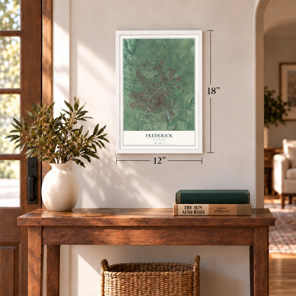
12" x 18" Archival Matte Print
A Map of Home. A Work of Art.
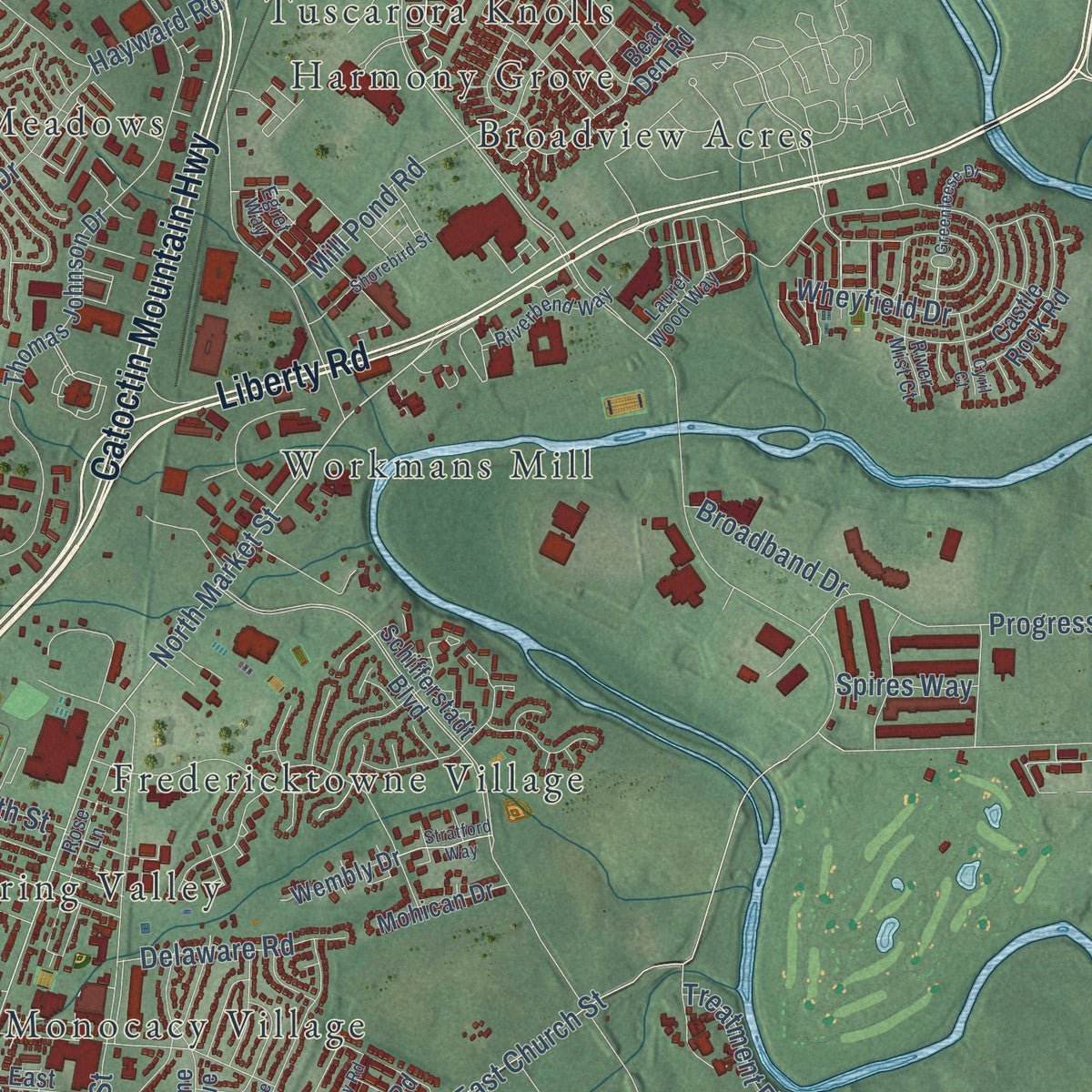
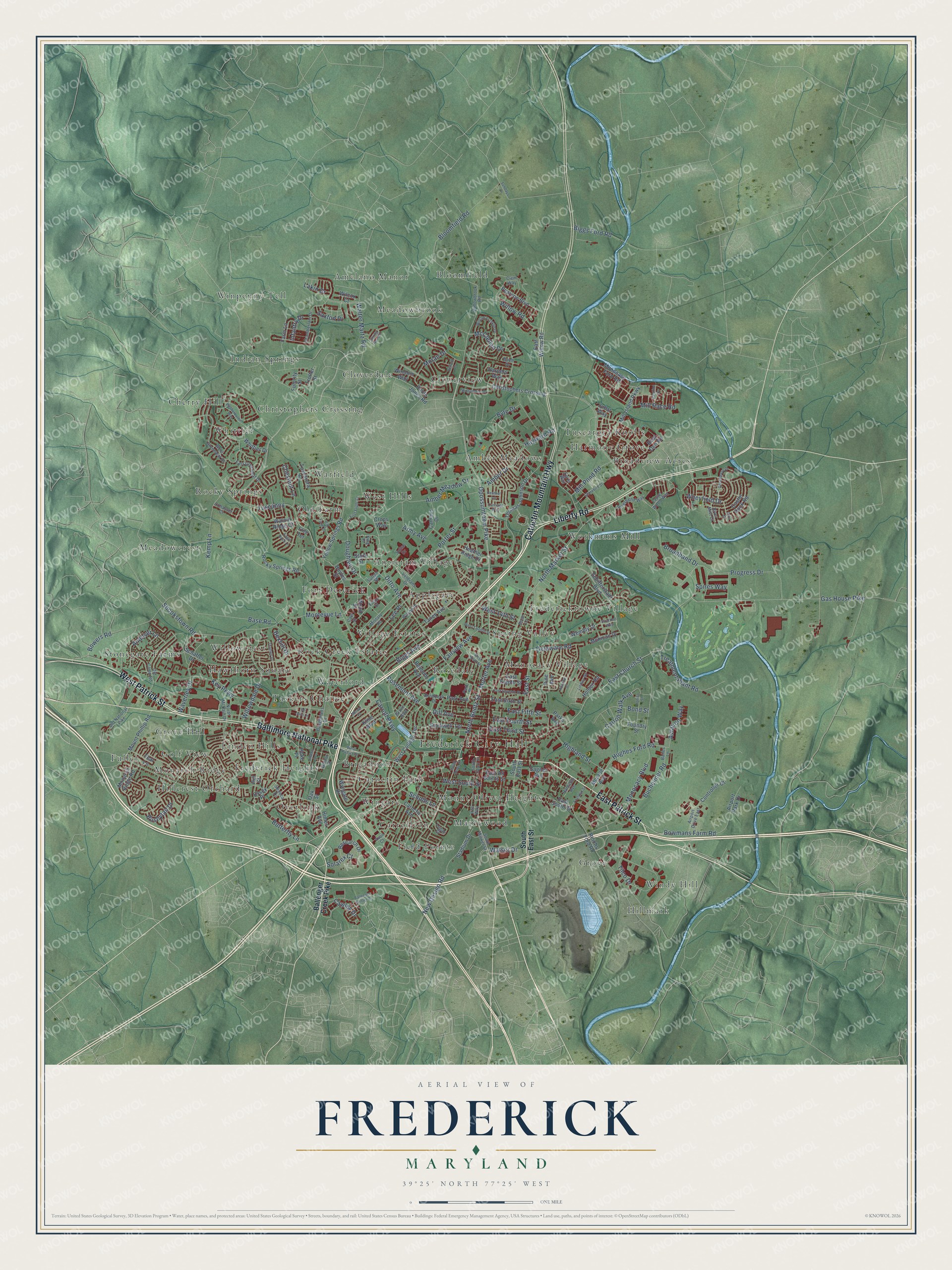
Explore Frederick, Maryland from a whole new perspective. Created using aerial imagery and detailed geographic data, this map captures Frederick building by building, with labeled streets, familiar landmarks, and shaded topographical relief that highlights the natural contours of the landscape.
Combining modern data with the timeless character of a vintage atlas, this map is just as interesting up close as it is beautiful on the wall. Whether you grew up in Frederick, spent memorable years there, or call it home today, this unique map is a great way to celebrate a place that means something to you. Zoom in on the preview to look for your street, and then order a print to put your memories on the wall.
Three ways to hang it
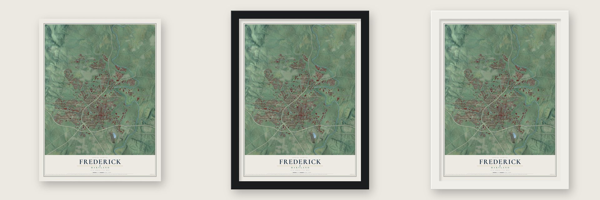
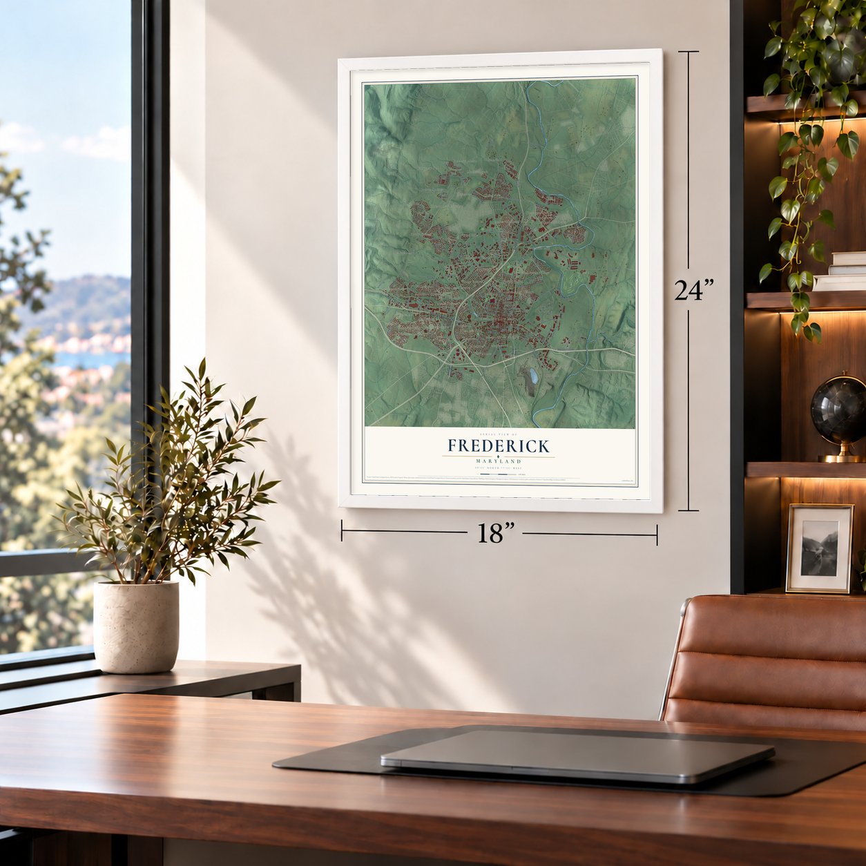
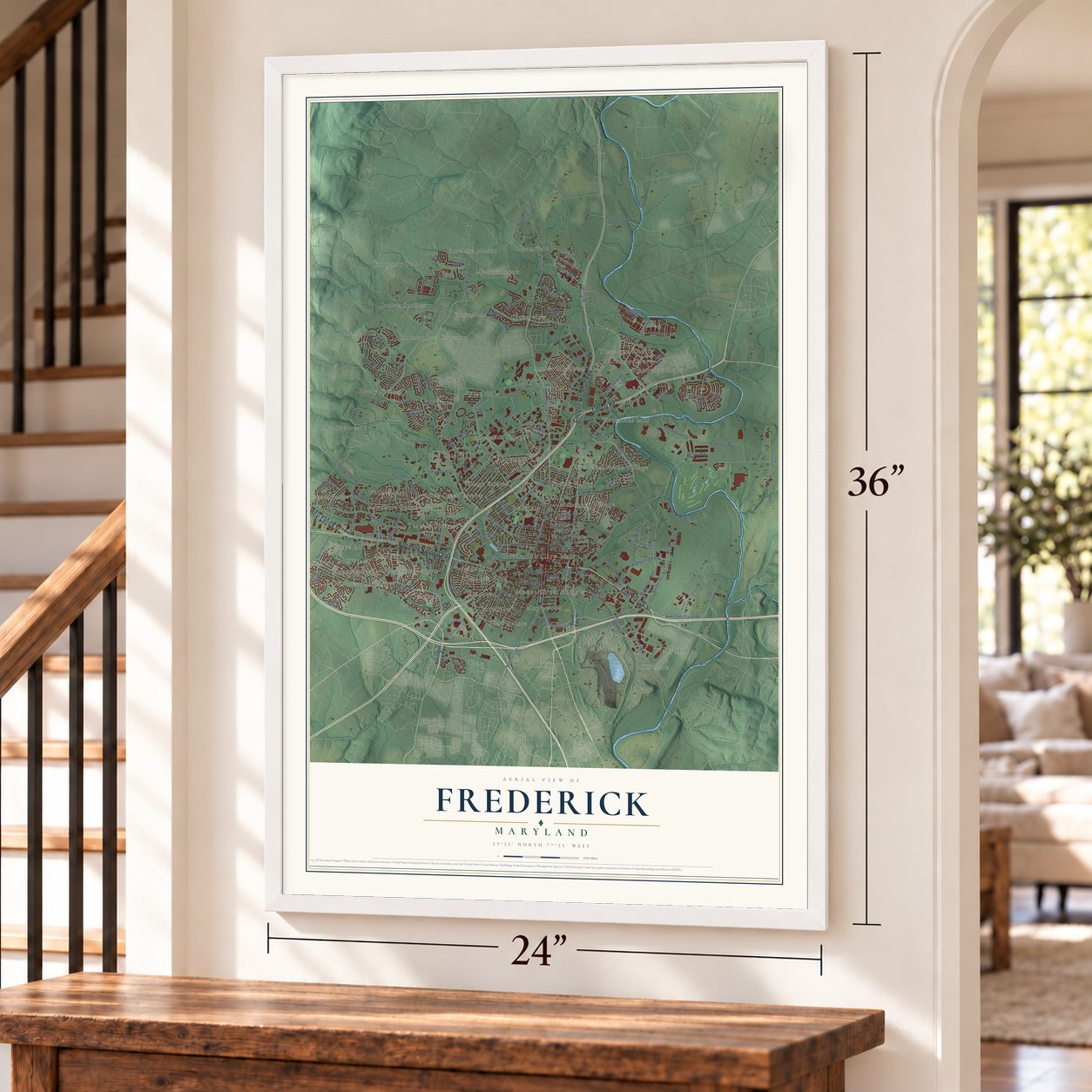
Unframed archival matte, a black wood frame or a white wood frame.
Up close
Geography Worth Displaying
This map was created using accurate cartographic data and authoritative geographic sources, including the U.S. Geological Survey and the Census Bureau. The map brings together terrain, waterways, roads, and building detail. The majority of the streets are labeled, houses are accurately depicted, and the topography is derived from government sources. Combining local data with carefully composed color and shading leads to this beautifully detailed Frederick artwork for your wall.
Rather than simply showing street outlines, we’ve included as many of the street names as we could reasonably fit on the map while keeping their names legible. Zoom in on the high resolution preview to see exactly what’s on the map. We truly set out to create a statement piece for anyone who loves Frederick. So whether it’s for you, or a gift for someone you love, we hope this map of Frederick brings back fond memories.
Read the story behind this map of Frederick, Maryland from 2026.

About Frederick, Maryland
Frederick is a city of 78,171 people and the county seat of Frederick County, where Catoctin Mountain meets the rolling Piedmont. Daniel Dulany, a land speculator, laid out Frederick Town by 1745. When Frederick County was formed from part of Prince George's County in 1748, the young town became its seat. Its first house was built by Johann Thomas Schley, a German Reformed schoolmaster from the Palatinate who brought a group of immigrants with him. They bought land from Dulany along Carroll Creek and started a German Reformed church.
The town grew on a crossroads of old trails, so travelers kept coming through. In 1755 General Edward Braddock marched British troops west through Frederick during the French and Indian War, and the young George Washington was among them. Later the National Road ran along Patrick Street, and that route became U.S. Route 40. In 1831 the Baltimore and Ohio Railroad finished its Frederick Branch, the same year the Chesapeake and Ohio Canal opened nearby.
“The clustered spires of Frederick stand/Green-walled by the hills of Maryland.”
- Maryland's capital in 1861In 1861 the Maryland legislature left Annapolis and met in Frederick to decide whether the state should secede. President Lincoln had several members arrested, and the assembly could never gather a quorum, so the vote on secession never took place.
- Hessian soldiers held hereDuring the American Revolution the British kept a regiment of German Hessian troops in Frederick to control the crossroads. Their stone, L-shaped quarters, the Hessian Barracks, still stand.
- Schifferstadt, built in 1756German settler Joseph Brunner built Schifferstadt in 1756, and it is likely the oldest house left in Frederick. Today it is the Schifferstadt Architectural Museum.
- A house built out of spiteIn 1814 a local doctor built the Tyler Spite House at 112 W. Church Street. He put it there to keep the city from running Record Street south across his land to West Patrick Street, and the house is still there.
- Key and Taney practiced hereAs the county seat for Western Maryland, Frederick was both a market town and a seat of justice. Three well-known lawyers worked in its courts: Roger B. Taney, Francis Scott Key and John Hanson.
Find your street
Names on the Frederick map
Every name below is printed on this map. Look for your street, your school, the park where you played, or the pond down the road.
Places and landmarks53
- Frederick City Hall
- Amber Meadows
- Amelano Manor
- Antietam Village
- Applegate
- Bloomfield
- Brigadoon
- Broadview Acres
- Carrollton
- Catoctin Park
- Cherry Hill
- Christophers Crossing
Show all 53 places
- Cloverdale
- Cloverview
- Field Pointe
- Fort Deterick
- Frederick Heights
- Fredericktowne Village
- Fuller
- Golf View
- Grove
- Grove Hill
- Harmony Grove
- Hawthorn Square
- Hillcrest Orchard
- Hillmark
- Indian Springs
- Linden Hills
- Maplewood
- Meadowbrook
- Meadowcrest
- Monarch Ridge
- Monocacy Village
- Mount Olivet Heights
- Old Farm
- Overlook
- Rock Creek Estates
- Rocky Springs
- Rosedale
- Spring Valley
- Stonegate Farms
- Taskers Chance
- Tuscarora Knolls
- Village Estates
- Warfield
- Waterford
- West Hills
- Whittier
- Willowcrest
- Windy Hill
- Wingate
- Winpenny Tell
- Workmans Mill
Streets and roads206
- West Patrick Street
- East Patrick Street
- Liberty Road
- Catoctin Mountain Highway
- Baltimore National Pike
- Opossumtown Pike
- North Bentz Street
- Motter Avenue
- North Market Street
- Bowmans Farm Road
- Base Road
- Dill Avenue
- Ditto Avenue
- Doughten Drive
- West South Street
- Rosemont Avenue
- East Fifth Street
- East Third Street
- Monocacy Boulevard
- Gas House Pike
- Shookstown Road
- Butterfly Lane
- Fairview Avenue
- East Church Street
- Key Parkway
- East Street
- New Design Road
- Porter Street
- Kemp Lane
- Wheyfield Drive
Show all 206 streets
- Carroll Parkway
- Amber Meadow Drive
- Tilco Drive
- Progress Drive
- Bloomfield Road
- Waverley Drive
- Hayward Road
- Tuscanny
- Willowdale Drive
- Walter Martz Road
- McClellan Drive
- Mill Pond Road
- Andover Lane
- Willow Road
- Hughes Ford Road
- Bowers Road
- Treatment Plant Road
- Montevue Lane
- Highland Street
- Lee Place
- Mill Race Road
- Carroll Walk Avenue
- Amber Drive
- Bond Street
- Moran Drive
- East Fourth Street
- Biggs Avenue
- Bucheimer Road
- Infantry Drive
- Delaware Road
- Biggs Ford Road
- Army Avenue
- Saxton Drive
- Aviation Way
- Chestnut Lane
- Broadband Drive
- West 14th Street
- Bushytail Drive
- Scholls Lane
- Solarex Court
- Byte Drive
- Cawley Drive
- Spires Way
- Walser Drive
- Lakin Drive
- Bexhill Drive
- South East Street
- Ballenger Creek Pike
- Catoctin Avenue
- Himes Avenue
- East South Street
- Yellow Springs Road
- Rockwell Terrace
- Hill Street
- Rocky Springs Road
- Schifferstadt Boulevard
- Thomas Johnson Drive
- Schaffer Drive
- Taney Avenue
- Holden Road
- Mill Island Parkway
- Wyngate Drive
- Stadium Drive
- Bear Den Road
- Poole Jones Road
- Controller Court
- Pearson Boulevard
- Heather Ridge Drive
- Whittier Drive
- Mount Phillip Road
- Reichs Ford Road
- West College Terrace
- Pine Avenue
- Kline Boulevard
- Castle Rock Road
- Monocacy Ford Road
- Stark Street
- Monarch Ridge Road
- Foundry Street
- Research Drive
- Jubal Way
- Campus Drive
- Harpers Way
- Crops Way
- Trotter Street
- Farm Lane
- Belmont Avenue
- Futurity Street
- Boyles Street
- East Sixth Street
- Wood Street
- East Willow Road
- Mohican Drive
- East All Saints Street
- Wembly Drive
- Walnut Ridge Court
- East Eighth Street
- Airport Park Drive
- Hoke Place
- Teal Lane
- Tuscarora Court
- Windom Way
- Monroe Avenue
- Sagner Avenue
- Park Avenue
- Oak Street
- Parks Avenue
- Wilcox Court
- Essex Place
- Free Terrace
- South Market Street
- West Greenleaf Drive
- Brodbeck Drive
- Baughmans Lane
- Wilson Place
- Chamberlain Drive
- Old Camp Road
- Veterans Drive
- Willowbrook Road
- Logan Street
- Military Road
- East Greenleaf Drive
- Cohasset Court
- Sultan Street
- Rose Lane
- Airport Drive East
- Riverbend Way
- Laurel Wood Way
- Sultan Drive
- North McCain Drive
- Old National Pike
- Walnut Street
- Hamilton Avenue
- Buell Drive
- Grove Boulevard
- Egret Way
- Seneca Drive
- Clem Way
- River Mist Court
- Fraim Street
- Iras Way
- South Court Street
- Bailes Lane
- Park Place
- King Place
- Cain Street
- Avon Court
- South Bentz Street
- Ballenger Center Drive
- First Flight Court
- Old Farm Drive
- Bel Aire Lane
- West Ninth Street
- Wetherburne Way
- West Twelfth Street
- William Franklin Drive
- Linden Avenue
- Greenleese Drive
- Lindley Road
- Midsummer Drive
- Carriage Way
- Shorebird Street
- Union Street
- East Seventh Street
- Thames Drive
- Heather Lane
- Mercer Place
- Palatine Drive
- Spring Run Circle
- Eagle Rock Lane
- Belford Drive
- Franklin Street
- Stratford Way
- Sundays Lane
- Apache Court
- Cyril Court
Names are listed as they appear on the printed map. Zoom into the product photos to find them.
The art of mapping a place
How This Map Was Made
Real places. Remarkable detail. Discover the layers that turn geographic data into a map of home.

The view from above
Aerial imagery reveals the character of the land: woodland, open fields, and the patterns of a place.

The shape of the land
Elevation data brings hills, valleys, and subtle changes in the landscape into view.

The details of home
Roads, waterways, and building footprints come together to make the map feel unmistakably local.

Geography becomes art
Considered color, shading, and typography bring the layers together in a map made for your wall.


Process illustrated with Mendon, Massachusetts. Aerial imagery: USDA NAIP. Terrain: USGS 3D Elevation Program. Map details and finished artwork: KNOWOL.
The Details
About This Print
Choose an archival matte print, or a black or white Ayous wood frame. The archival matte print is unframed.
Select your size and finish above to see the matching product image and price.
Materials & Craftsmanship
A contemporary map with the character of a classic atlas, printed on archival matte paper. Optional frames are made from Ayous wood.
Your printed map does not include the watermark shown in the full-map preview.
Shipping & Delivery
Free shipping within the United States. Every print is made to order in the USA.
Buying a gift? Add a note in your cart and we'll include it. We never put prices in the package.
Prints ship within 2 to 3 business days. Allow 7 to 10 days total from ordering for delivery. Timing may vary during holidays or periods of high order volume.
Read our shipping policy.
Returns and damaged prints
Each print is made to order. Change-of-mind refunds are not available after production.
If your print arrives damaged, misprinted or incorrect, contact support@knowol.com within 30 days of receiving it. Include your order number, photos and a description of the issue.
Read our full refund and replacement policy. For questions about your order, email support@knowol.com.
Find your town
Looking for another city?
Find a map of home in our Maryland collection, or any town in the country.
Nearby
Maps of towns near Frederick
Know someone from one of these towns? Their map makes a great gift.
 Walkersville
, Maryland
From $39.99See the map
 Yellow Springs
, Maryland
From $39.99See the map
 Ballenger Creek
, Maryland
From $39.99See the map
More maps nearby: Spring Ridge, Bartonsville, Braddock Heights, Linganore and Middletown.