


Search for another town


Free U.S. delivery 7 to 10 days after you order
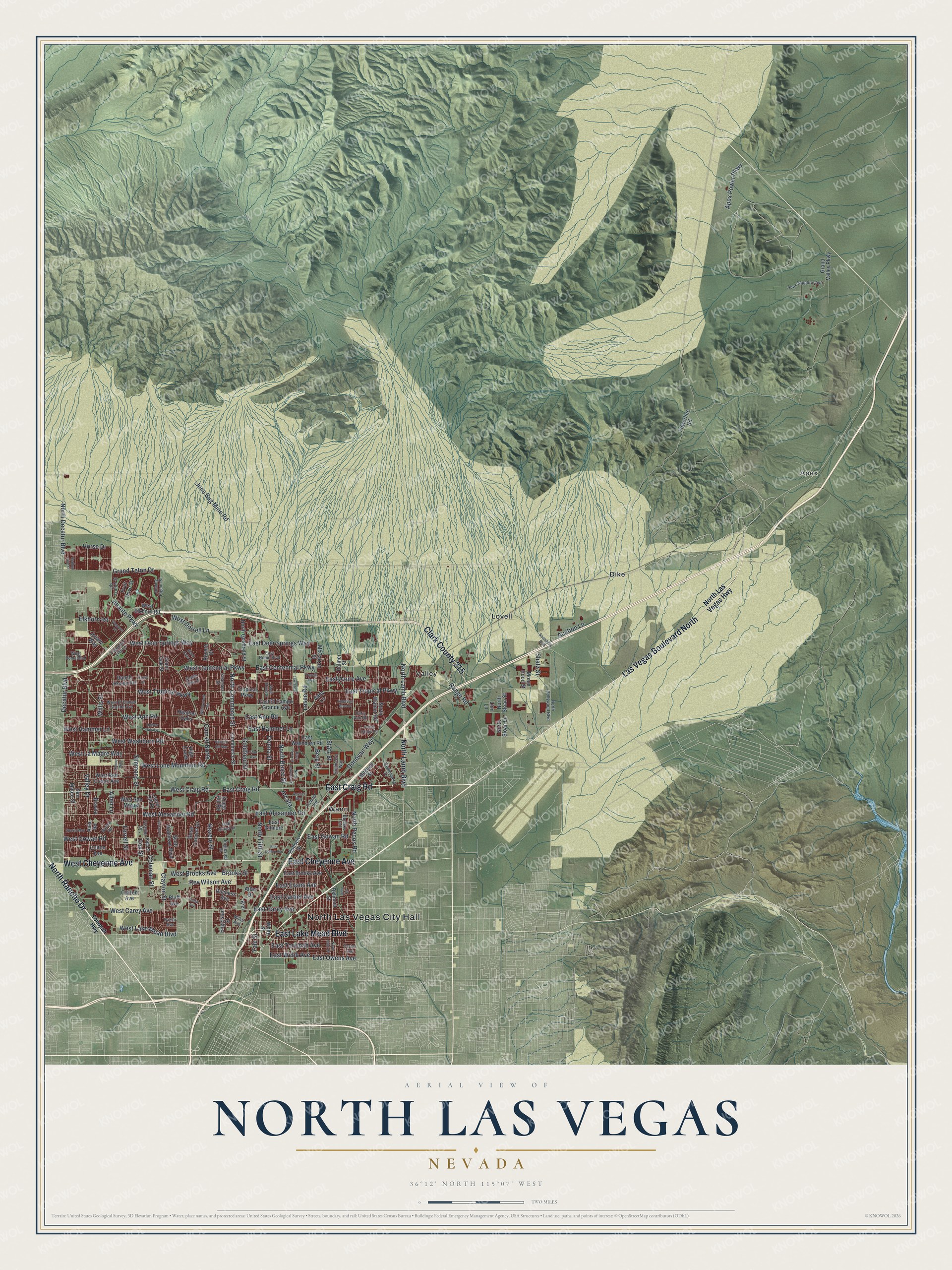
North Las Vegas, Nevada Map Art
Building by building, with labeled streets and shaded relief.
12" x 18" Archival Matte Print
A Map of Home. A Work of Art.
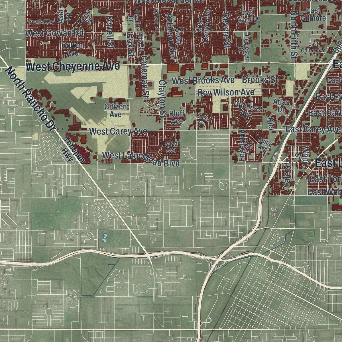
Explore North Las Vegas, Nevada from a whole new perspective. Created using aerial imagery and detailed geographic data, this map captures North Las Vegas building by building, with labeled streets, familiar landmarks, and shaded topographical relief that highlights the natural contours of the landscape.
Combining modern data with the timeless character of a vintage atlas, this map is just as interesting up close as it is beautiful on the wall. Whether you grew up in North Las Vegas, spent memorable years there, or call it home today, this unique map is a great way to celebrate a place that means something to you. Zoom in on the preview to look for your street, and then order a print to put your memories on the wall.
Three ways to hang it
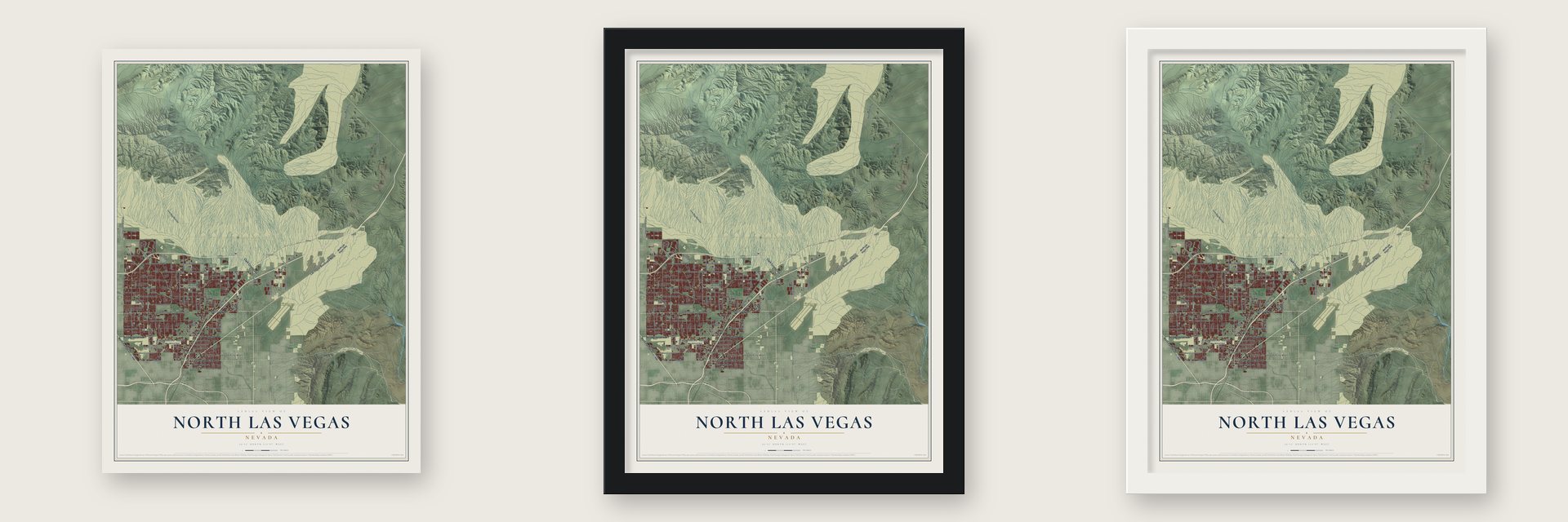
Unframed archival matte, a black wood frame or a white wood frame.
Up close
Geography Worth Displaying
This map was created using accurate cartographic data and authoritative geographic sources, including the U.S. Geological Survey and the Census Bureau. The map brings together terrain, waterways, roads, and building detail. The majority of the streets are labeled, houses are accurately depicted, and the topography is derived from government sources. Combining local data with carefully composed color and shading leads to this beautifully detailed North Las Vegas artwork for your wall.
Rather than simply showing street outlines, we’ve included as many of the street names as we could reasonably fit on the map while keeping their names legible. Zoom in on the high resolution preview to see exactly what’s on the map. We truly set out to create a statement piece for anyone who loves North Las Vegas. So whether it’s for you, or a gift for someone you love, we hope this map of North Las Vegas brings back fond memories.
Read the story behind this map of North Las Vegas, Nevada from 2026.

Find your street
Names on the North Las Vegas map
Every name below is printed on this map. Look for your street, your school, the park where you played, or the pond down the road.
Places and landmarks6
- North Las Vegas City Hall
- Apex
- Dike
- Lovell
- Valley
- Wann
Streets and roads166
- Las Vegas Boulevard North
- West Cheyenne Avenue
- North Rancho Drive
- East Craig Road
- Clark County 215
- East Cheyenne Avenue
- East Lake Mead Boulevard
- Clayton Street
- North Lamb Boulevard
- Coleman Street
- East Owens Avenue
- East Ann Road
- North Bruce Street
- East Hammer Lane
- Simmons Street
- East Centennial Parkway
- West Hammer Lane
- East Carey Avenue
- North Fifth Street
- West Centennial Parkway
- West Carey Avenue
- Goldfield Street
- West Washburn Road
- Aliante Parkway
- North Pecos Road
- North Decatur Boulevard
- Losee Road
- June Bug Mine Road
- North Commerce Street
- West Craig Road
Show all 166 streets
- East Tropical Parkway
- Valley Drive
- Allen Lane
- Donna Street
- East Azure Avenue
- Revere Street
- West Gowan Road
- West Alexander Road
- West Ann Road
- Ferrell Street
- West Lone Mountain Road
- Statz Street
- West Deer Springs Way
- Donovan Way
- East Deer Springs Way
- West Lake Mead Boulevard
- West Brooks Avenue
- West Tropical Parkway
- Range Road
- East Tonopah Avenue
- West Dorrell Lane
- Elkhorn Road
- Grand Teton Drive
- East Gowan Road
- East Webb Avenue
- East Alexander Road
- West La Madre Way
- Cam Al Norte
- Brooks Street
- Berg Street
- Horse Drive
- Willis Street
- East Evans Avenue
- East Cartier Avenue
- Apex Power Parkway
- Rev Wilson Avenue
- Shatz Street
- Auction Lane
- Decatur Boulevard
- Yale Street
- Arcata
- Cox Street
- North Las Vegas Highway
- North Goldfield Street
- Ranch House Road
- Commerce Street
- East Washburn Road
- Scott Robinson Boulevard
- East El Campo Grande Avenue
- Tropical Parkway
- Aviary Way
- Belmont Street
- McCarran Street
- North Walnut Road
- Grand Valley Parkway
- San Mateo Street
- East Brooks Avenue
- West Elkhorn Road
- Powerline Road
- Palmer Street
- West Red Coach Avenue
- Engelstad Street
- Bulloch Street
- Mount Hood Street
- Rose Canyon Drive
- West San Miguel
- Mitchell Street
- Colton Avenue
- Kings Hill Road
- White Street
- Laurel Hill Drive
- Fruit Dove Street
- North Sloan Street
- Revere Drive
- North Sloan Lane
- Bravita
- East Gilmore
- Bluff Avenue
- Heather Oaks
- Duchess Avenue
- High Creek
- Citizen Avenue
- Giant Oak Street
- Asia Road
- Addy Lane
- Atlas Drive
- Linn Lane
- Kiel
- Tonopah Highway
- Balzar Avenue
- West El Campo Grande Avenue
- North Hollywood Boulevard
- East Rome Boulevard
- Taylor Avenue
- Fuselier Drive
- Apex Sapphire Avenue
- Oak Island Drive
- West Rome Boulevard
- Carla Ann Road
- Miller Avenue
- Engineers Way
- Vandenberg Drive
- Kitamaya Street
- Lily Trotter Street
- Frehner Road
- Baylake Trail
- Kidd Street
- Stable Glen Drive
- Englested Street
- Homing Pigeon Street
- Lavender Lilly Lane
- Burma Road
- Torch Avenue
- Azure Drive
- Lawrence Street
- East Colton Avenue
- North Statz Street
- North Lawrence Street
- North Donna Street
- Helen Avenue
- Willowcreek Road
- Black Oaks Street
- Blue Rose Street
- Aerojet Way
- Iverson Lane
- Sparta Way
- Speedway Boulevard
- Kenny Way
- American Rose Drive
- Prairie Orchid Road
- Weavers Place
- Redbud Vine Street
- Hollow Oak Avenue
- Rancho del Mar
- Frad Avenue
- Bello Drive
Names are listed as they appear on the printed map. Zoom into the product photos to find them.
About North Las Vegas, Nevada
North Las Vegas is a city of 262,527 people in Clark County, in the Las Vegas Valley. Paiute people lived here by around 700 AD, and in the 1860s Conrad Kiel ran a ranch near today's corner of Carey Street and Losee Road. In 1917 Thomas L. Williams of Eureka, Utah, toured the valley. He disliked rowdy Las Vegas but liked the artesian water and the farmland, and in 1919 he brought his wife and three sons to 160 acres a mile outside that city.
Williams built a house, sank a well, graded roads, ran power lines and dug irrigation ditches. He wanted church people to govern, so he urged churches to buy land. Prohibition brought something else: tunnels joined underground speakeasies, and bootleggers came out from Las Vegas. In 1924 his Oasis Auto Court became the first business, with a grocery, a campground, a post office and the town's only telephone. Hoover Dam workers who weren't welcome in Las Vegas settled here between 1928 and 1935, and the town became a city on May 1, 1946.
“The airport, the creation of John and Florence Murphy and their partner, John Barrett, was celebrating its opening day when news of the air raid on Pearl Harbor came.”
- Vegas Verdes, brieflyWhen the town board formed in 1932, it needed a name, and Williams refused to let the place be named for him. The board first chose Vegas Verdes, Spanish for green meadows, over North Las Vegas. A few months later, board member George Hansen noticed two Vegas Verdes backers missing from a meeting, and in a new vote North Las Vegas won. Williams died in 1939, and an elementary school and a road now carry his name.
- Washington School, 1932The town's first grammar school, Washington School, opened in 1932, the same year the town board took charge. The school building joined the National Register in 1992.
- Sky Haven AirportThe Murphys and Barrett cancelled the opening day flying show at Sky Haven on December 7, 1941, when war came. Both men went to Arizona to teach for the Army Air Corps, so Florence Murphy ran the field through the war, and Howard Hughes flew in many times. Barrett bought out the Murphys and ran the airport until 1948, when he became the first manager of McCarran Airport. Today it is North Las Vegas Airport.
- A pilot's choice in 1964On May 13, 1964, student pilot Raynor Lee Hebert, a first lieutenant from Port Arthur, Texas, left Nellis Air Force Base, which began in World War II as the Las Vegas Aerial Gunnery School. His F-105's nose gear stuck down, so he couldn't climb. Ejecting would have sent the jet into Lincoln Elementary School's 800 students. He held the nose up past the school and crashed into nine Lenwood Avenue houses, killing himself and four civilians.
Keep exploring Nevada
North Las Vegas is one of 152 Nevada towns we've mapped. Every dot on the map is a print of its own.
The search covers every state, Nevada first.
Near North Las Vegas
Order 2 or more town maps and save 10%. Shown in the size and finish you picked above, so they hang as a set.
- Nellis AFB 12" x 18" / Archival Matte Print $39.99
- Sunrise Manor 12" x 18" / Archival Matte Print $39.99
- West Las Vegas 12" x 18" / Archival Matte Print $39.99
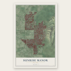

More maps nearby: Downtown Las Vegas, Las Vegas, Winchester, Lone Mountain and Whitney.
The art of mapping a place
How This Map Was Made
Real places. Remarkable detail. Discover the layers that turn geographic data into a map of home.

The view from above
Aerial imagery reveals the character of the land: woodland, open fields, and the patterns of a place.

The shape of the land
Elevation data brings hills, valleys, and subtle changes in the landscape into view.

The details of home
Roads, waterways, and building footprints come together to make the map feel unmistakably local.

Geography becomes art
Considered color, shading, and typography bring the layers together in a map made for your wall.


Process illustrated with Mendon, Massachusetts. Aerial imagery: USDA NAIP. Terrain: USGS 3D Elevation Program. Map details and finished artwork: KNOWOL.
The Details
About This Print
Choose an archival matte print, or a black or white Ayous wood frame. The archival matte print is unframed.
Select your size and finish above to see the matching product image and price.
Materials & Craftsmanship
A contemporary map with the character of a classic atlas, printed on archival matte paper. Optional frames are made from Ayous wood.
Your printed map does not include the watermark shown in the full-map preview.
Shipping & Delivery
Free shipping within the United States. Every print is made to order in the USA.
Buying a gift? Add a note in your cart and we'll include it. We never put prices in the package.
Prints ship within 2 to 3 business days. Allow 7 to 10 days total from ordering for delivery. Timing may vary during holidays or periods of high order volume.
Read our shipping policy.
Returns and damaged prints
Each print is made to order. Change-of-mind refunds are not available after production.
If your print arrives damaged, misprinted or incorrect, contact support@knowol.com within 30 days of receiving it. Include your order number, photos and a description of the issue.
Read our full refund and replacement policy. For questions about your order, email support@knowol.com.