
Search for another town





Free U.S. delivery 7 to 10 days after you order
Venice, Florida Map Art
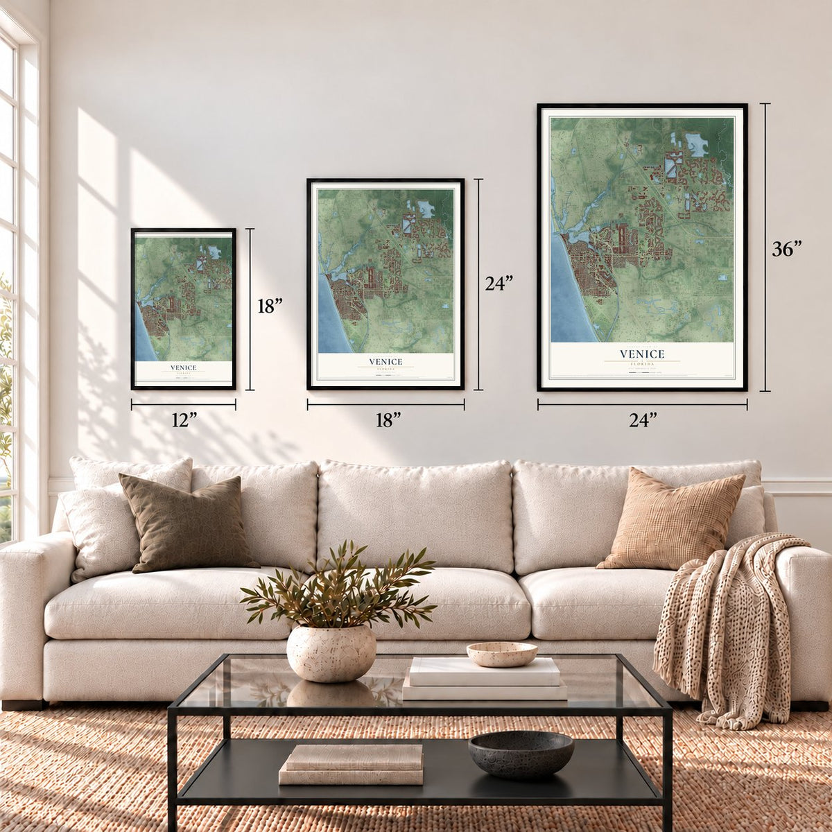
A new map of Venice, Florida, made in 2026 and printed to order on thick archival matte paper.
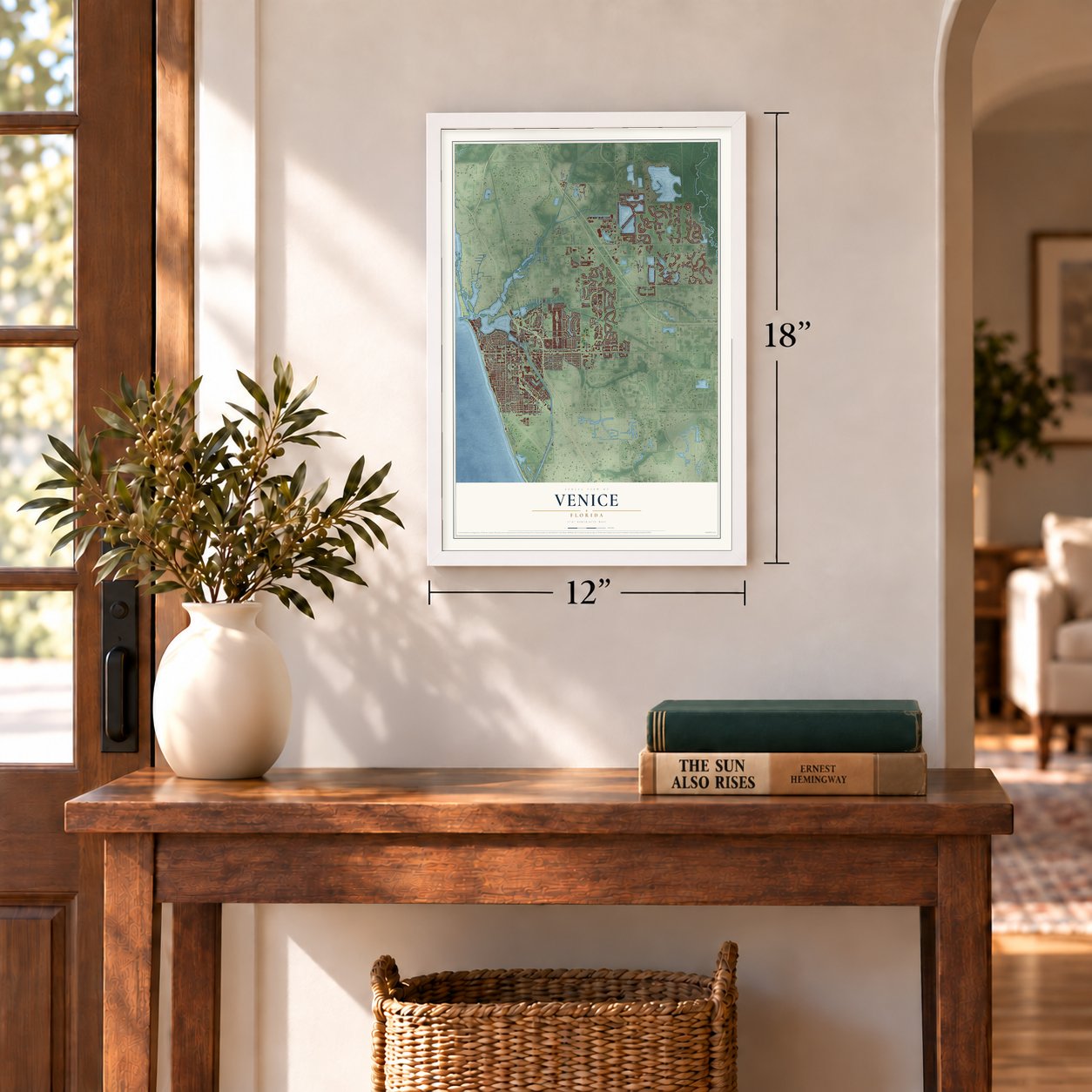
12" x 18" Archival Matte Print
A Map of Home. A Work of Art.
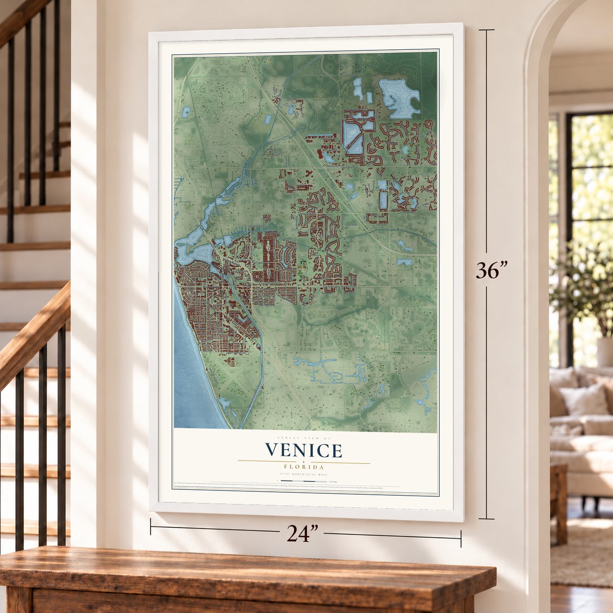
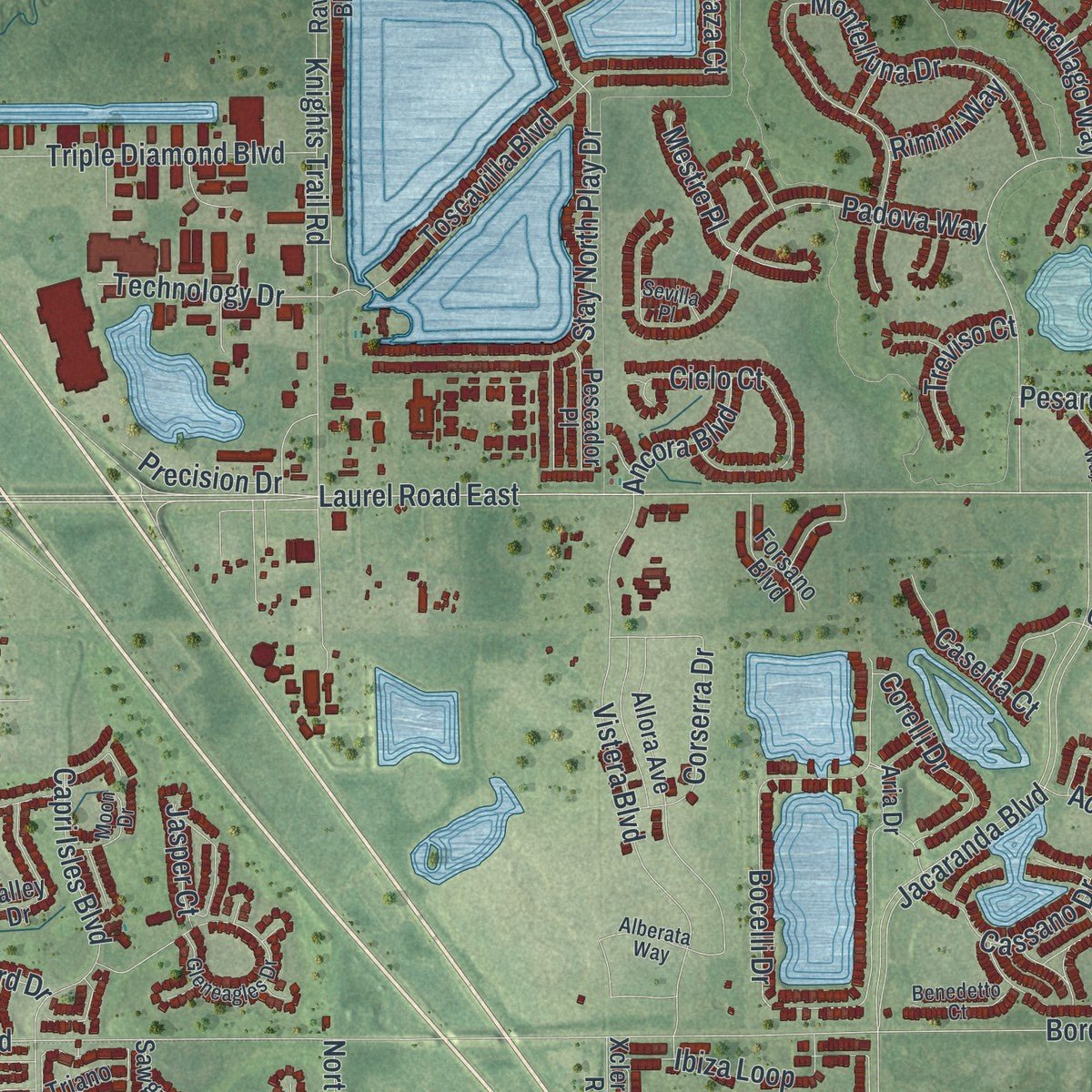
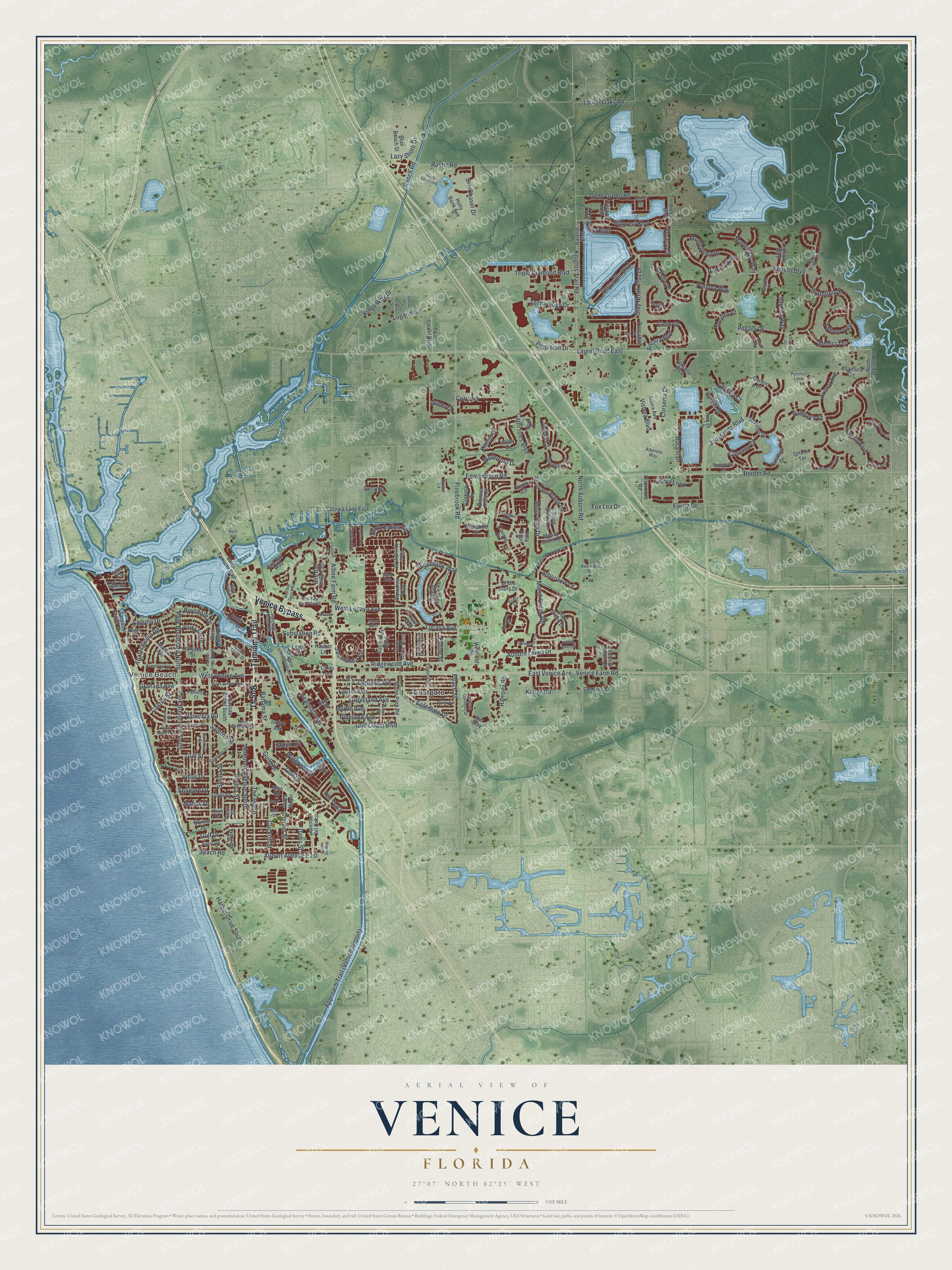
Explore Venice, Florida from a whole new perspective. Created using aerial imagery and detailed geographic data, this map captures Venice building by building, with labeled streets, familiar landmarks, and shaded topographical relief that highlights the natural contours of the landscape.
Combining modern data with the timeless character of a vintage atlas, this map is just as interesting up close as it is beautiful on the wall. Whether you grew up in Venice, spent memorable years there, or call it home today, this unique map is a great way to celebrate a place that means something to you. Zoom in on the preview to look for your street, and then order a print to put your memories on the wall.
Three ways to hang it
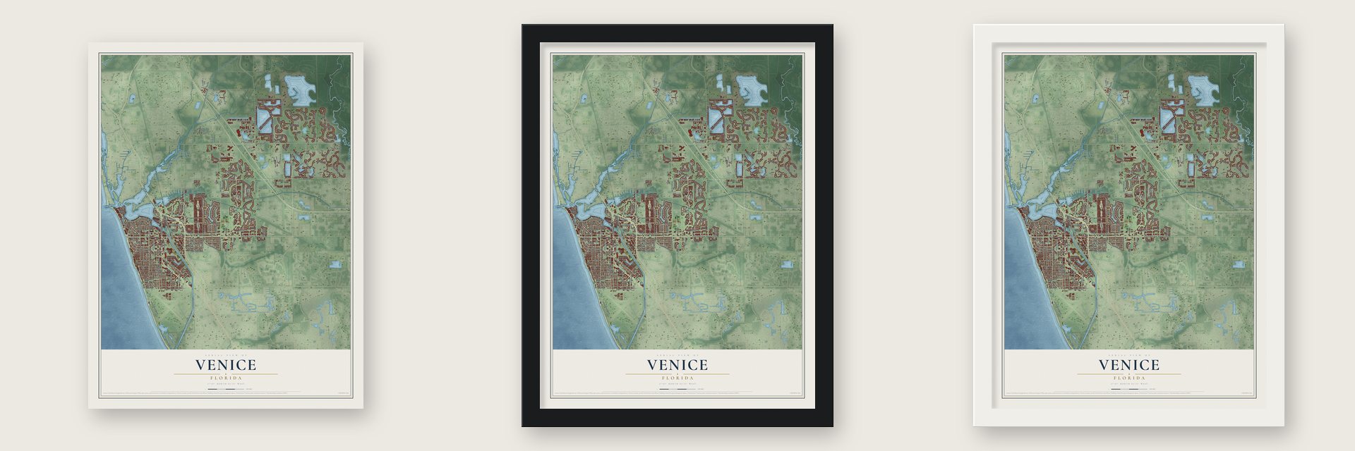
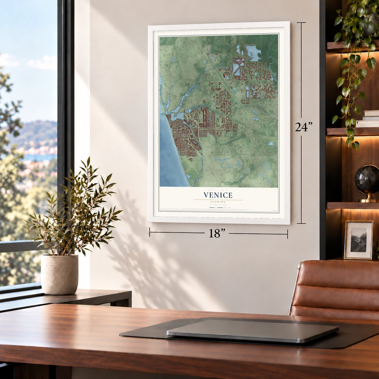
Unframed archival matte, a black wood frame or a white wood frame.
Up close
Geography Worth Displaying
This map was created using accurate cartographic data and authoritative geographic sources, including the U.S. Geological Survey (USGS) and FEMA. The map brings together terrain, waterways, roads, and building detail. The majority of the streets are labeled, houses are accurately depicted, and the topography is derived from government sources. Combining local data with carefully composed color and shading leads to this beautifully detailed Venice artwork for your wall.
Rather than simply showing street outlines, we’ve included as many of the street names as we could reasonably fit on the map while keeping their names legible. Zoom in on the high resolution preview to see exactly what’s on the map. We truly set out to create a statement piece for anyone who loves Venice. So whether it’s for you, or a gift for someone you love, we hope this map of Venice brings back fond memories.
Explore the full map of Venice, Florida and read about the local places it shows.

About Venice, Florida
Venice is a city of 25,463 people in Sarasota County, on Florida's southwest coast. Fishermen once called the spot Horse and Chaise, after a stand of trees shaped like a carriage, and in the 1870s Robert Rickford Roberts homesteaded beside the water now named Roberts Bay. Frank Higel, a Frenchman, arrived in 1883 with his wife and six sons and paid $2,500 for part of the Roberts land.
Higel opened a post office named Eyry in 1885 to serve the thirty people living here, but it closed that November, and the mail went back to Osprey. A new office opened in 1888 under the name Venice. Higel chose that name himself, because the area reminded him of the Italian city built on canals.
- Higel's canned citrusOn his homestead, Frank Higel grew citrus and canned it in several forms. His products included jams, lemon juice, pickled orange peel and even orange wine.
- A planned city in 1926In the 1920s Florida land boom, Fred H. Albee, a surgeon known for his bone grafts, bought 112 acres from Bertha Palmer and hired John Nolen to draw a master plan for the streets. Albee then sold the property to the Brotherhood of Locomotive Engineers, and the union kept Nolen on. Building began in 1925 and 1926, Venice became a town on July 1, 1926, and a charter change made it a city on May 9, 1927.
- A fire engine from a hurricaneVenice formed its first fire department in 1926 with thirty-two volunteers. That same year the town got a new American LaFrance engine. The Brotherhood of Locomotive Engineers paid for it and bought it from Moore Haven, where the Great Miami Hurricane had damaged it.
- From one shelf to a libraryThe Venice-Nokomis Women's Club started the first library in 1926, with a few books on a shelf in a store. It moved several times before the Venice Area Public Library opened in 1965. Mold forced that building's demolition in 2017, and in 2018 the new William H. Jervey Jr. Venice Library took its place, named for a donor.
- Shark's Tooth Capital of the WorldFossilized shark's teeth wash up in large numbers along the Venice shore, and the city celebrates them every year with its Shark's Tooth Festival.
Find your street
Names on the Venice map
Every name below is printed on this map. Look for your street, your school, the park where you played, or the pond down the road.
Places and landmarks4
- Venice Beach
- Pinebrook Park
- Wellfield Park
- Eastgate
Streets and roads242
- Tamiami Trail
- Bus 41
- Venice Bypass
- East Venice Avenue
- Capri Isles Boulevard
- The Rialto
- Park Boulevard North
- Bayshore Drive
- Laurel Road East
- Beach Road
- Airport Avenue East
- Laguna Drive
- West Venice Avenue
- Gulf Drive
- Harbor Drive South
- Waterway Street
- Salerno Street
- Jacaranda Boulevard
- Green Circle
- Groveland Avenue
- Gulf Coast Boulevard
- Pinebrook Road
- Venice Farm Road
- North Auburn Road
- Edmondson Road
- Knights Trail Road
- Nokomis Avenue South
- Border Road
- Bocelli Drive
- Ariano Avenue
Show all 242 streets
- Marsh Creek Road
- Ibiza Loop
- Montelluna Drive
- Ridgewood Avenue
- Veneto Boulevard
- Sun Chaser Drive
- Daylily Boulevard
- Cypress Avenue
- Vistera Boulevard
- Lugano Circle
- Albee Farm Road
- Padova Way
- Riviera Street
- Park Boulevard South
- Laurel Avenue
- Gene Green Road
- Pesaro Drive
- Lazy Shore Drive
- Toscavilla Boulevard
- Auburn Lakes Drive
- Rustic Road
- Portofino Drive
- Golf Drive
- Triple Diamond Boulevard
- Valencia Road
- Villoresi Boulevard
- Rio Terra
- Pinebrook Way
- Cockrill Street
- Lucaya Avenue
- Guild Drive
- Kunze Road
- Maraviya Boulevard
- Jacaranda Circle
- Seaboard Avenue
- Cielo Court
- Waterford Drive
- Laurel Oaks Road
- East Gate Drive
- Stay North Play Drive
- Corserra Drive
- Palmaria Court
- Granada Avenue
- Cooper Street
- Misty Pine Drive
- Acerno Drive
- Bahama Street
- Apalachicola Road
- Pineland Avenue
- Myrtle Avenue
- Cassano Drive
- Corelli Drive
- Martellago Way
- North Indies Circle
- Kilruss Drive
- Curry Lane
- Villas Drive
- Mestre Place
- Technology Drive
- Savona Way
- Ewing Drive
- West Lucaya Avenue
- Peach Street
- Medici Terrace
- Castile Street
- Arborview Lane
- Substation Road
- Caserta Court
- Ramsey Road
- Serata Street
- Ancora Boulevard
- Precision Drive
- Fox Lea Drive
- Kings Way Drive
- Spadaro Drive
- Treviso Court
- Pine Road
- Davis Street
- Rimini Way
- Gulf Street
- Ranch Road
- Jasper Court
- Avens Drive
- Mahon Drive
- Veraza Court
- Elaine Street
- Lillian Street
- North Jackson Road
- Sunset Drive
- Bay Indies Boulevard
- Villa Capri
- Colonia Lane East
- Bird Bay Drive East
- Sawgrass Bridge Road
- Casalino Drive
- San Lino Circle
- Allora Avenue
- Ravello Boulevard
- Nassau Street South
- Tarpon Center Drive
- Pine Needle Road
- Holly Bank Avenue
- Sleepy Hollow Road
- Bird Bay Way
- Otter Creek Drive
- Vinadio Boulevard
- Madrid Avenue
- Triano Circle
- Carlino Drive
- Brenner Park Drive
- Valenza Loop
- Valley Drive
- Cipriani Way
- Home Park Road
- Inlet Circle
- Cherry Street
- Park Lane Drive
- Altamura Circle
- Avenue del Circo
- South Port Drive
- Pond Willow Lane
- Narvaezi Street
- Valencia Lakes Drive
- Turnberry Drive
- Paradise Way
- Outer Drive West
- Ravinia Circle
- Aria Drive
- Twin Laurel Boulevard
- Berkshire Court
- Forsano Boulevard
- Leslie Lane
- Indian Avenue
- Blue Beach Street
- Pescador Place
- Mossy Creek Drive
- Coral Street
- Bridle Oaks Drive
- Xclermont Road
- Cobia Avenue
- Curry Avenue
- West Bay Drive
- Cll de Toro
- Wellfield Road
- Yawl Way
- Hauser Lane
- Teramo Way
- Plaza Mayor
- Spur Street
- Ortelle Terrace
- Ibis Way
- Turf Street
- Dawn Street
- Higel Drive
- Bliss Road
- Harbor Drive North
- Gleneagles Drive
- Bella Vista Terrace
- Aston Gardens Drive
- Potenza Loop
- Brienza Loop
- Hatchett Creek Road
- Gulf Manor Drive
- Ravenna Street
- Shore Road
- Pellegrin Avenue
- Bird Bay Drive South
- Mistiflower Circle
- Turin Street West
- Sorrento Street
- North Seaboard Avenue
- Palazzo Court
- Palmetto Court
- Baneberry Court
- Benedetto Court
- Santa Maria Street
- Fort Street
- Moon Drive
- Alberata Way
- Gibbs Road
- Kennedy Drive
- Sevilla Place
- Bristol Lane
- Short Road
- Sand Cay
- South Tamiami Trail
- Eagle Point Drive
- Bird Bay Drive West
- Gondola Park Drive
- Barcelona Avenue
- Alhambra Road
- Soliera Street
- Live Oak Street
- Miami Avenue West
- Ironwood Circle
- Poplar Avenue
- School Street
- Auburn Lakes Circle
- Village Circle
- Avalini Way
- Bolsena Street
- Andros Avenue
- Shady Edge Loop
- Varese Street
- Chatham Drive
- Galleon Drive
- Citadella Drive
- Johnson Lane
- Ringling Drive
- Bay Street
- Inagua West
- Nash Avenue
Names are listed as they appear on the printed map. Zoom into the product photos to find them.
The art of mapping a place
How This Map Was Made
Real places. Remarkable detail. Discover the layers that turn geographic data into a map of home.

The view from above
Aerial imagery reveals the character of the land: woodland, open fields, and the patterns of a place.

The shape of the land
Elevation data brings hills, valleys, and subtle changes in the landscape into view.

The details of home
Roads, waterways, and building footprints come together to make the map feel unmistakably local.

Geography becomes art
Considered color, shading, and typography bring the layers together in a map made for your wall.


Process illustrated with Mendon, Massachusetts. Aerial imagery: USDA NAIP. Terrain: USGS 3D Elevation Program. Map details and finished artwork: KNOWOL.
The Details
About This Print
Choose an archival matte print, or a black or white Ayous wood frame. The archival matte print is unframed.
Select your size and finish above to see the matching product image and price.
Materials & Craftsmanship
A contemporary map with the character of a classic atlas, printed on archival matte paper. Optional frames are made from Ayous wood.
Your printed map does not include the watermark shown in the full-map preview.
Shipping & Delivery
Free shipping within the United States. Every print is made to order in the USA.
Buying a gift? Add a note in your cart and we'll include it. We never put prices in the package.
Prints ship within 2 to 3 business days. Allow 7 to 10 days total from ordering for delivery. Timing may vary during holidays or periods of high order volume.
Read our shipping policy.
Returns and damaged prints
Each print is made to order. Change-of-mind refunds are not available after production.
If your print arrives damaged, misprinted or incorrect, contact support@knowol.com within 30 days of receiving it. Include your order number, photos and a description of the issue.
Read our full refund and replacement policy. For questions about your order, email support@knowol.com.
Find your town
Looking for another city?
Find a map of home in our Florida collection, or any town in the country.
Nearby
Maps of towns near Venice
Know someone from one of these towns? Their map makes a great gift.
 Nokomis
, Florida
From $39.99See the map
 Venice Gardens
, Florida
From $39.99See the map
 Laurel
, Florida
From $39.99See the map
More maps nearby: South Venice, Osprey, Palmer Ranch, Vamo and Warm Mineral Springs.