


Search for another town





Free U.S. delivery 7 to 10 days after you order
Granby, Connecticut Map Art
Building by building, with labeled streets and shaded relief.
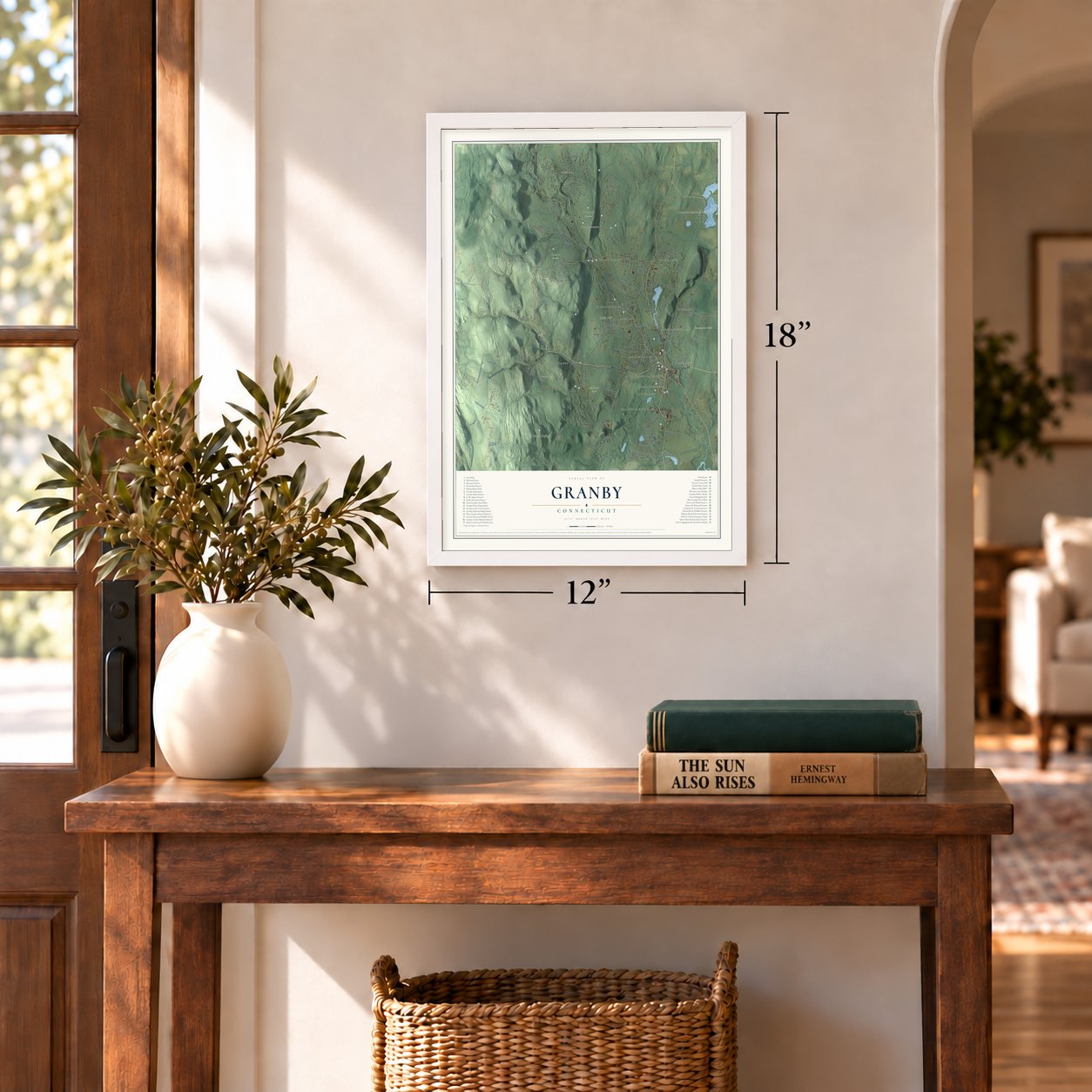
12" x 18" Archival Matte Print
A Map of Home. A Work of Art.
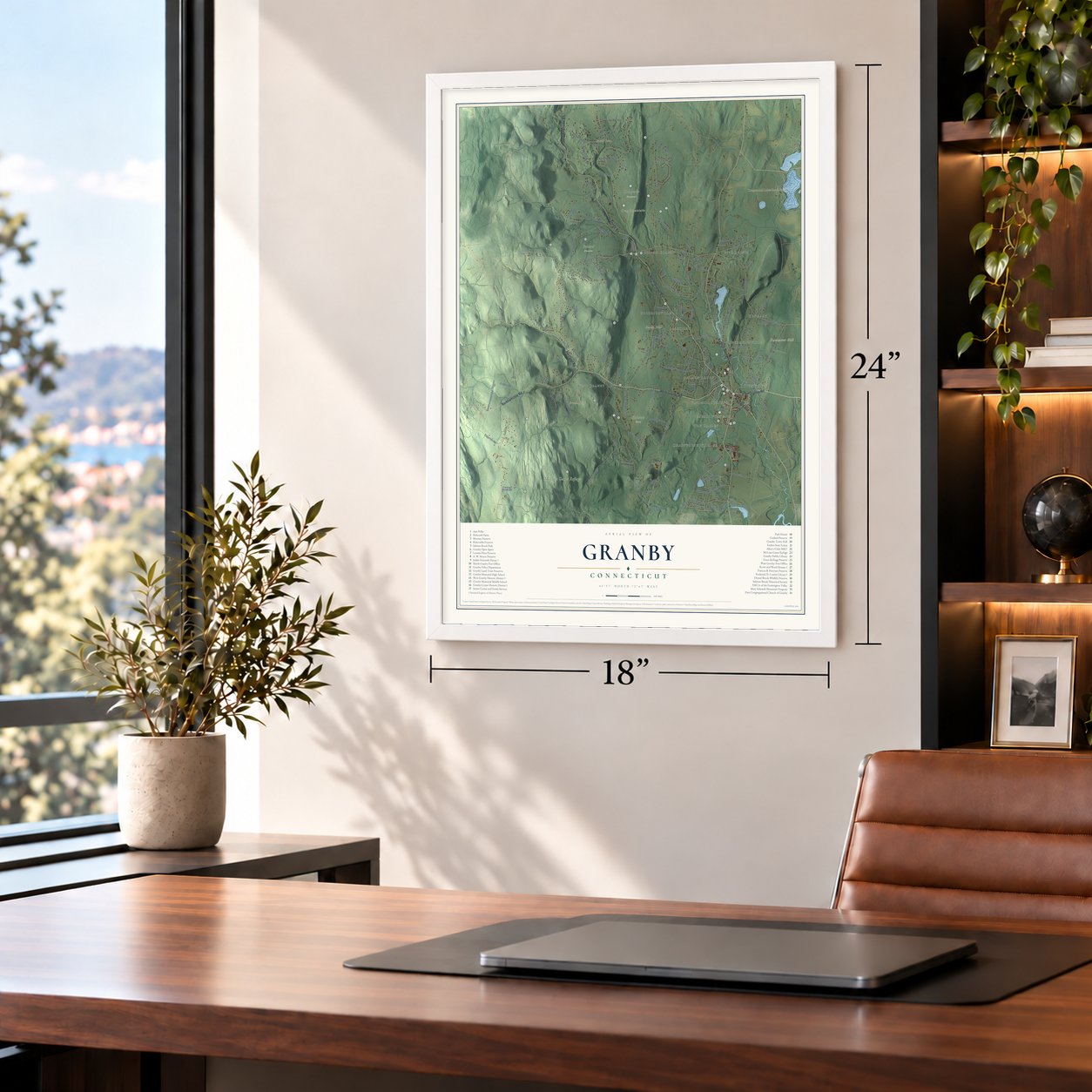
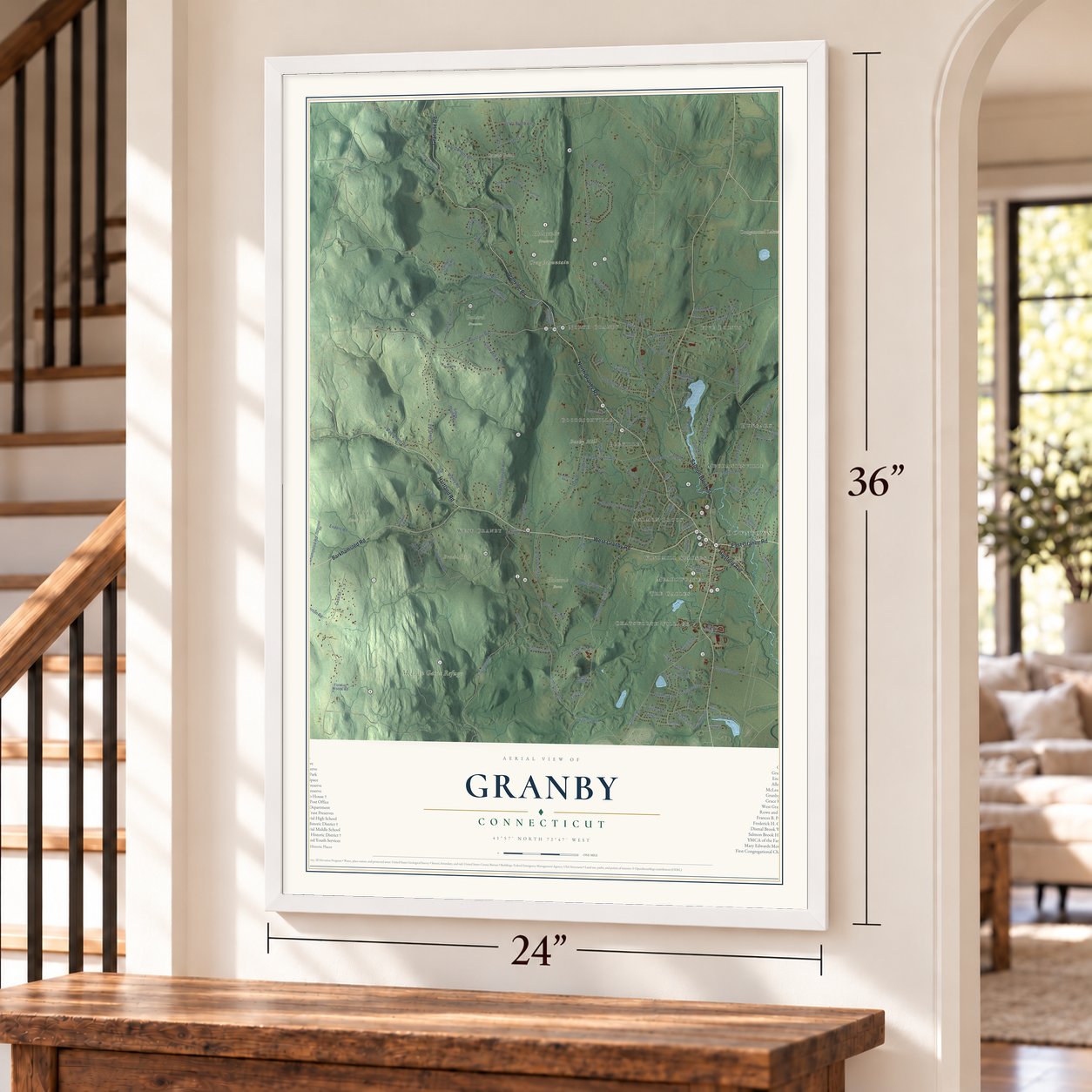
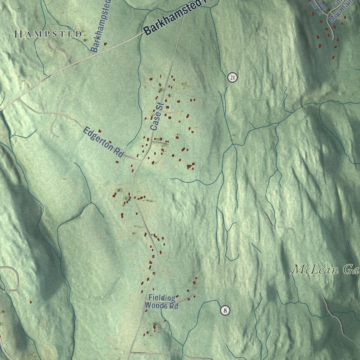
Explore Granby, Connecticut from a whole new perspective. Created using aerial imagery and detailed geographic data, this map captures Granby building by building, with labeled streets, familiar landmarks, and shaded topographical relief that highlights the natural contours of the landscape.
Combining modern data with the timeless character of a vintage atlas, this map is just as interesting up close as it is beautiful on the wall. Whether you grew up in Granby, spent memorable years there, or call it home today, this unique map is a great way to celebrate a place that means something to you. Zoom in on the preview to look for your street, and then order a print to put your memories on the wall.

Three ways to hang it
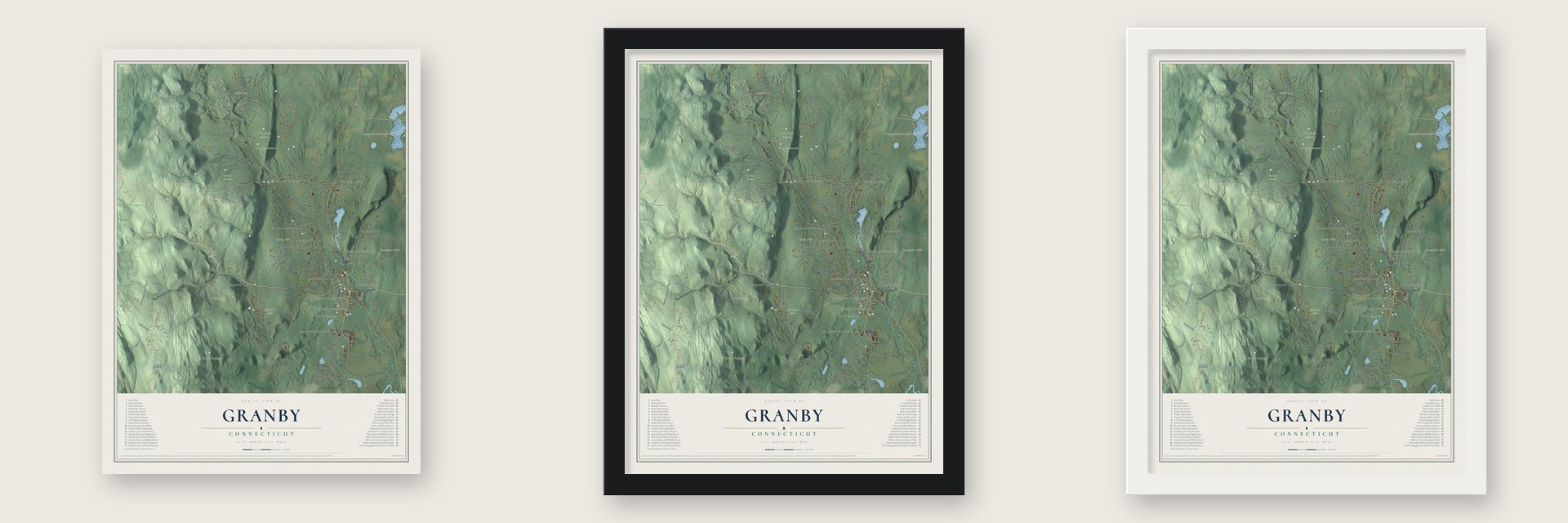
Unframed archival matte, a black wood frame or a white wood frame.
Up close
Geography Worth Displaying
This map was created using accurate cartographic data and authoritative geographic sources, including the U.S. Geological Survey (USGS) and FEMA. The map brings together terrain, waterways, roads, and building detail. The majority of the streets are labeled, houses are accurately depicted, and the topography is derived from government sources. Combining local data with carefully composed color and shading leads to this beautifully detailed Granby artwork for your wall.
Rather than simply showing street outlines, we’ve included as many of the street names as we could reasonably fit on the map while keeping their names legible. Zoom in on the high resolution preview to see exactly what’s on the map. We truly set out to create a statement piece for anyone who loves Granby. So whether it’s for you, or a gift for someone you love, we hope this map of Granby brings back fond memories.
Explore the full map of Granby, Connecticut and read about the local places it shows.

Find your street
Names on the Granby map
Every name below is printed on this map. Look for your street, your school, the park where you played, or the pond down the road.
Places and landmarks25
- Downtown
- Broad Hill
- Bushy Hill
- Crag Mountain
- Duncaster Hill
- Carson Pond
- Congamond Lakes South Pond
- Enders State Forest
- Godard Preserve
- Holcomb Farm
- Holcombe Preserve
- McLean Game Refuge
Show all 25 places
- Chatsworth Village
- Five Points
- Hampsted
- Pegville
- North Granby
- Meadowgate
- West Granby
- Hungary
- Mechanicsville
- The Gables
- Goodrichville
- Windmill Springs
- Salmon Brook
Streets and roads144
- North Granby Road
- Hartland Road
- East Granby Road
- Granville Road
- Salmon Brook Street
- West Granby Road
- Barkhamsted Road
- Hartford Avenue
- East Street
- Mountain Road
- Notch Road
- Quarry Road
- Wells Street
- Simsbury Road
- Loomis Street
- Silver Street
- Barndoor Hills Road
- Hungary Road
- Case Street
- Day Street
- Broad Hill Road
- Lost Acres Road
- Silver Brook Lane
- Firetown Road
- Canton Road
- Wells Road
- Silkey Road
- Donahue Road
- Cider Mill Heights
- Petersen Road
Show all 144 streets
- Higley Road
- Old Stage Coach Road
- Bushy Hill Road
- Northwoods Road
- Harmony Hill Road
- Heather Lane
- Creamery Hill Road
- Buttles Road
- Old Messenger Road
- Canal Road
- Kelly Lane
- Fox Road
- Cooley Road
- Enders Road
- Barkhampsted Road
- Day Street South
- Copper Hill Road
- Mechanicsville Road
- Spring Glen Drive
- Meadowbrook Road
- Sawmill Road
- Griffin Road
- Fern Hollow Drive
- Greenwood Road
- Edgerton Road
- Doherty Road
- Moosehorn Road
- Strong Road
- Twilight Drive
- Holcomb Hill Road
- Glen Road
- Zimmer Road
- Whitman Drive
- Floydville Road
- Powder Mill Lane
- County Road
- Reed Hill Drive
- Fawn Drive
- Hemlock Road
- Hillyer Way
- Dara Lane
- Oakwood Drive
- Burleigh Drive
- Byron Drive
- Kearns Drive
- Allen Road
- Haven Drive
- Granby Farms Road
- Silkey Heights Drive
- Lakeside Drive
- Haleview Drive
- Strawberry Fields Road
- Pheasant Run
- Pendleton Road
- Cone Mountain Road
- Clemons Spring Road
- Hunt Glen Drive
- Eric Drive
- Fielding Woods Road
- Peck Orchard Road
- Sakrison Road
- Danielle Road
- Stonewall Drive
- Brookside Drive
- Manitook Lake Road
- Indian Hill Drive
- Becontree Heath Road
- Mountain Crest Drive
- Elizabeth Street
- Sunny Heights
- Juniper Drive
- Longlott Road
- Cedar Drive
- Kettle Pond Lane
- Tinker Trail
- Sutton Drive
- Trout Drive
- Aster Drive
- Woodcliff Drive
- Hampsted Road
- Loveland Road
- Hampton Village Drive
- Maple Hill Drive
- Farmview Lane
- Roundhill Road
- Halwood Drive
- Stone Hedge Way
- Sullivan Drive
- Old Simsbury Road
- Schoolhouse Road
- Cranberry Lane
- Shelley Drive
- Messenger Road
- Vining Hill Road
- Quail Lane
- Ice Pond Road
- Basile Road
- Goddard Road
- Beman Road
- Cone Hill Drive
- Cortland Way
- Muriel Drive
- Wolcott Drive
- Bradley Brook Drive
- Old Field Road
- Ridge Road
- Shepherds Way
- High Ridge Drive
- Candle Wood Drive
- Partridge Meadow Road
- Birchwood Drive
- Massaco Lane
- Brendas Way
- Pine Hill Road
Names are listed as they appear on the printed map. Zoom into the product photos to find them.
About Granby, Connecticut
Granby is a town of 10,903 people in Hartford County, on the Massachusetts line. Its first name was Salmon Brook, the northern part of Simsbury, and settlers from Simsbury were living there as early as 1723. The frontier was dangerous: raiders carried off a young settler in 1707, and in 1709 the land of today's town held just eleven families.
The first church services were held in Daniel Hays's house, which was also a tavern. In 1739 neighbors argued so hard over where to build a meetinghouse that the General Assembly sent a committee, and it chose Seminary Hill. In 1775 the building was dismantled and rebuilt roughly two miles to the north. When Granby split from Simsbury in 1786, taking the name of Granby, Massachusetts, its first town meeting was called there for December. In 1858 the eastern part of town left to form East Granby.
“No wilder portion of Connecticut can be found than in some parts of West Granby.”
- Thirty days to CanadaRaiders seized Daniel Hayes, 22, at Salmon Brook in 1707. A rescue party never caught up, and each night of the march north he was tied to saplings. Made to run the gauntlet, he ducked into a wigwam, and a woman whose husband and son died in war adopted him. Years later she sold him to a Frenchman who used his weaving skill. Hayes won freedom within two years and came home to farm and lead the Salmon Brook church.
- 62 distilleries in 1828An 1819 gazetteer ranked Granby's apple orchards with the best in Connecticut, and most of the cider was distilled into brandy. By 1828 the town counted 62 distilleries. Beside a rocky gorge in North Granby, the Godards' Crag mills sawed shingles, ground grain and pressed cider. Harvy Godard, head of the State Grange from 1875 to 1879, kept up the old method and still turned out a small batch of brandy from his cider every year.
- Higley's coppers of 1737Dr. Samuel Higley dug copper from his own mine in what was then North Simsbury and struck coins from it in 1737, the first unauthorized coins made in the American colonies. The first ones were stamped three pence. Pure copper is soft, so few survive today, and later coins carried the line "Value me as you please."
- The town's first libraryFrederick H. Cossitt, a New York merchant whose family came from Granby, left the money for a library in North Granby. The Queen Anne building opened in 1890 with George S. Godard, later Connecticut's state librarian, as its first librarian. The Frederick H. Cossitt Library still serves as a branch of the town library.
- Senator McLean's woodsGeorge P. McLean, a governor and senator, bought these woods piece by piece over his life, and Presidents Coolidge, Taft and Hoover came to see him there. Amos Everett George, a Pequot caretaker, built its trails and huts. When McLean died in 1932 he left the land to the McLean Fund, and the 4,400-acre refuge is open to the public. In 1973, 1,800 of those acres were designated a National Natural Landmark.
Keep exploring Connecticut
Granby is one of 382 Connecticut towns we've mapped. Every dot on the map is a print of its own.
The search covers every state, Connecticut first.
Near Granby
Order 2 or more town maps and save 10%. Shown in the size and finish you picked above, so they hang as a set.
- Salmon Brook 12" x 18" / Archival Matte Print $39.99
- North Granby 12" x 18" / Archival Matte Print $39.99
- East Granby 12" x 18" / Archival Matte Print $39.99
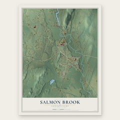

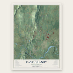
More maps nearby: Tariffville, Simsbury Center, West Simsbury, Hartland and Simsbury.
The art of mapping a place
How This Map Was Made
Real places. Remarkable detail. Discover the layers that turn geographic data into a map of home.

The view from above
Aerial imagery reveals the character of the land: woodland, open fields, and the patterns of a place.

The shape of the land
Elevation data brings hills, valleys, and subtle changes in the landscape into view.

The details of home
Roads, waterways, and building footprints come together to make the map feel unmistakably local.

Geography becomes art
Considered color, shading, and typography bring the layers together in a map made for your wall.


Process illustrated with Mendon, Massachusetts. Aerial imagery: USDA NAIP. Terrain: USGS 3D Elevation Program. Map details and finished artwork: KNOWOL.
The Details
About This Print
Choose an archival matte print, or a black or white Ayous wood frame. The archival matte print is unframed.
Select your size and finish above to see the matching product image and price.
Materials & Craftsmanship
A contemporary map with the character of a classic atlas, printed on archival matte paper. Optional frames are made from Ayous wood.
Your printed map does not include the watermark shown in the full-map preview.
Shipping & Delivery
Free shipping within the United States. Every print is made to order in the USA.
Buying a gift? Add a note in your cart and we'll include it. We never put prices in the package.
Prints ship within 2 to 3 business days. Allow 7 to 10 days total from ordering for delivery. Timing may vary during holidays or periods of high order volume.
Read our shipping policy.
Returns and damaged prints
Each print is made to order. Change-of-mind refunds are not available after production.
If your print arrives damaged, misprinted or incorrect, contact support@knowol.com within 30 days of receiving it. Include your order number, photos and a description of the issue.
Read our full refund and replacement policy. For questions about your order, email support@knowol.com.