
Search for another town




Free U.S. delivery 7 to 10 days after you order
Greenwich, Connecticut Map Art
Building by building, with labeled streets and shaded relief.
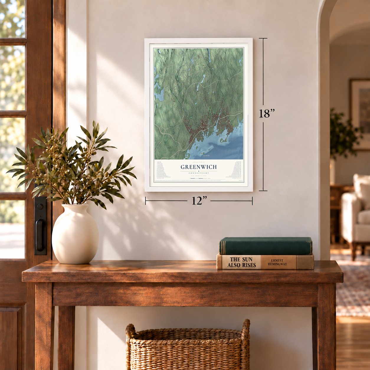
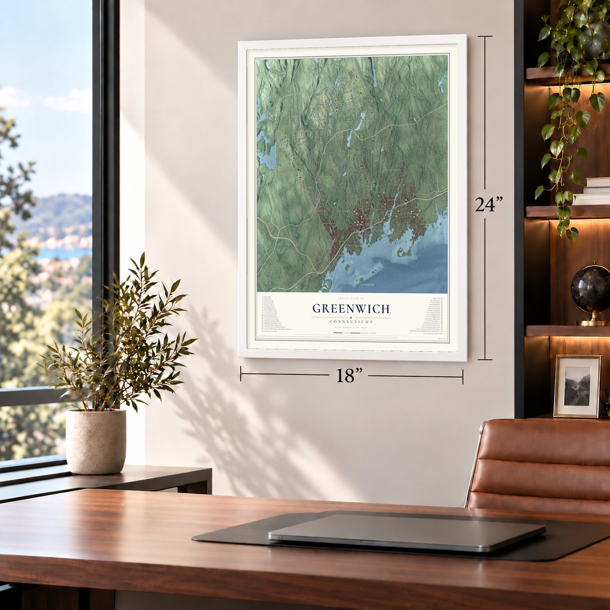
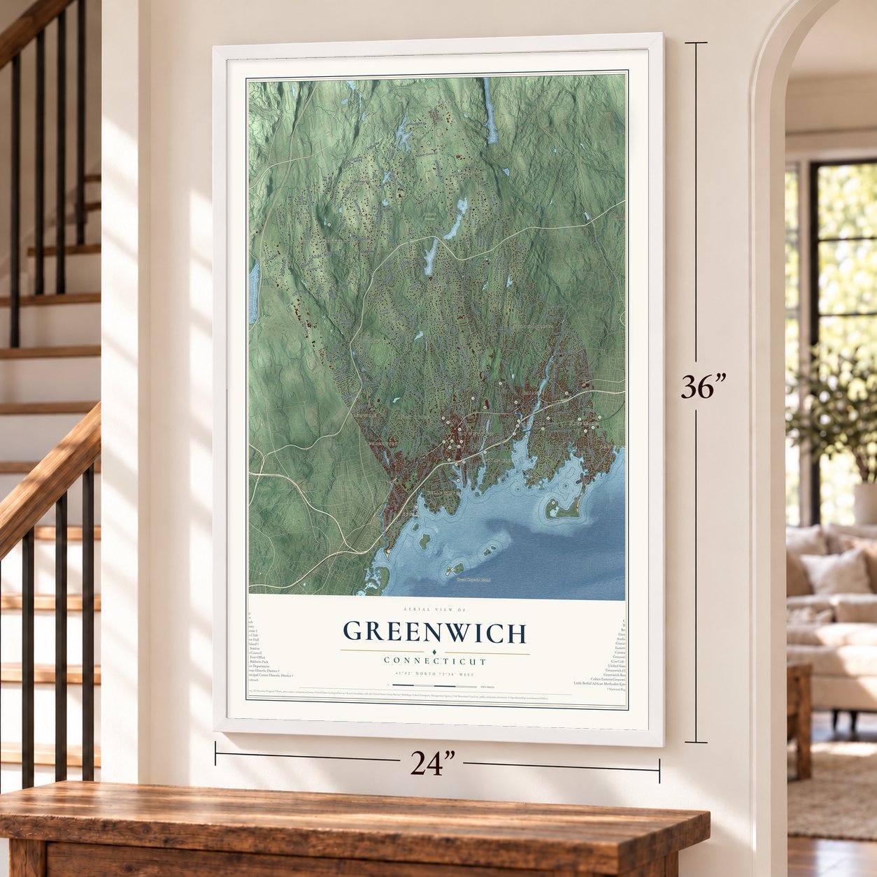
12" x 18" Archival Matte Print
A Map of Home. A Work of Art.
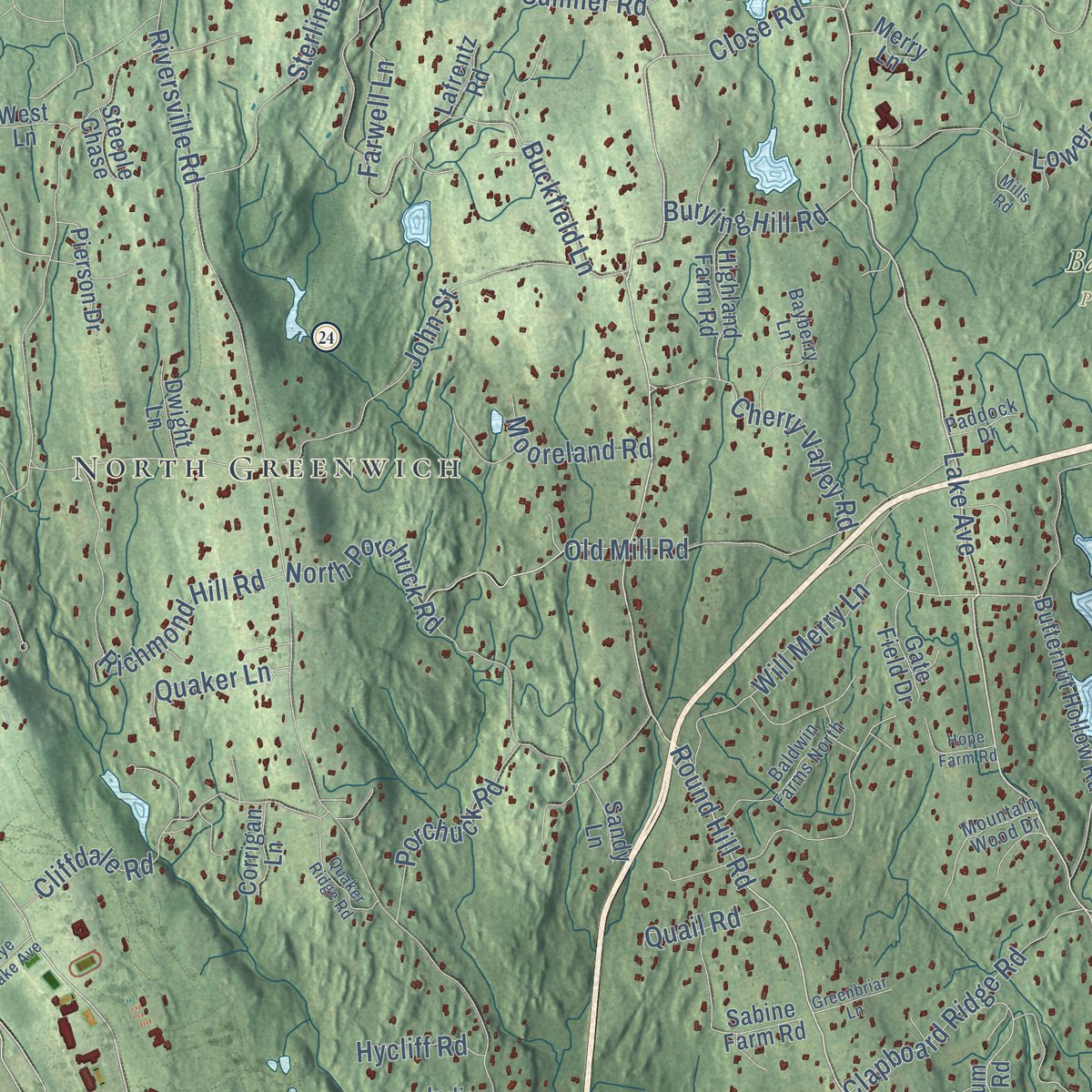
Explore Greenwich, Connecticut from a whole new perspective. Created using aerial imagery and detailed geographic data, this map captures Greenwich building by building, with labeled streets, familiar landmarks, and shaded topographical relief that highlights the natural contours of the landscape.
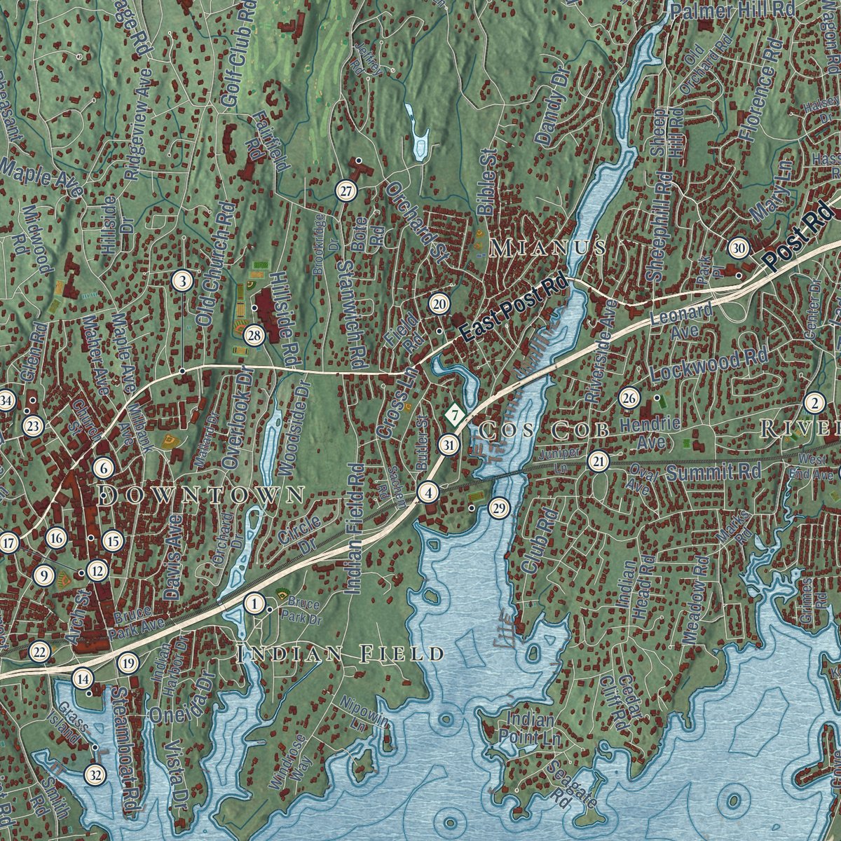
Combining modern data with the timeless character of a vintage atlas, this map is just as interesting up close as it is beautiful on the wall. Whether you grew up in Greenwich, spent memorable years there, or call it home today, this unique map is a great way to celebrate a place that means something to you. Zoom in on the preview to look for your street, and then order a print to put your memories on the wall.

Three ways to hang it
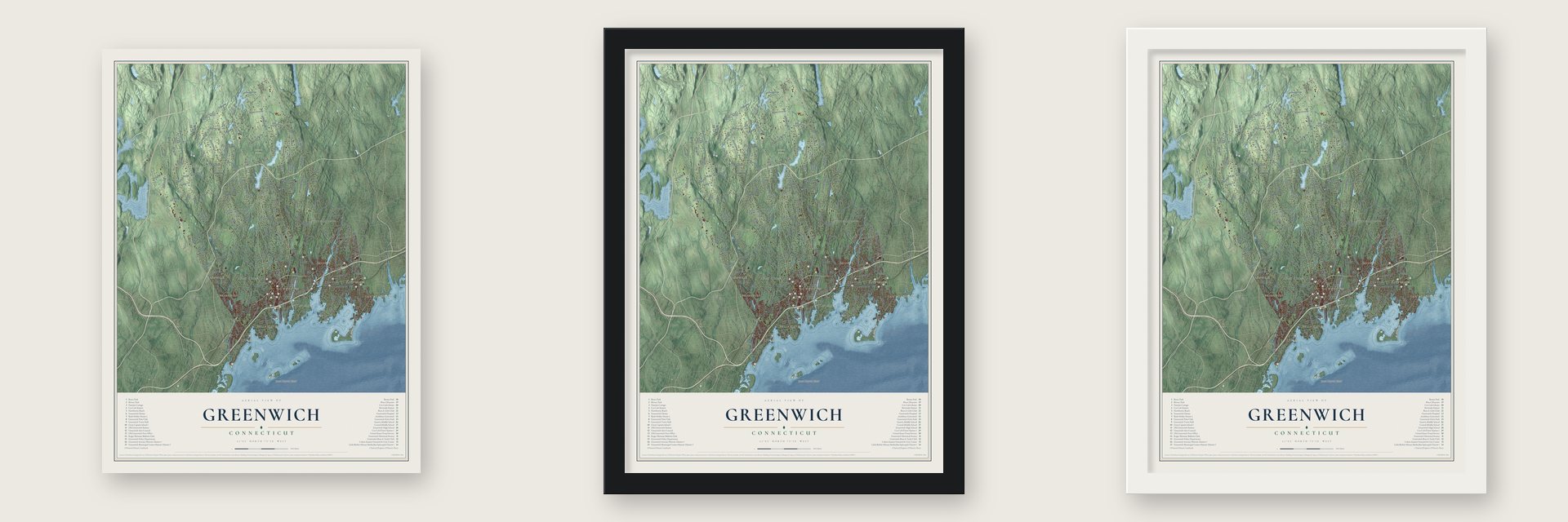
Unframed archival matte, a black wood frame or a white wood frame.
Up close
Geography Worth Displaying
This map was created using accurate cartographic data and authoritative geographic sources, including the U.S. Geological Survey (USGS) and FEMA. The map brings together terrain, waterways, roads, and building detail. The majority of the streets are labeled, houses are accurately depicted, and the topography is derived from government sources. Combining local data with carefully composed color and shading leads to this beautifully detailed Greenwich artwork for your wall.
Rather than simply showing street outlines, we’ve included as many of the street names as we could reasonably fit on the map while keeping their names legible. Zoom in on the high resolution preview to see exactly what’s on the map. We truly set out to create a statement piece for anyone who loves Greenwich. So whether it’s for you, or a gift for someone you love, we hope this map of Greenwich brings back fond memories.
Explore the full map of Greenwich, Connecticut and read about the local places it shows.
Find your street
Names on the Greenwich map
Every name below is printed on this map. Look for your street, your school, the park where you played, or the pond down the road.
Places and landmarks19
- Banksville
- North Greenwich
- Old Greenwich
- Great Captain Island
- Downtown
- Byram
- Cos Cob
- Riverside
- Glenville
- Stanwich
- Babcock Preserve
- North Mianus
Show all 19 places
- Riversville
- Pine Hill
- Belle Haven
- Pemberwick
- Indian Field
- Mianus
- Rock Ridge
Streets and roads258
- West Putnam Avenue
- Post Road
- Lake Avenue
- Round Hill Road
- King Street
- Edgar Road
- Davis Avenue
- Parsonage Road
- North Street
- Riversville Road
- Stanwich Road
- Taconic Road
- Valley Road
- Bedford Road
- Clapboard Ridge Road
- Conyers Farm Drive
- John Street
- Tods Driftway
- Glenville Road
- Shore Road
- Old Mill Road
- Cat Rock Road
- Weaver Street
- Zaccheus Mead Lane
- Indian Field Road
- Field Point Road
- River Road
- Bible Street
- Doubling Road
- Pecksland Road
Show all 258 streets
- Cutler Road
- Lower Cross Road
- Porchuck Road
- Byram Shore Road
- Richmond Hill Road
- Orchard Street
- Bowman Drive
- Cliffdale Road
- North Porchuck Road
- Sheephill Road
- North Maple Avenue
- Husted Lane
- Perkins Road
- Londonderry Drive
- Old Church Road
- Stag Lane
- Hillcrest Park Road
- Sterling Road
- Sherwood Avenue
- Hamilton Avenue
- Lockwood Road
- Burning Tree Road
- Park Avenue
- Cherry Valley Road
- Hurlingham Drive
- Sawmill Lane
- Overlook Drive
- Buckfield Lane
- Vineyard Lane
- Palmer Hill Road
- Duncan Drive
- Dandy Drive
- Tomac Avenue
- Hillside Road
- Birch Lane
- South Water Street
- Steamboat Road
- Locust Road
- Byram Road
- Memory Lane
- Lismore Lane
- Mead Avenue
- Oneida Drive
- Close Road
- Burying Hill Road
- Farwell Lane
- Club Road
- Upland Drive
- Grahampton Lane
- Frontier Road
- Will Merry Lane
- Florence Road
- Mooreland Road
- Summit Road
- Dewart Road
- Quaker Lane
- Alpine Road
- Flagler Drive
- Caroline Place
- Crown Lane
- Sumner Road
- Edgewood Drive
- Mimosa Drive
- Golf Club Road
- Quail Road
- Hycliff Road
- Mohawk Lane
- Cross Lane
- Byfield Lane
- Mary Lane
- Vista Drive
- The Avenue
- Oak Street
- Tod Lane
- East Post Road
- Laddins Rock Road
- Havemeyer Lane
- Fairfield Road
- Field Point Circle
- Riverside Avenue
- Pemberwick Road
- Sound Beach Avenue
- Butternut Hollow Road
- Hunting Ridge Road
- Rockwood Lane
- Arch Street
- Indian Head Road
- Upper Cross Road
- Hendrie Avenue
- Valley Drive
- Khakum Wood Road
- Woodside Drive
- Winding Lane
- Stonehedge Drive South
- Ridgeview Avenue
- Sheep Hill Road
- Midwood Road
- Meadow Road
- Hillside Drive
- Fox Run Lane
- Lafrentz Road
- Cedar Cliff Road
- South Stanwich Road
- Pheasant Lane
- Mayfair Lane
- Highland Farm Road
- Glen Ridge Road
- Interlaken Road
- Dublin Hill Drive
- Harding Road
- Wilshire Road
- Skyridge Road
- Hettiefred Road
- Creamer Hill Road
- Field Road
- Indian Knoll Place
- Dairy Road
- Maher Avenue
- Circle Drive
- Pierson Drive
- Old Camp Lane
- Angus Lane
- Prospect Street
- Gate Field Drive
- Maple Avenue
- Fort Hill Lane
- Old Wagon Road
- Hill Road
- Guards Road
- Lauder Lane
- Indian Point Lane
- Bote Road
- Benenson Drive
- Aiken Road
- Deep Gorge Road
- Dwight Lane
- Merry Lane
- Frost Road
- Corrigan Lane
- Glen Road
- Leonard Avenue
- Seagate Road
- Sandy Lane
- Oakley Lane
- Guinea Road
- Steeple Chase
- Sabine Farm Road
- Howard Road
- West Lane
- Hunt Terrace
- Mayo Avenue
- Cove Road
- Smith Road
- Grove Lane
- Ford Lane
- Mill Street
- Pine Street
- Marks Road
- Cognewaugh Road
- Dingletown Road
- Milbank Avenue
- Calhoun Drive
- Baldwin Farms North
- Beechcroft Road
- Bayberry Lane
- Old Orchard Road
- Bruce Park Avenue
- Mountain Wood Drive
- Midwood Drive
- Meeting House Road
- Hillcrest Lane
- Butler Street
- Pilgrim Drive
- Indian Harbor Drive
- Center Drive
- Indian Mill Road
- Orchard Drive
- Nutmeg Drive
- Bailiwick Road
- Park Place
- Hassake Road
- Mountain Laurel Drive
- Chitwick Pond Road
- Wyckham Hill Lane
- View Street
- Grass Island
- Day Road
- Desiree Drive
- Windrose Way
- Oval Avenue
- Church Street
- Nipowin Lane
- Paddock Drive
- Grimes Road
- Loch Lane
- Bruce Park Drive
- Meadow Wood Drive
- Round Hill Club Road
- Brookridge Drive
- North Stanwich Road
- Glenwood Drive
- Halsey Drive
- Rock Ridge Avenue
- Mallard Drive
- Quaker Ridge Road
- Montgomery Lane
- Meadowcroft Lane
- Cambridge Drive
- Andrews Farm Road
- Keofferam Road
- Gregory Road
- Jeffrey Road
- Hope Farm Road
- Grey Rock Drive
- Sachem Road
- West End Avenue
- American Lane
- Lindsay Drive
- Greenbriar Lane
- French Road
- Daffodil Lane
- Mills Road
- Red Coat Lane
- Juniper Lane
- Kandahar Road
- Rye Lake Avenue
- Deer Lane
- Fado Lane
Names are listed as they appear on the printed map. Zoom into the product photos to find them.
About Greenwich, Connecticut
Greenwich is a town of 63,518 people in Fairfield County, in the far southwest corner of Connecticut. On July 18, 1640, Daniel Patrick and Robert Feake came ashore at Greenwich Point and bought land from the Siwanoy for 25 coats. One of the founders, Elizabeth Fones Winthrop Feake, bought the point itself, so it was long known as Elizabeth's Neck. The General Assembly made Greenwich a township on May 11, 1665.
The village at the center took the name Horseneck from a strip of land along the Sound where settlers grazed their horses. The last stretch of track between New Haven and New York crossed the Cos Cob Bridge on Christmas Day 1848. In 1854 Horseneck became the Borough of Greenwich, though Greenwich Avenue still had only three or four small stores. Mianus and Cos Cob remained the business centers until after 1886, when the borough finally pulled ahead.
“This parish is the largest, richest, and most populous part of the town.”
- Putnam's ride in 1779A 1911 town history says one ball passed through his hat, and that the stone steps shown as his route were cut by the town in 1902. On August 20, 1824, Lafayette walked down that hill beneath an arch of hemlock and roses. Knapp Tavern stands nearby, and the town seal shows the ride.
- Spike iron and hoopskirt wireIn 1829 Robert Cox, an English ironworker, set up a rolling mill beside the Mianus. During the Civil War its spike iron climbed from $60 to $200 a ton. Just below it, a wire mill turned out hoopskirt wire from 1859 to 1868, then shut down when the fashion faded. Upriver, Walter Swan had made linen paper fine enough for ledgers since about 1800.
- Selleck's gristmill of 1796Sylvanus Selleck built his gristmill on Converse Pond Brook in northern Greenwich in 1796, and it ground grain until 1895. The braced-frame building is one of just two mill buildings from the 18th century known in the state. It joined the National Register in 1990.
- Oysters at the MianusIn 1850 Captain Henry S. Lockwood began raising oysters by laying down shells where the Mianus River empties out. In 1878 he launched a steamboat built for oystering, the first of its kind in the country. Boats were built at Cos Cob too, and Palmer and Duff's shipyard there did not close until 1907, when its two partners were 88 and 83.
- Ward's CastleWilliam E. Ward finished his house on the New York line in 1876. He built it entirely of reinforced concrete so that it could not burn. Known as Ward's Castle, it is often described as the country's first building of its kind. The William E. Ward House joined the National Register in 1976.
Keep exploring Connecticut
Greenwich is one of 376 Connecticut towns we've mapped. Every dot on the map is a print of its own.
The search covers every state, Connecticut first.
Near Greenwich
Order 2 or more town maps and save 10%. Shown in the size and finish you picked above, so they hang as a set.
- Rock Ridge 12" x 18" / Archival Matte Print $39.99
- Glenville 12" x 18" / Archival Matte Print $39.99
- Pemberwick 12" x 18" / Archival Matte Print $39.99

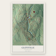

More maps nearby: Cos Cob, Indian Field, Riverside, North Mianus and Byram.
The art of mapping a place
How This Map Was Made
Real places. Remarkable detail. Discover the layers that turn geographic data into a map of home.

The view from above
Aerial imagery reveals the character of the land: woodland, open fields, and the patterns of a place.

The shape of the land
Elevation data brings hills, valleys, and subtle changes in the landscape into view.

The details of home
Roads, waterways, and building footprints come together to make the map feel unmistakably local.

Geography becomes art
Considered color, shading, and typography bring the layers together in a map made for your wall.


Process illustrated with Mendon, Massachusetts. Aerial imagery: USDA NAIP. Terrain: USGS 3D Elevation Program. Map details and finished artwork: KNOWOL.
The Details
About This Print
Choose an archival matte print, or a black or white Ayous wood frame. The archival matte print is unframed.
Select your size and finish above to see the matching product image and price.
Materials & Craftsmanship
A contemporary map with the character of a classic atlas, printed on archival matte paper. Optional frames are made from Ayous wood.
Your printed map does not include the watermark shown in the full-map preview.
Shipping & Delivery
Free shipping within the United States. Every print is made to order in the USA.
Buying a gift? Add a note in your cart and we'll include it. We never put prices in the package.
Prints ship within 2 to 3 business days. Allow 7 to 10 days total from ordering for delivery. Timing may vary during holidays or periods of high order volume.
Read our shipping policy.
Returns and damaged prints
Each print is made to order. Change-of-mind refunds are not available after production.
If your print arrives damaged, misprinted or incorrect, contact support@knowol.com within 30 days of receiving it. Include your order number, photos and a description of the issue.
Read our full refund and replacement policy. For questions about your order, email support@knowol.com.