
Search for another town





Free U.S. delivery 7 to 10 days after you order
Poquoson, Virginia Map Art
A new map of Poquoson, Virginia, made in 2026 and printed to order on thick archival matte paper.
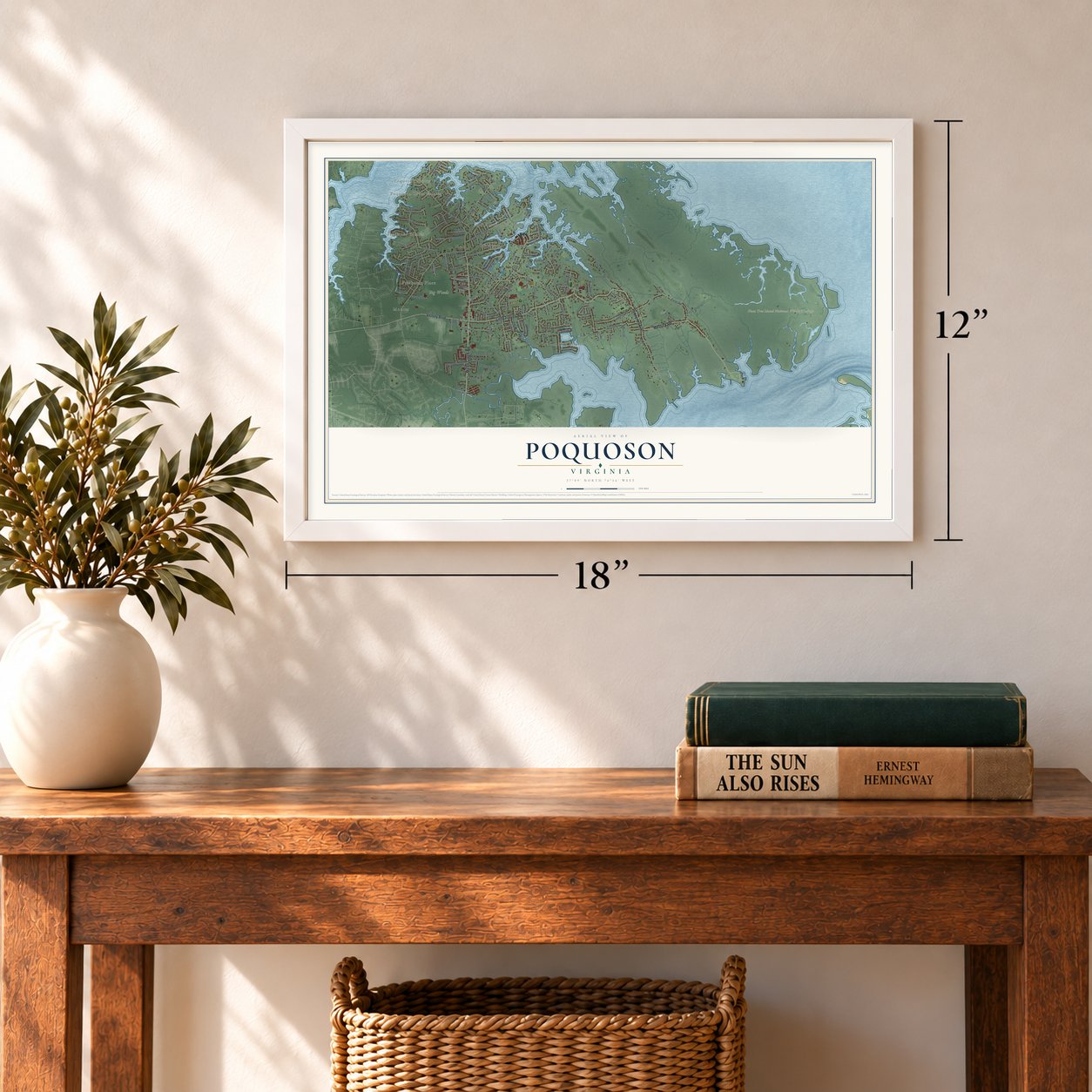
12" x 18" Archival Matte Print
A Map of Home. A Work of Art.
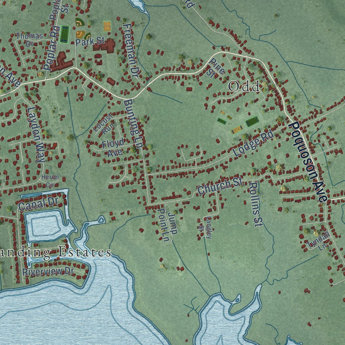
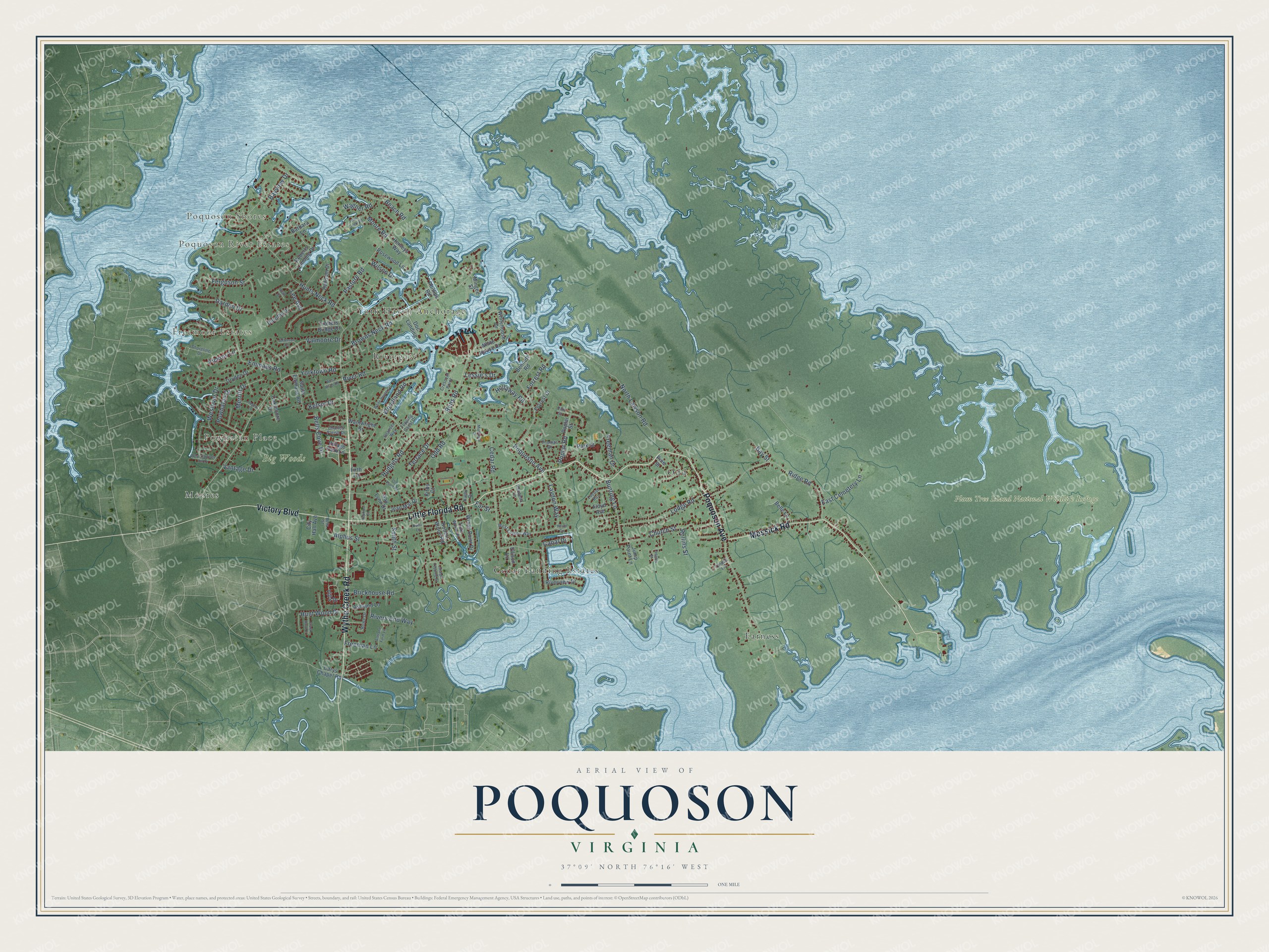
Explore Poquoson, Virginia from a whole new perspective. Created using aerial imagery and detailed geographic data, this map captures Poquoson building by building, with labeled streets, familiar landmarks, and shaded topographical relief that highlights the natural contours of the landscape.
Combining modern data with the timeless character of a vintage atlas, this map is just as interesting up close as it is beautiful on the wall. Whether you grew up in Poquoson, spent memorable years there, or call it home today, this unique map is a great way to celebrate a place that means something to you. Zoom in on the preview to look for your street, and then order a print to put your memories on the wall.
Three ways to hang it
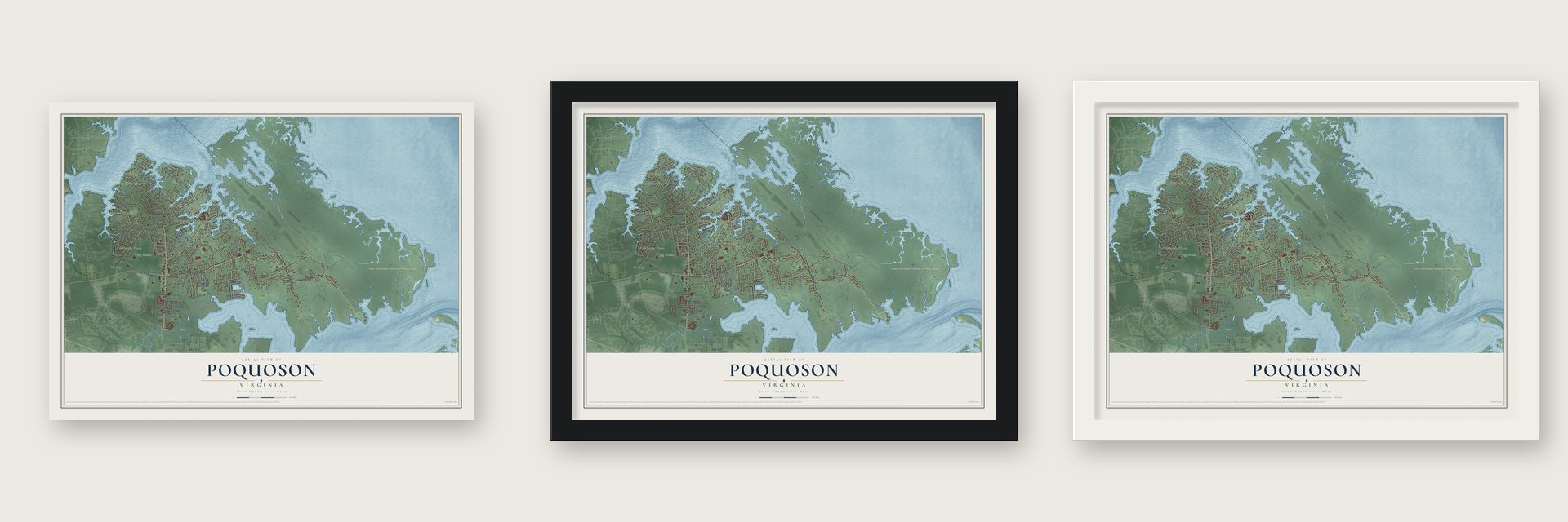
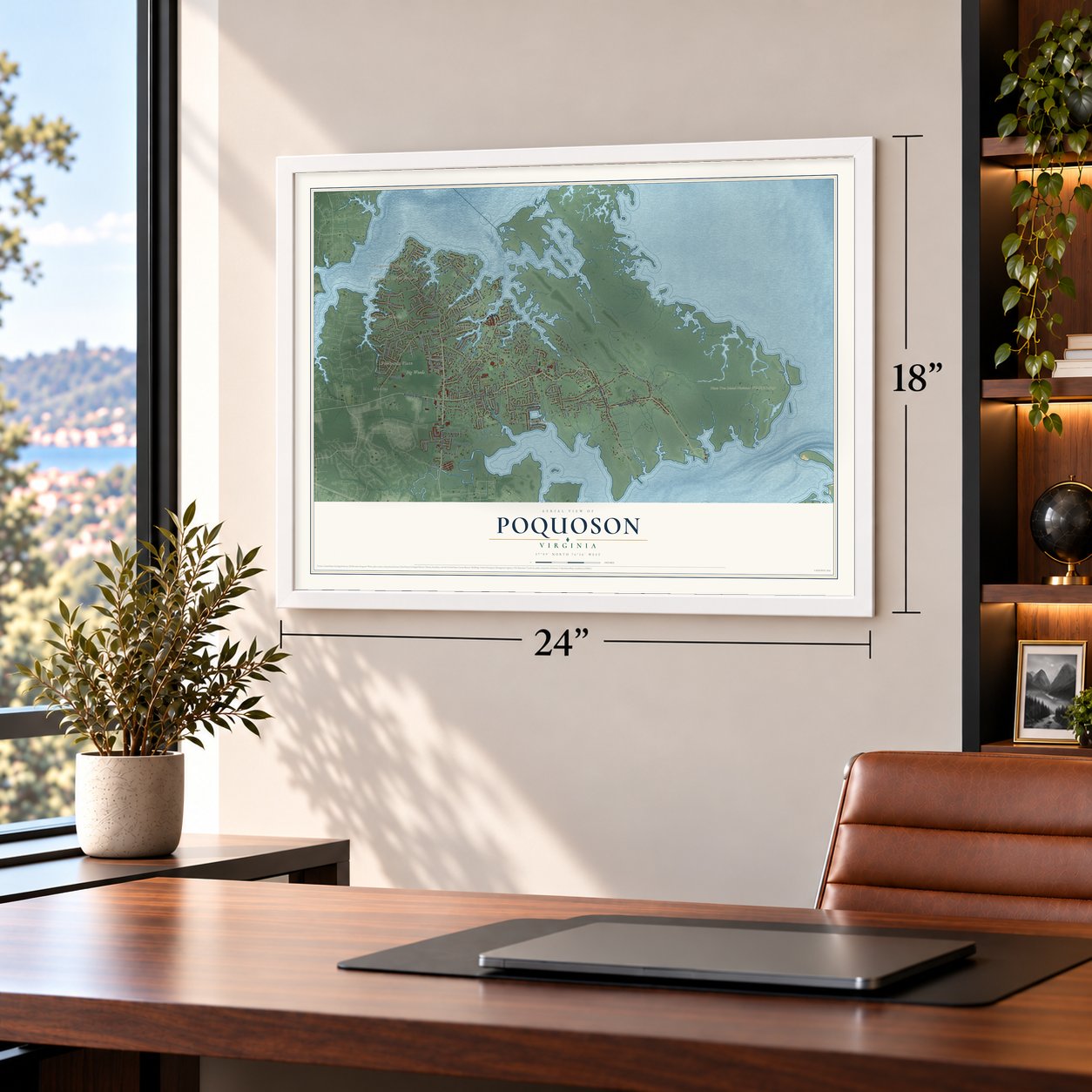
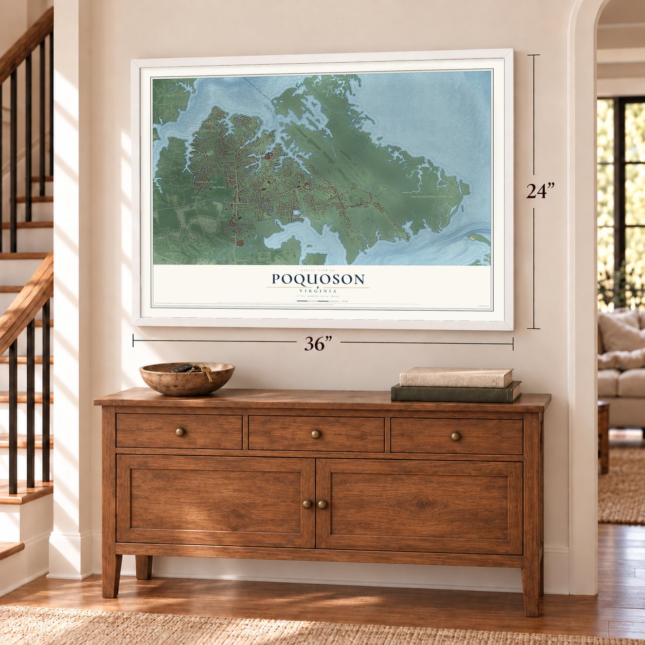
Unframed archival matte, a black wood frame or a white wood frame.
Up close
Geography Worth Displaying
This map was created using accurate cartographic data and authoritative geographic sources, including the U.S. Geological Survey and the Census Bureau. The map brings together terrain, waterways, roads, and building detail. The majority of the streets are labeled, houses are accurately depicted, and the topography is derived from government sources. Combining local data with carefully composed color and shading leads to this beautifully detailed Poquoson artwork for your wall.
Rather than simply showing street outlines, we’ve included as many of the street names as we could reasonably fit on the map while keeping their names legible. Zoom in on the high resolution preview to see exactly what’s on the map. We truly set out to create a statement piece for anyone who loves Poquoson. So whether it’s for you, or a gift for someone you love, we hope this map of Poquoson brings back fond memories.
Read the story behind this map of Poquoson, Virginia from 2026.

About Poquoson, Virginia
Poquoson is an independent city of 12,460 people on the Virginia Peninsula, with the Poquoson River on its north side and the Back River on its south. English colonists from the settlement at Kecoughtan opened this land in 1628, and it belonged to New Poquoson Parish, which also took in Tabb, Grafton, Dare and Seaford. In 1634 the area fell within Charles River Shire, one of Virginia's eight original shires, and that shire was renamed York County in 1642-43.
For the next three centuries Poquoson stayed a small rural corner of York County. In 1952 residents incorporated it as a town because they wanted to keep their own high school open, rather than have their children ride the long way to York High School. To hold on to that school, the town became an independent city in 1975, a move that also shielded it from annexation by neighboring Hampton. The courts, sheriff and jail are still shared with York County.
- A name that outlasted a petitionPoquoson comes from an Algonquian word, often translated as "great marsh," for low, wooded ground that lay under water in winter and dried out in summer. A petition once tried to rename the parish and the river to wipe out Indian words, but it failed. Few cities in Virginia have carried a single name without a break for as long as Poquoson has.
- Why it's called Bull IslandFor centuries local farmers turned their cattle loose to graze in the salt marshes, so people came to call the place Bull Island. Only a few small farms are left and the marsh herd is long gone, but residents still call themselves Bull Islanders.
- A Confederate line at Ship PointWhen Union General George B. McClellan planned a march up the peninsula toward Richmond in spring 1862, Confederate General John B. Magruder built three lines of defenses against him. The northern end of the first line rested on a redoubt at Ship Point, near the Poquoson River's mouth. After the Confederates pulled out, the Union Army made it a supply depot and hospital.
- Homes raised above the waterBecause the city sits so low, storms hit it hard. In 2003 Hurricane Isabel's surge left most of Poquoson under several feet of water, the worst flooding in the region since the 1933 Chesapeake-Potomac hurricane. The November 2009 nor'easter flooded much of the city again, and Hurricane Irene brought a mandatory evacuation in 2011. After these floods, many families lifted their houses onto raised foundations.
Find your street
Names on the Poquoson map
Every name below is printed on this map. Look for your street, your school, the park where you played, or the pond down the road.
Places and landmarks12
- Freemoor Estates
- Poquoson Shores
- Powhatan Place
- Poquoson River Estates
- Big Woods
- Plum Tree Island National Wildlife Refuge
- Cedar Landing Estates
- Earness
- Moores
- Odd
- Rivergate
- York Haven Anchorage
Streets and roads123
- Wythe Creek Road
- Poquoson Avenue
- Little Florida Road
- Victory Boulevard
- Messick Road
- Yorktown Road
- Hunts Neck Road
- Cedar Road
- Odd Road
- Browns Neck Road
- North Lawson Road
- Ridge Road
- Emmaus Road
- Pasture Road
- Rens Road
- Valmoore Drive
- Church Street
- Forrest Road
- Lodge Road
- Hudgins Road
- River Road
- Westover Drive
- Laydon Way
- Darden Drive
- Bayview Drive
- Powhatan Drive
- Bunting Lane
- Alphus Street
- Woodland Road
- Beach Road
Show all 123 streets
- Poplar Road
- Brickhouse Road
- Rivers End Way
- Bells Cove Drive
- Ferguson Street
- East Cemetery Lane
- Smith Street
- Hunt Wood Drive
- Lee Avenue
- Hollaway Road
- Terrace Drive
- Bay Street
- Freeman Drive
- Kelsor Drive
- Vantage Drive
- Moore Road
- Wagner Road
- Pickins Lane
- Freeman Lane
- Lessie's Drive
- Wilson Drive
- Canal Drive
- Merritt Drive
- Rollins Street
- Far Street
- Dryden Drive
- White House Drive
- Whitehouse Drive
- Barbara Lane
- Poplar Street
- Villa Drive
- Wainwright Drive
- Bennett Road
- Robert Bruce Road
- Windy Point Drive
- Roberts Landing Drive
- South Emmaus Road
- Belle Lane
- Dorothy Drive
- Riverview Drive
- Ashland Lane
- Hansom Drive
- Rosewood Lane
- Park Street
- Carys Chapel Road
- Jean Mar Drive
- Gay Lynn Drive
- Trotters Bridge Drive
- Oakmoore Drive
- Henleys Way
- Floyd Avenue
- Village Park Lane
- Forrest Drive
- Jump Point Lane
- Doc Landing
- Mingee Street
- Phillips Road
- Ellison Lane
- City Hall Avenue
- Firth Lane
- Kirby Court
- Pine Street
- Shoreline Drive
- Charles Parish Drive
- West Laydon Way
- Thomas Drive
- Trott Wood Drive
- Crescent Point
- Rowe Drive
- Locust Run
- Rhodelia Lane
- Islander Way
- Topping Canal Drive
- Tyndall Lane
- Kathy Drive
- Elm Street
- Beta Street
- West Carriage Hill Drive
- Langley Street
- Municipal Drive
- Old Pond Road
- White House Circle
- Joseph Topping Drive
- Twin Creek Road
- Ashland Farm Lane
- Rogers Lane
- Frank Hunt Court
- West River Road
- Jefferson Court
- Hopkins Court
- Heron Circle
- Ruth Drive
- Kurtz Lane
Names are listed as they appear on the printed map. Zoom into the product photos to find them.
The art of mapping a place
How This Map Was Made
Real places. Remarkable detail. Discover the layers that turn geographic data into a map of home.

The view from above
Aerial imagery reveals the character of the land: woodland, open fields, and the patterns of a place.

The shape of the land
Elevation data brings hills, valleys, and subtle changes in the landscape into view.

The details of home
Roads, waterways, and building footprints come together to make the map feel unmistakably local.

Geography becomes art
Considered color, shading, and typography bring the layers together in a map made for your wall.


Process illustrated with Mendon, Massachusetts. Aerial imagery: USDA NAIP. Terrain: USGS 3D Elevation Program. Map details and finished artwork: KNOWOL.
The Details
About This Print
Choose an archival matte print, or a black or white Ayous wood frame. The archival matte print is unframed.
Select your size and finish above to see the matching product image and price.
Materials & Craftsmanship
A contemporary map with the character of a classic atlas, printed on archival matte paper. Optional frames are made from Ayous wood.
Your printed map does not include the watermark shown in the full-map preview.
Shipping & Delivery
Free shipping within the United States. Every print is made to order in the USA.
Buying a gift? Add a note in your cart and we'll include it. We never put prices in the package.
Prints ship within 2 to 3 business days. Allow 7 to 10 days total from ordering for delivery. Timing may vary during holidays or periods of high order volume.
Read our shipping policy.
Returns and damaged prints
Each print is made to order. Change-of-mind refunds are not available after production.
If your print arrives damaged, misprinted or incorrect, contact support@knowol.com within 30 days of receiving it. Include your order number, photos and a description of the issue.
Read our full refund and replacement policy. For questions about your order, email support@knowol.com.
Find your town
Looking for another city?
Find a map of home in our Virginia collection, or any town in the country.
Nearby
Maps of towns near Poquoson
Know someone from one of these towns? Their map makes a great gift.
 Hampton
, Virginia
From $39.99See the map
 Bethel Manor
, Virginia
From $39.99See the map
 Newport News
, Virginia
From $39.99See the map
More maps nearby: Yorktown, Norfolk, Gloucester Point, Cape Charles and Carrollton.