
Search for another town





Free U.S. delivery 7 to 10 days after you order
Norfolk, Virginia Map Art
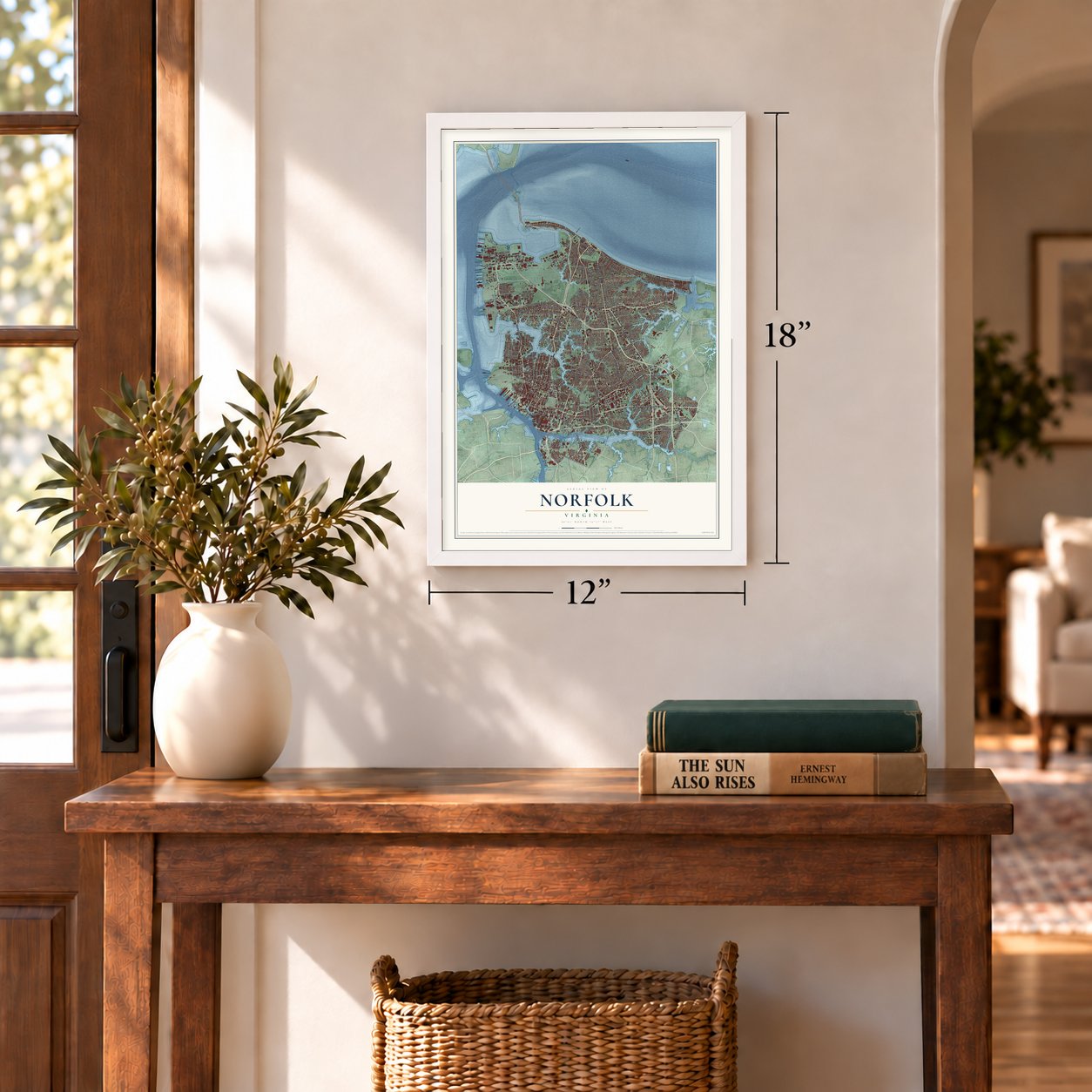
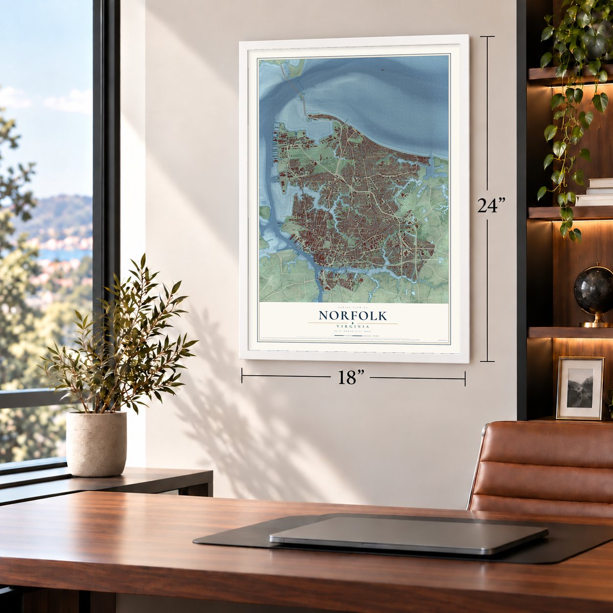
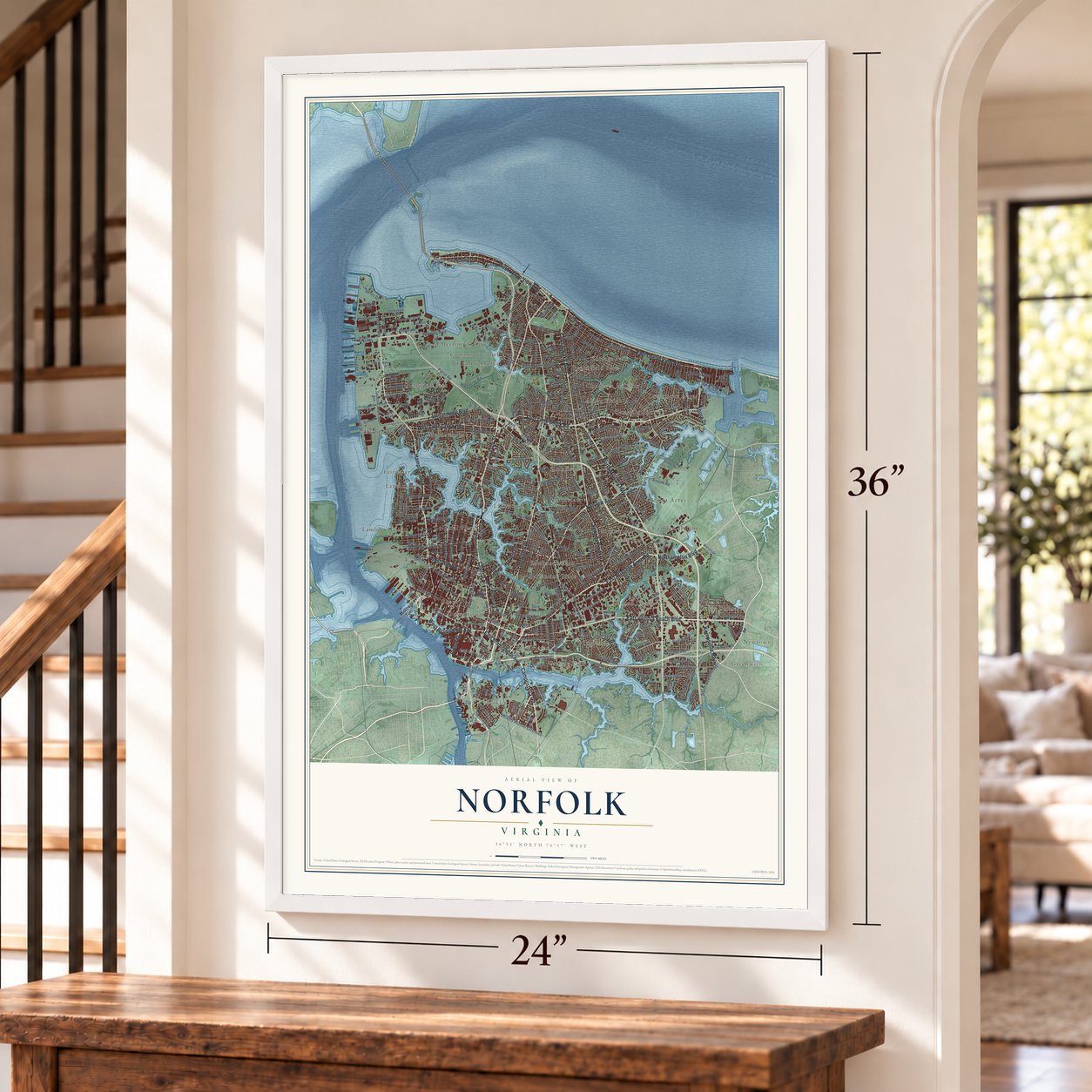
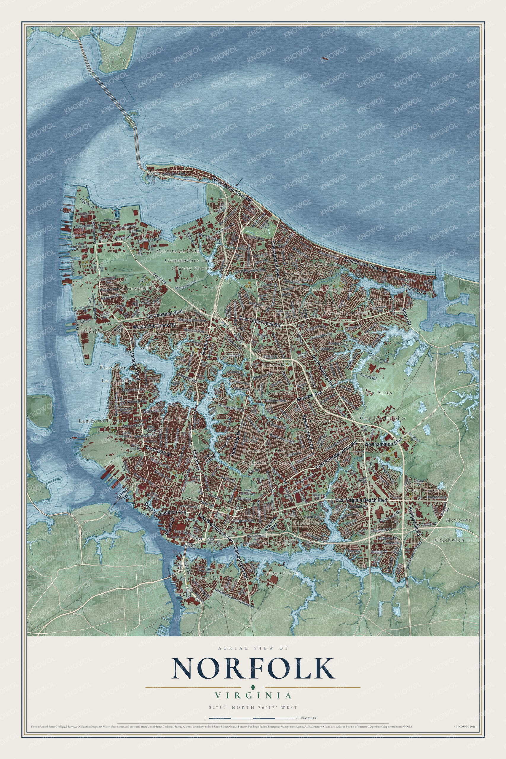
A new map of Norfolk, Virginia, made in 2026 and printed to order on thick archival matte paper.
12" x 18" Archival Matte Print
A Map of Home. A Work of Art.
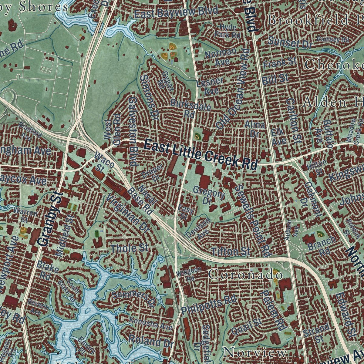
Explore Norfolk, Virginia from a whole new perspective. Created using aerial imagery and detailed geographic data, this map captures Norfolk building by building, with labeled streets, familiar landmarks, and shaded topographical relief that highlights the natural contours of the landscape.
Combining modern data with the timeless character of a vintage atlas, this map is just as interesting up close as it is beautiful on the wall. Whether you grew up in Norfolk, spent memorable years there, or call it home today, this unique map is a great way to celebrate a place that means something to you. Zoom in on the preview to look for your street, and then order a print to put your memories on the wall.
Three ways to hang it
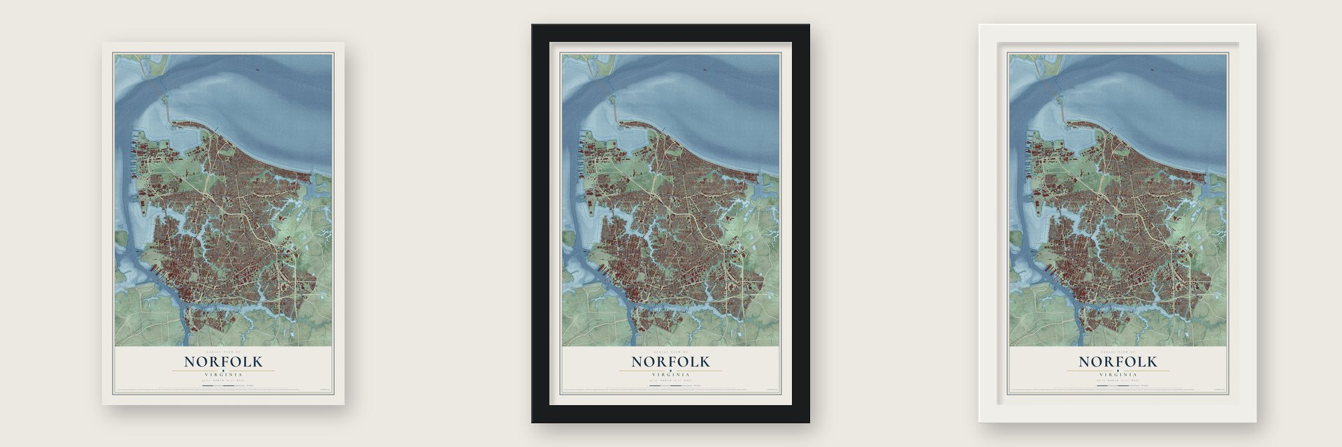
Unframed archival matte, a black wood frame or a white wood frame.
Up close
Geography Worth Displaying
This map was created using accurate cartographic data and authoritative geographic sources, including the U.S. Geological Survey and the Census Bureau. The map brings together terrain, waterways, roads, and building detail. The majority of the streets are labeled, houses are accurately depicted, and the topography is derived from government sources. Combining local data with carefully composed color and shading leads to this beautifully detailed Norfolk artwork for your wall.
Rather than simply showing street outlines, we’ve included as many of the street names as we could reasonably fit on the map while keeping their names legible. Zoom in on the high resolution preview to see exactly what’s on the map. We truly set out to create a statement piece for anyone who loves Norfolk. So whether it’s for you, or a gift for someone you love, we hope this map of Norfolk brings back fond memories.
Read the story behind this map of Norfolk, Virginia from 2026.

About Norfolk, Virginia
Norfolk is a city of 238,005 people where the Elizabeth River meets the Chesapeake Bay. Colonists built a "Half Moone" fort here and paid 10,000 pounds of tobacco to local people of the Powhatan Confederacy for 50 acres of land. The House of Burgesses created the "Towne of Lower Norfolk County" in 1680. The town was incorporated in 1705, and George II made it a royal borough in 1736. It grew into a busy port that shipped goods to the British Isles.
When the Revolution forced Lord Dunmore, the royal governor, out of Williamsburg, he made Norfolk the capital of Virginia in 1775. Most of the town's 6,250 people were Loyalists, because British trade monopolies favored their businesses. Dunmore lost the Battle of Great Bridge that December, and his ships shelled the town. Next the Patriot side's Fourth Virginia Convention took a vote, dated January 16, 1776, to burn most of the remaining homes so the British could not gather troops there. St. Paul's Church was the only building whose walls still stood. Norfolk rebuilt slowly and became a city in 1845.
- Yellow fever in 1855On June 7, 1855, the ship Benjamin Franklin arrived from the West Indies, where yellow fever had broken out. After eleven days in quarantine it was allowed to dock, and within days the fever reached Norfolk. A third of the city had fled by August, and the sick numbered 5,000 in September. Only cooler weather ended the outbreak, with about 3,200 dead. The Hospital of Saint Vincent DePaul, Norfolk's first civilian hospital, opened that same year.
- Ironclads off Sewell's PointIn the spring of 1862, the USS Monitor and the CSS Virginia fought the Battle of Hampton Roads off Sewell's Point. It was the first fight between two ironclads. Neither side won, but navies built metal-armored warships from then on. In May, Mayor William Lamb surrendered Norfolk to Union General John E. Wool. The city stayed under martial law for the rest of the war, and people who escaped slavery quickly opened schools here.
- Liberia's first presidentJoseph Jenkins Roberts was a free person of color born in Norfolk. Many emigrants from Virginia and North Carolina sailed for Liberia from this port. Roberts went with the American Colonization Society and was later elected the first president of Liberia.
- From fairground to naval baseThe Jamestown Exposition opened at Sewell's Point in 1907 to mark 300 years since Jamestown was founded. President Theodore Roosevelt came, along with diplomats from twenty-one countries. Its large Naval Review showed how well the site suited a navy. By 1917 Naval Air Station Hampton Roads stood on the old fairgrounds, and Naval Station Norfolk, founded that year, is now the world's largest naval base.
- Seventeen students in 1959In 1958 federal courts ordered Virginia schools to integrate, and Governor J. Lindsay Almond closed them instead. The state's high court then ordered all public schools funded, and Almond gave in. In February 1959, seventeen Black children entered six Norfolk schools that had been segregated. Lenoir Chambers, editor of the Virginian-Pilot, won the Pulitzer Prize for his editorials against massive resistance.
Find your street
Names on the Norfolk map
Every name below is printed on this map. Look for your street, your school, the park where you played, or the pond down the road.
Places and landmarks37
- Downtown
- Alden Heights
- Algonquin Park
- Azalea Acres
- Ballentine Place
- Berkley
- Brambleton
- Broad Creek
- Brookfield Park
- Camden Heights
- Camellia Shores
- Campostella
Show all 37 places
- Cherokee Heights
- Colonial Place
- Commodore Park
- Coronado
- Cottage Park
- Davis Corner
- Elmhurst
- Estabrook Park
- Fairwater
- Ghent
- Glenwood Park
- Granby Shores
- Grandy Park
- Greenwich
- Greenwood
- Ingleside
- Lakewood
- Lamberts Point
- Larchmont
- Larrymore Acres
- Lochhaven
- Meadowbrook
- Merrimack Park
- Newtown
- Norview
Streets and roads336
- Granby Street
- East Virginia Beach Boulevard
- Hampton Boulevard
- East Princess Anne Road
- Northampton Boulevard
- Kempsville Road
- West Little Creek Road
- East Little Creek Road
- Campostella Road
- Tidewater Drive
- West Ocean View Avenue
- East Ocean View Avenue
- North Military Highway
- East Brambleton Avenue
- West Brambleton Avenue
- Church Street
- Shore Drive
- Boush Street
- Sewells Point Road
- West 26th Street
- Chesapeake Boulevard
- Int Terminal Boulevard
- Norview Avenue
- Ballentine Boulevard
- East Liberty Street
- Bellinger Boulevard
- South Newtown Road
- Curlew Drive
- Berkley Avenue Extended
- Chambers Street
Show all 336 streets
- Norchester Street
- Monticello Avenue
- Village Avenue
- Patrol Road
- Colley Avenue
- Newport Avenue
- Robin Hood Road
- Colonial Avenue
- Llewellyn Avenue
- Ingleside Road
- Poplar Hall Drive
- East Bayview Boulevard
- Cape Henry Avenue
- Maryland Avenue
- Powhatan Avenue
- Old Ocean View Road
- Pretty Lake Avenue
- West 38th Street
- Pleasant Avenue
- Johnstons Road
- Westover Avenue
- Gilbert Street
- Willow Wood Drive
- Tait Terrace
- Cromwell Drive
- Heutte Drive
- Fifth Avenue
- Gosnold Avenue
- Halprin Drive
- First View Street
- Sellger Drive
- Helmick Street
- Corprew Avenue
- Maltby Avenue
- Galveston Boulevard
- West 49th Street
- West 43rd Street
- East City Hall Avenue
- Airport Road
- Magazine Road
- Bolling Avenue
- Piersey Street
- Thole Street
- Kingston Avenue
- Carlton Street
- Modoc Avenue
- Rugby Street
- Hughes Drive
- Little Bay Avenue
- West 21st Street
- Pocahontas Street
- Magnolia Avenue
- Hammett Avenue
- Norway Place
- Shirley Avenue
- Virginian Drive
- West Bay Avenue
- Dune Street
- Larkin Street
- Progress Road
- Maycox Avenue
- Wells Parkway
- Main Street
- Goff Street
- Warwick Avenue
- Early Street
- Monroe Place
- Hudson Avenue
- Texas Avenue
- Trant Avenue
- Philpotts Road
- Denver Avenue
- Sunset Drive
- Simons Drive
- Bulkhead Street
- Farrell Street
- Bayberry Drive
- Birmingham Avenue
- Devon Street
- Edward Street
- Lenoir Circle
- Hunters Trail
- Bill Street
- Forrest Avenue
- Ridgeley Road
- Riverside Drive
- Tifton Street
- Cary Avenue
- Center Drive
- Adderley Street
- Lenox Avenue
- Kingsway Road
- Bridle Way
- Palem Road
- Orion Avenue
- Janaf Place
- Orange Street
- Faulk Road
- Bacon Avenue
- Jasper Court
- Brickell Road
- Roland Drive
- Rush Street
- State Street
- Croft Street
- Henry Street
- Third Street
- Ball Avenue
- Okeefe Street
- While Lane
- Terry Drive
- Pike Street
- Midtown Tunl
- East 26th Street
- May Avenue
- Redgate Avenue
- East Indian River Road
- Wesleyan Drive
- Priory Place
- West Olney Road
- Azalea Garden Road
- Dominion Avenue
- Miller Store Road
- Westminster Avenue
- Kimball Terrace
- West 25th Street
- Omohundro Avenue
- Powhatan Street
- Dillingham Boulevard
- Bapaume Avenue
- South Main Street
- Burksdale Road
- Gregory Drive
- West 39th Street
- Lens Avenue
- West 41st Street
- Ussa Drive
- Saint Julian Avenue
- Mason Creek Road
- Naval Base Road
- Herbert Street
- Blandy Road
- Claremont Avenue
- Hyde Circle
- Park Avenue
- Buffalo Avenue
- Scott Street
- Godfrey Avenue
- Norfolk Avenue
- Sedgefield Drive
- Leafwood Drive
- Executive Drive
- West Glen Road
- Ligon Street
- Melrose Parkway
- Bayville Street
- Shirland Avenue
- Dana Street
- Summers Drive
- Lead Street
- Quail Street
- Production Road
- Bunker Hill
- Sabre Road
- Belgrave Avenue
- East Water Street
- Norman Avenue
- Greenbrier Avenue
- Sixth Street
- Elk Avenue
- Terminal Avenue
- Columbus Avenue
- Lagoon Road
- Rippard Avenue
- East 18th Street
- Porter Road
- Alma Drive
- Grimes Avenue
- River Road
- Midfield Street
- Melon Street
- Strand Street
- Lesner Avenue
- Wingfield Road
- Franklin Street
- Pefley Drive
- 30th Bay Street
- Waltham Street
- Branch Road
- Oakmont Drive
- Daniel Avenue
- Waco Street
- Frank Street
- Argall Avenue
- Leutze Boulevard
- Dare Circle
- Barre Street
- Wood Street
- Security Lane
- Sturgis Road
- Twa Drive
- Anna Street
- Taylor Drive
- Kidd Boulevard
- Tower Street
- First Street
- Dupre Avenue
- Howe Street
- King Street
- Beatty Street
- Blake Road
- Utah Avenue
- Ivy Street
- Newtown Road
- Admiral Taussig Boulevard
- East Olney Road
- Somme Avenue
- Ingersol Avenue
- Mayflower Road
- Longdale Drive
- Marshall Avenue
- Morris Street
- Allen Street
- Lance Road
- Merrimac Avenue
- Botanical Gardens Access Road
- Denison Avenue
- Hillside Avenue
- Gabriel Drive
- Gygax Road
- Bainbridge Boulevard
- Fourth Avenue
- West Balview Avenue
- Peace Haven Drive
- Draper Drive
- Kenosha Avenue
- Pecan Point Road
- Kenton Avenue
- Silbert Road
- Lockamy Lane
- Warren Street
- Sandpiper Lane
- Baychester Avenue
- 37th Street
- Woodall Road
- 15th Bay Street
- Lewis Road
- Edgewater Drive
- Brown Avenue
- Sixth Bay Street
- Hilton Street
- Kings Lynn Drive
- Hyde Park Road
- Turner Road
- Tidal Road
- Mariner Street
- Whaley Avenue
- Biak Avenue
- Pebble Lane
- Patent Road
- Regent Road
- Ivor Avenue
- Emory Place
- Anne Street
- Easy Street
- 90th Street
- Jett Street
- Lafayette Boulevard
- West 35th Street
- Mona Avenue
- Widgeon Road
- Meadow Creek Road
- Jamestown Crescent
- Nancy Drive
- West 45th Street
- Majestic Avenue
- East Main Street
- Oak Grove Road
- Gresham Drive
- Selden Avenue
- Hanover Avenue
- Inlet Road
- Beacon Hill Circle
- Stoney Point South
- Bell Street
- Land Street
- Helsley Avenue
- Lucas Avenue
- Kingwood Avenue
- Atlans Street
- Ramsey Road
- Bradford Avenue
- Baker Street
- Auburn Avenue
- Orapax Street
- Riddick Street
- East Bay Avenue
- South Blake Road
- Bay Front Drive
- Arizona Avenue
- Windsor Point Road
- Calla Avenue
- Kenlake Place
- Beverly Avenue
- Liberia Drive
- West 52nd Street
Names are listed as they appear on the printed map. Zoom into the product photos to find them.
The art of mapping a place
How This Map Was Made
Real places. Remarkable detail. Discover the layers that turn geographic data into a map of home.

The view from above
Aerial imagery reveals the character of the land: woodland, open fields, and the patterns of a place.

The shape of the land
Elevation data brings hills, valleys, and subtle changes in the landscape into view.

The details of home
Roads, waterways, and building footprints come together to make the map feel unmistakably local.

Geography becomes art
Considered color, shading, and typography bring the layers together in a map made for your wall.


Process illustrated with Mendon, Massachusetts. Aerial imagery: USDA NAIP. Terrain: USGS 3D Elevation Program. Map details and finished artwork: KNOWOL.
The Details
About This Print
Choose an archival matte print, or a black or white Ayous wood frame. The archival matte print is unframed.
Select your size and finish above to see the matching product image and price.
Materials & Craftsmanship
A contemporary map with the character of a classic atlas, printed on archival matte paper. Optional frames are made from Ayous wood.
Your printed map does not include the watermark shown in the full-map preview.
Shipping & Delivery
Free shipping within the United States. Every print is made to order in the USA.
Buying a gift? Add a note in your cart and we'll include it. We never put prices in the package.
Prints ship within 2 to 3 business days. Allow 7 to 10 days total from ordering for delivery. Timing may vary during holidays or periods of high order volume.
Read our shipping policy.
Returns and damaged prints
Each print is made to order. Change-of-mind refunds are not available after production.
If your print arrives damaged, misprinted or incorrect, contact support@knowol.com within 30 days of receiving it. Include your order number, photos and a description of the issue.
Read our full refund and replacement policy. For questions about your order, email support@knowol.com.
Find your town
Looking for another city?
Find a map of home in our Virginia collection, or any town in the country.
Nearby
Maps of towns near Norfolk
Know someone from one of these towns? Their map makes a great gift.
 Portsmouth
, Virginia
From $39.99See the map
 Hampton
, Virginia
From $39.99See the map
 Poquoson
, Virginia
From $39.99See the map
More maps nearby: Virginia Beach, Bethel Manor, Carrollton, Chesapeake and Newport News.