
Search for another town


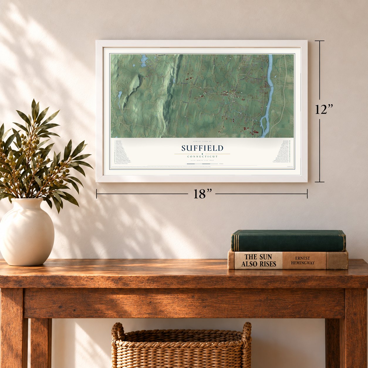

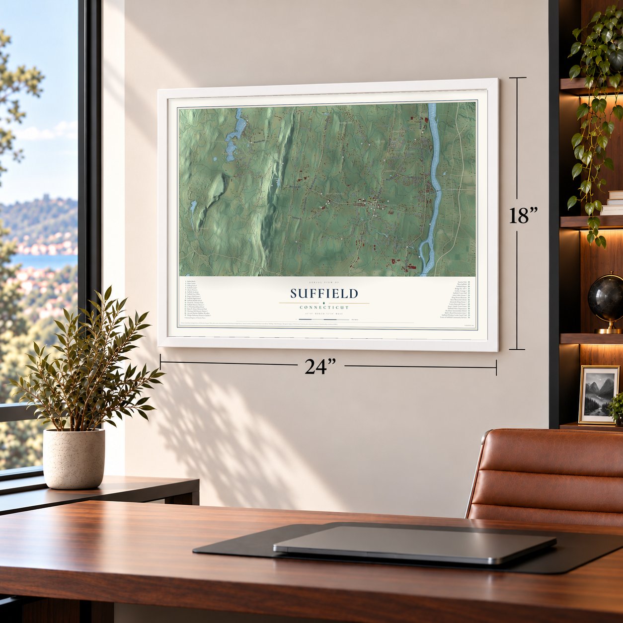

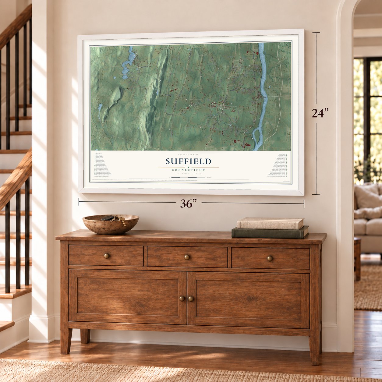
Free U.S. delivery 7 to 10 days after you order
Suffield, Connecticut Map Art
Building by building, with labeled streets and shaded relief.
12" x 18" Archival Matte Print
A Map of Home. A Work of Art.
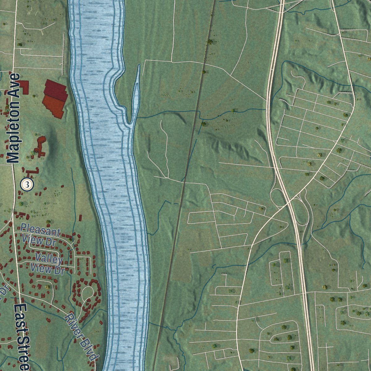
Explore Suffield, Connecticut from a whole new perspective. Created using aerial imagery and detailed geographic data, this map captures Suffield building by building, with labeled streets, familiar landmarks, and shaded topographical relief that highlights the natural contours of the landscape.
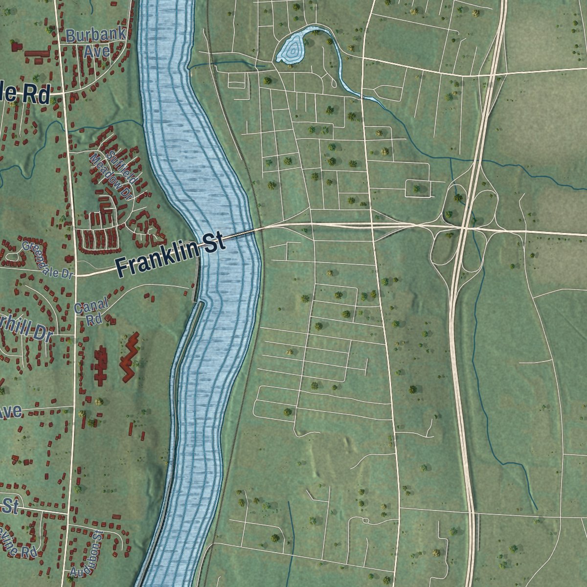
Combining modern data with the timeless character of a vintage atlas, this map is just as interesting up close as it is beautiful on the wall. Whether you grew up in Suffield, spent memorable years there, or call it home today, this unique map is a great way to celebrate a place that means something to you. Zoom in on the preview to look for your street, and then order a print to put your memories on the wall.

Three ways to hang it
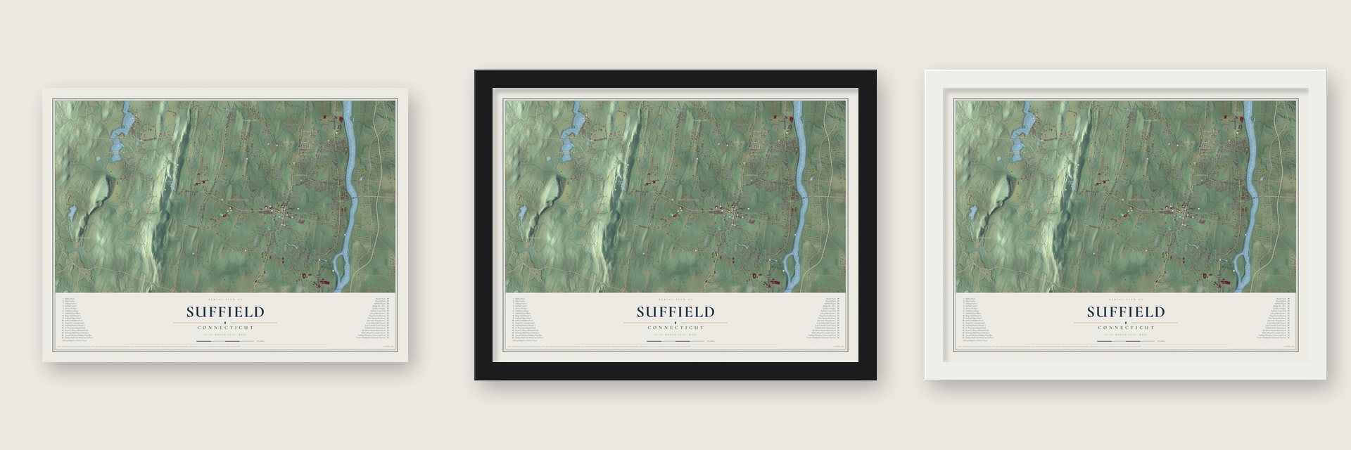
Unframed archival matte, a black wood frame or a white wood frame.
Up close
Geography Worth Displaying
This map was created using accurate cartographic data and authoritative geographic sources, including the U.S. Geological Survey (USGS) and FEMA. The map brings together terrain, waterways, roads, and building detail. The majority of the streets are labeled, houses are accurately depicted, and the topography is derived from government sources. Combining local data with carefully composed color and shading leads to this beautifully detailed Suffield artwork for your wall.
Rather than simply showing street outlines, we’ve included as many of the street names as we could reasonably fit on the map while keeping their names legible. Zoom in on the high resolution preview to see exactly what’s on the map. We truly set out to create a statement piece for anyone who loves Suffield. So whether it’s for you, or a gift for someone you love, we hope this map of Suffield brings back fond memories.
Explore the full map of Suffield, Connecticut and read about the local places it shows.
Find your street
Names on the Suffield map
Every name below is printed on this map. Look for your street, your school, the park where you played, or the pond down the road.
Places and landmarks13
- Downtown
- Ebbs Corner
- Buck Hill
- Duncaster Hill
- Glovers Hill
- Hastings Hill
- Arnold Pond
- Bromes Pond
- Sunrise Park
- Rising Corner
- West Suffield
- Halladay Corner
Show all 13 places
- Suffield Depot
Streets and roads115
- South Street
- North Main Street
- Mapleton Avenue
- Sheldon Street
- Thompsonville Road
- East Street North
- North Street
- East Street South
- Mountain Road
- North Grand Street
- South Grand Street
- Franklin Street
- North Stone Street
- Bridge Street
- South Stone Street
- Quarry Road
- River Boulevard
- Hill Street
- Ratley Road
- Phelps Road
- Copper Hill Road
- Halladay Avenue West
- Russell Avenue
- Perimeter Road
- Suffield Street
- Taintor Street
- Spruce Street
- Boston Neck Road
- Babbs Road
- Newgate Road
Show all 115 streets
- Hale Street
- Thrall Avenue
- Warnertown Road
- Hickory Street
- Griffin Road
- Remington Street
- Lake Road
- Halladay Avenue East
- Mather Street
- Austin Street
- Wisteria Lane
- Prospect Street
- Blackhill Road
- Blossom Street
- Poole Road
- Silver Creek Drive
- Harvey Lane
- Overhill Drive
- Wren Drive
- Colson Street
- Kent Avenue
- Susan Drive
- Marbern Drive
- Redstone Road
- Forest Road
- Stiles Road
- Branch Road
- First Street
- Dylan Drive
- Oak Street
- Barry Place
- South Main Street
- Fair Hill Lane
- Randall Drive
- Quail Run Road
- Halladay Drive
- Pleasant View Drive
- Farmstead Lane
- Old Farms Lane
- Lise Circle
- Meadow Wood Drive
- Spencer Street
- Heritage Trail
- Firestone Drive
- Valley View Drive
- Third Street
- Highland Ridge Drive
- Latham Lane
- Burbank Avenue
- Betty Lane
- Green Briar Drive
- Paper Street
- Lebria Road
- Pine Road
- Crane Hill Road
- Plantation Road
- Stratton Farms Road
- Devine Road
- Woods Hollow Road
- Diane Lane
- Canal Road
- Wendover Road
- La Fountain Road
- Pilgrim Lane
- Edgewood Drive
- Plantation Drive
- Limric Lane
- Clay Creek Crossing
- Suffield Meadow Drive
- Jesse Smithtown Forest Road
- High Street
- Chestnut Circle
- Greendale Drive
- Willow Creek Avenue
- Maybury
- Rosewood Drive
- Audubon Street
- Hunters Crossing
- Day Avenue
- Kildeer Lane
- Metacomet Lane
- Apple Lane
- Winter Drive
- Pond View Drive
- Cain Street
Names are listed as they appear on the printed map. Zoom into the product photos to find them.
About Suffield, Connecticut
Suffield is a town of 15,752 people in Hartford County. It sits on the Connecticut River's west bank, at the Massachusetts line. It began in 1670 as Southfield, a plantation of Massachusetts, on land that Major John Pynchon had purchased from Pampunkshat, a local leader, for thirty pounds. Ephraim Bartlett, the settlement's first child, was born on June 17, 1673.
On May 20, 1674, the settlers asked to call the place Suffield because it was the southernmost town in that country, and the Massachusetts court agreed on June 8, 1674. The first meetinghouse was built in 1680 with Rev. John Younglove as minister, and in March 1682 the town was incorporated with one hundred proprietors. Suffield remained part of Massachusetts until 1749, when its people petitioned to join Connecticut and were accepted.
“Suffield is one of the most beautiful of New England villages, and is noted for its healthfulness and quiet.”
- Spanish cigars from 1810Few people here had seen a cigar before 1800. Girls apprenticed in the trade, and James Loomis sold the cigars across New York State.
- Washington rode through in 1789By the town's account, cannon fired as his carriage came into view and thirteen young women walked out to meet him. The church couldn't hold the crowd, so the greeting moved to the great elm opposite the common's south end. That old pasture became a graded park in 1859, and in 1888 the town dedicated a Soldiers' Monument there in pouring rain.
- Soldiers from SuffieldCaptain Joseph Kellogg, once a captive at Deerfield, took command of Fort Dummer in 1726. In 1755 Phinehas Lyman of Suffield began eight campaigns at the head of Connecticut's forces. After the Lexington alarm in 1775, Elihu Kent gathered 94 men in less than a day and marched them to Boston.
- Oliver Phelps's mansionThe center of the Hatheway House on South Main Street dates to about 1762. In 1788 it was bought by Oliver Phelps, one of the partners behind the six-million-acre Phelps and Gorham Purchase in upstate New York, and he made it a mansion. In 1795 he gave it a north wing and portico, the work of Asher Benjamin. The house joined the National Register in 1975, and Connecticut Landmarks opens it from May to October.
- Dr. King's house of 1764Dr. Alexander King, a Yale graduate, built his house on South Main Street in 1764. He served in the legislature and helped Connecticut ratify the Constitution in 1788. The Alexander King House holds some of the state's best Georgian woodwork, joined the National Register in 1976, and is now a museum of the Suffield Historical Society.
Keep exploring Connecticut
Suffield is one of 376 Connecticut towns we've mapped. Every dot on the map is a print of its own.
The search covers every state, Connecticut first.
Near Suffield
Order 2 or more town maps and save 10%. Shown in the size and finish you picked above, so they hang as a set.
- Suffield Depot 12" x 18" / Archival Matte Print $39.99
- Thompsonville 12" x 18" / Archival Matte Print $39.99
- Windsor Locks 12" x 18" / Archival Matte Print $39.99


More maps nearby: Sherwood Manor, East Granby, Southwood Acres, Enfield and Salmon Brook.
The art of mapping a place
How This Map Was Made
Real places. Remarkable detail. Discover the layers that turn geographic data into a map of home.

The view from above
Aerial imagery reveals the character of the land: woodland, open fields, and the patterns of a place.

The shape of the land
Elevation data brings hills, valleys, and subtle changes in the landscape into view.

The details of home
Roads, waterways, and building footprints come together to make the map feel unmistakably local.

Geography becomes art
Considered color, shading, and typography bring the layers together in a map made for your wall.


Process illustrated with Mendon, Massachusetts. Aerial imagery: USDA NAIP. Terrain: USGS 3D Elevation Program. Map details and finished artwork: KNOWOL.
The Details
About This Print
Choose an archival matte print, or a black or white Ayous wood frame. The archival matte print is unframed.
Select your size and finish above to see the matching product image and price.
Materials & Craftsmanship
A contemporary map with the character of a classic atlas, printed on archival matte paper. Optional frames are made from Ayous wood.
Your printed map does not include the watermark shown in the full-map preview.
Shipping & Delivery
Free shipping within the United States. Every print is made to order in the USA.
Buying a gift? Add a note in your cart and we'll include it. We never put prices in the package.
Prints ship within 2 to 3 business days. Allow 7 to 10 days total from ordering for delivery. Timing may vary during holidays or periods of high order volume.
Read our shipping policy.
Returns and damaged prints
Each print is made to order. Change-of-mind refunds are not available after production.
If your print arrives damaged, misprinted or incorrect, contact support@knowol.com within 30 days of receiving it. Include your order number, photos and a description of the issue.
Read our full refund and replacement policy. For questions about your order, email support@knowol.com.