


Search for another town





Free U.S. delivery 7 to 10 days after you order
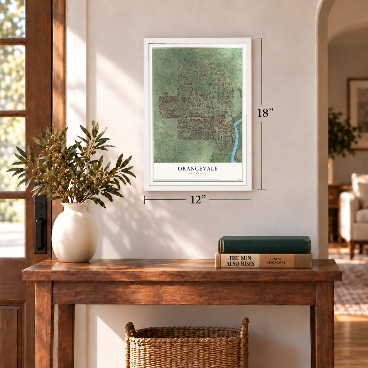
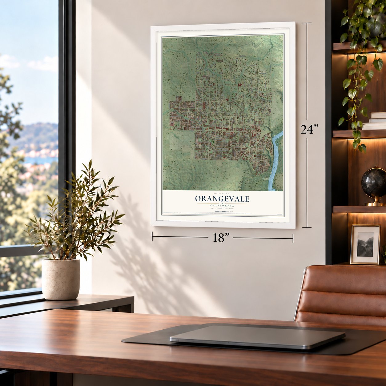
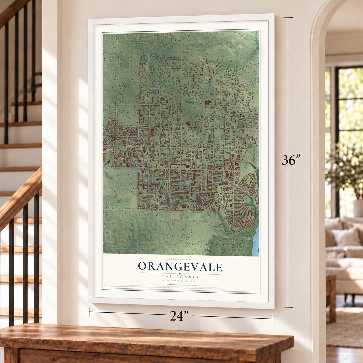
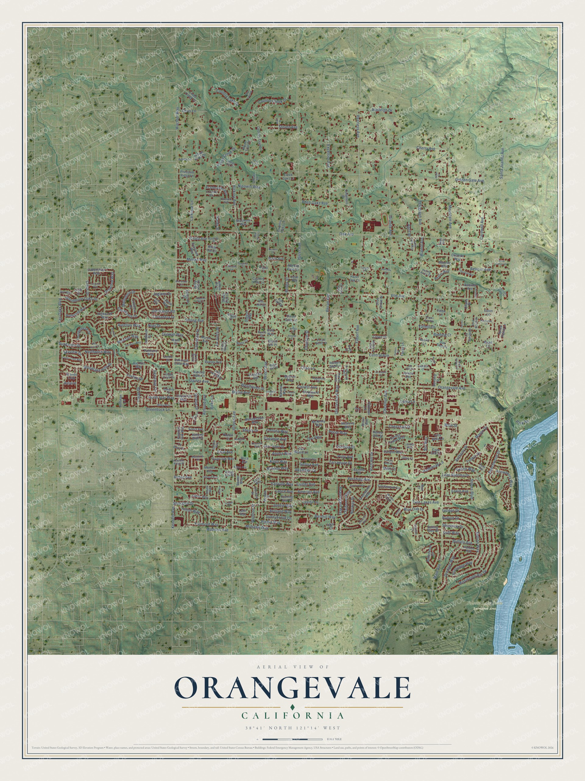
Orangevale, California Map Art
Building by building, with labeled streets and shaded relief.
12" x 18" Archival Matte Print
A Map of Home. A Work of Art.
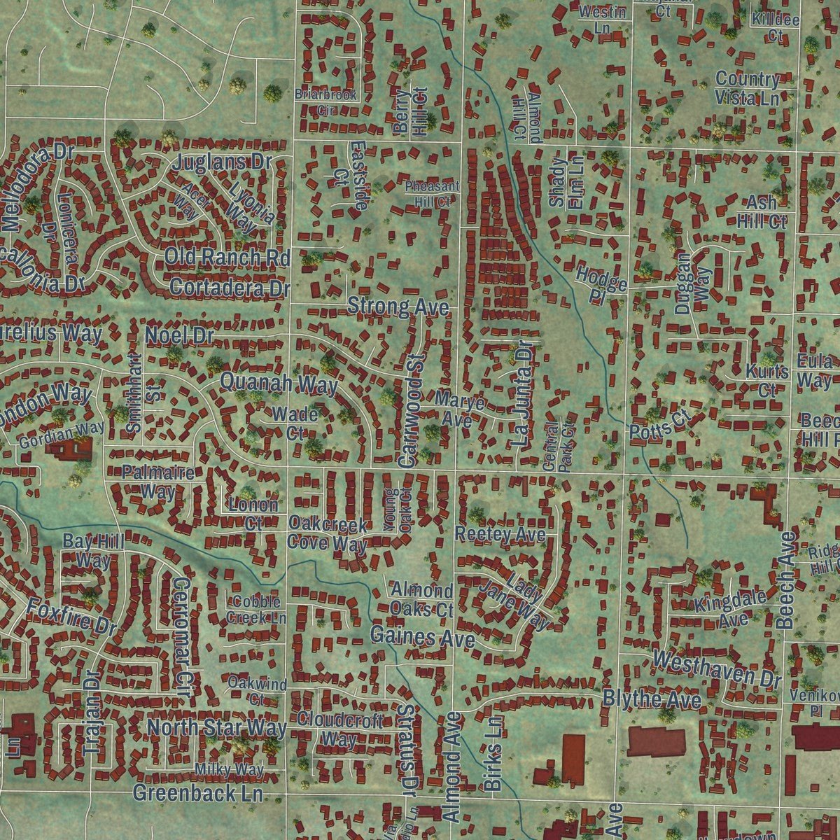
Explore Orangevale, California from a whole new perspective. Created using aerial imagery and detailed geographic data, this map captures Orangevale building by building, with labeled streets, familiar landmarks, and shaded topographical relief that highlights the natural contours of the landscape.
Combining modern data with the timeless character of a vintage atlas, this map is just as interesting up close as it is beautiful on the wall. Whether you grew up in Orangevale, spent memorable years there, or call it home today, this unique map is a great way to celebrate a place that means something to you. Zoom in on the preview to look for your street, and then order a print to put your memories on the wall.
Three ways to hang it
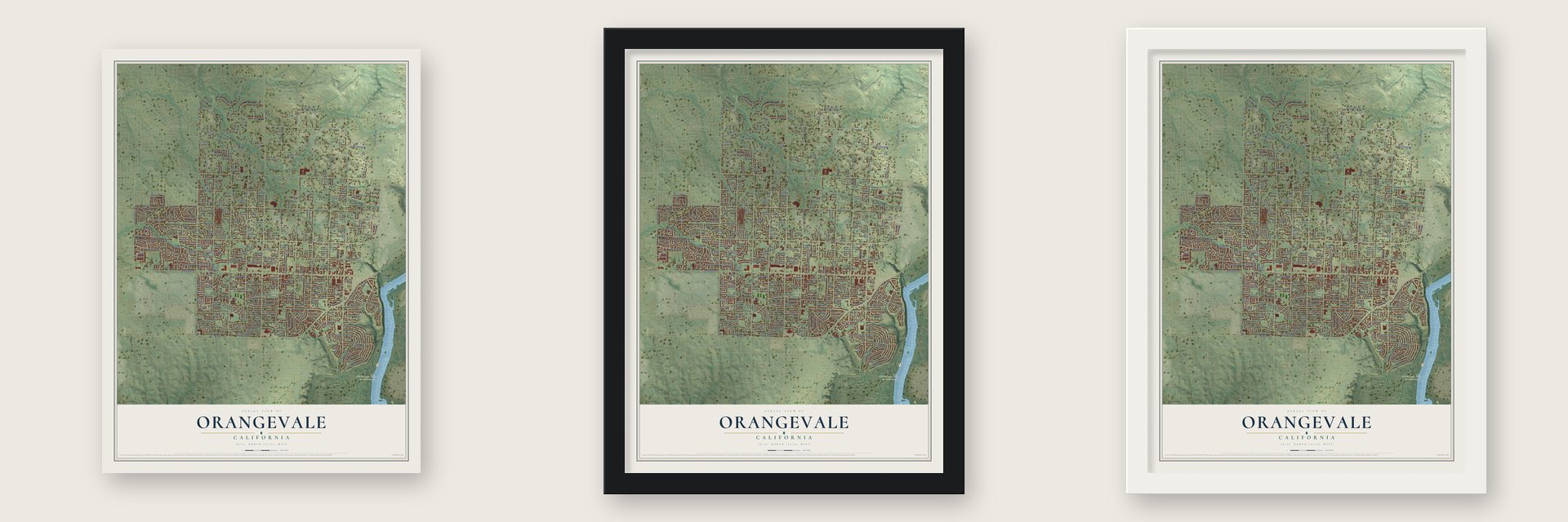
Unframed archival matte, a black wood frame or a white wood frame.
Up close
Geography Worth Displaying
This map was created using accurate cartographic data and authoritative geographic sources, including the U.S. Geological Survey and the Census Bureau. The map brings together terrain, waterways, roads, and building detail. The majority of the streets are labeled, houses are accurately depicted, and the topography is derived from government sources. Combining local data with carefully composed color and shading leads to this beautifully detailed Orangevale artwork for your wall.
Rather than simply showing street outlines, we’ve included as many of the street names as we could reasonably fit on the map while keeping their names legible. Zoom in on the high resolution preview to see exactly what’s on the map. We truly set out to create a statement piece for anyone who loves Orangevale. So whether it’s for you, or a gift for someone you love, we hope this map of Orangevale brings back fond memories.
Read the story behind this map of Orangevale, California from 2026.

Find your street
Names on the Orangevale map
Every name below is printed on this map. Look for your street, your school, the park where you played, or the pond down the road.
Places and landmarks3
- Folsom Lake State Recreation Area
- Almond Park
- Pecan Park
Streets and roads331
- Main Street
- Woodlake Hills Drive
- Skyview Drive
- Menke Way
- Greenback Lane
- Cerromar Circle
- Calvert Avenue
- Hazel Avenue
- Central Avenue
- Main Avenue
- Madison Avenue
- Oak Avenue
- Beech Avenue
- Pershing Avenue
- Kenneth Avenue
- Elm Avenue
- Walnut Avenue
- Hickory Avenue
- Santa Juanita Avenue
- Almond Avenue
- Chestnut Avenue
- Filbert Avenue
- Pecan Avenue
- Golden Gate Avenue
- Cherry Avenue
- Wachtel Way
- Orangevale Avenue
- Golden Drive
- Fair Oaks Boulevard
- Mountain Avenue
Show all 331 streets
- Illinois Avenue
- Granite Avenue
- Cardwell Avenue
- Lake Natoma Drive
- Country Creek Drive
- Woodmore Oaks Drive
- Peerless Avenue
- Blue Oak Drive
- Excelsior Avenue
- Mississippi Bar Drive
- Bullion Drive
- Bullion Way
- Trajan Drive
- Dredger Way
- Indian Creek Drive
- Beauregard Way
- Sheraton Drive
- Beachwood Drive
- Vallejo Drive
- Rich Hill Drive
- Piedra Way
- Jonnie Way
- Twin Lakes Avenue
- Fairmont Way
- Gaines Avenue
- Escallonia Drive
- Mohawk Way
- Buffalo Avenue
- Snowberry Way
- Old Orchard Way
- Foxfire Drive
- Tonkin Drive
- Eden Oaks Avenue
- Terramore Drive
- Noel Drive
- Barrhill Way
- Old Ranch Road
- Juglans Drive
- Leedy Lane
- Blythe Avenue
- Fortuna Way
- Northwind Way
- Norway Drive
- Beacon Avenue
- Quanah Way
- Telegraph Avenue
- Pecor Way
- Country Lake Drive
- Stratus Drive
- Shumway Drive
- Hadleigh Drive
- Larkspur Lane
- Loma Lane
- Hallenoak Lane
- Fairvale Way
- Hilton Way
- Strong Avenue
- Anthony Drive
- Aksarben Drive
- Drywood Way
- Britland Way
- Clarissa Drive
- Sunnybrook Lane
- Westhaven Drive
- Polly Avenue
- Nimbus Way
- Nipawin Way
- Mellodora Drive
- Aurelius Way
- Steven Avenue
- Sundance Drive
- Oro Way
- Anona Way
- Kona Way
- Carrwood Street
- Cross Drive
- Sherry Drive
- Chestwall Street
- Chris Lane
- Coan Lane
- Cortadera Drive
- Dalton Way
- Claiborne Way
- Biruta Avenue
- Custer Avenue
- Snipes Boulevard
- Lance Avenue
- Amerigo Avenue
- Sirl Way
- Canarsie Avenue
- North Star Way
- Flintridge Way
- La Junta Drive
- Genoa Avenue
- Mondon Way
- Chastain Street
- Waldron Street
- Binning Court
- Erwin Avenue
- Bobby Street
- Char Avenue
- Almaz Avenue
- Drift Way
- Margo Drive
- Mott Court
- Hardy Street
- Birks Lane
- April Street
- Astaire
- Park Road
- Country Trail Drive
- Butterwood Circle
- Brando Loop
- Highwood Way
- Thunderhead Circle
- Castlemont Circle
- Rock Canyon Way
- Ruthwood Way
- Glori Dawn Drive
- Kenneth Oak Way
- Country Oaks Lane
- Caballero Drive
- El Sobrante Way
- McNeely Way
- Ottomon Way
- Garden Towne Way
- Creek Oaks Lane
- Baxter Way
- Duggan Way
- Oakenshaw Way
- Corinne Drive
- Lonicera Drive
- Greenacres Way
- Quail Oak Way
- Sprow Ranch Lane
- Woodward Way
- Bay Hill Way
- Cloudcroft Way
- Suncreek Way
- Wyatt Lane
- Almond View Court
- Kingdale Avenue
- Marye Avenue
- Indian Knoll Drive
- Oakcreek Cove Way
- Lady Jane Way
- Smithhart Street
- Mellowdawn Way
- Lyonia Way
- Reetey Avenue
- Nevins Way
- Kon Tiki Drive
- Palmaire Way
- Linda Creek Court
- Jaytee Way
- Olive Grove Drive
- Lonon Court
- Eastside Court
- Deanna Avenue
- Pheasant Ridge Lane
- Hoffman Lane
- Tilton Lane
- Westeria Way
- Shoshone Way
- Almond Oaks Court
- Le Parc Court
- Leever Lane
- Rolling Glen Court
- Sonia Avenue
- Ydra Court
- Mavis Avenue
- Latin Way
- Hidden Glen Lane
- Myhren Way
- Country Vista Lane
- Arlene Avenue
- Crown Street
- Fiesta Lane
- Eula Way
- Brazil Avenue
- Boca Avenue
- Naranja Way
- Monica Avenue
- Cape Cod Lane
- Benning Street
- Villa Bella Lane
- Manette Way
- Hazel Oak Court
- Van Moore Lane
- Amna Lane
- Nostaw Street
- La Siesta Drive
- Oak Tree Lane
- Palmaya Lane
- Rocky Lane
- Dixon Oaks Lane
- Beech Hill Place
- Potts Court
- Blaze Trail Court
- Kurts Court
- Evening Star Court
- Shady Elm Lane
- Suzette Court
- Ohana Place
- Almond Bluff Court
- Ultra Court
- Thelen Court
- Renee Ann Street
- Berry Hill Court
- Leue Avenue
- White Owl Court
- Wade Court
- Ash Hill Court
- Craft Court
- Hodge Place
- Poni Court
- Eaton Lane
- Mist Court
- Cape Windham Place
- Green Top Way
- Plantain Circle
- Mandorla Circle
- Dahboy Way
- Milky Way
- Gordian Way
- Dart Way
- Acer Way
- Richdale Way
- Indian Hill Court
- Patte Way
- Kevmich Way
- Kenneth Ridge Place
- Taajanar Court
- Saint John Way
- Stehlin Avenue
- Baton Avenue
- Cobble Creek Lane
- Rose Acres Road
- Ridge Hill Court
- Pardillo Avenue
- Killdee Court
- Augustine Court
- Rock Ranch Drive
- Paddock Court
- Shadle Way
- Oakwind Court
- Jan Dra Court
- Kauhale Place
- Pecan Ranch Court
- Village Park Court
- High Sierra Court
- Steve Way
- Venikov Place
- Rolling Acres Court
- Almond Hill Court
- Central Park Court
- Westin Lane
- Young Oak Court
- Tapper Lane
- Linda Lane
- Airhill Way
- Davlil Way
- Briarbrook Circle
- Crossoak Way
- Ivy League Circle
- Rotherfeild Way
- Kendrick Way
- Turnbull Circle
- Chauncey Way
- Golden Crest Way
- Petite Creek Drive
- La Paenda Way
- Tamara Jean Road
- Oakmore Way
- Lazy Trail Court
- Pheasant Creek Place
- Serenity Lane
- Red Wing Court
- Via Presidio Lane
- Millie Street
- Pemberley Lane
- Cerezo Drive
- Brooks Ann Way
- Windshire Lane
- Bella Palazzo Court
- South Canyon Court
- Anice Street
- Hunters Road
- Madison Green Lane
- Pheasant Hill Court
- Nola Place
- War Horse Court
- Fir Tree Lane
- Mirwood Court
- Nickens Court
- Memory Lane
- Pittman Lane
- Brome Court
- Casten Lane
- Noemi Lane
- Kezar Street
Names are listed as they appear on the printed map. Zoom into the product photos to find them.
About Orangevale, California
Orangevale is a community of 35,569 people in Sacramento County, set on rolling hills at the foot of the Sierra Nevada. The land was once part of Rancho San Juan, a Mexican land grant made in 1844, and Maidu people had worn trails across it many years before. Oak trees covered much of the ground, and a few of them still grow in Orangevale Park.
In 1887 a group of Sacramento's leading businessmen formed the Orange Vale Colonization Company to sell the land as a farm colony. The new owners planted orange groves and olive orchards, and the settlement went by the name Orange Vale Colony. It stayed rural for years and grew into the Orangevale of today.
“When manhood brought the possibilities of a change into the life of Mr. Andrew he sought the opportunities of the vast west and during 1889 arrived in California, where he became one of the very first settlers in the Orangevale colony.”
- Olive trees from the colonyOlive orchards once grew here beside the orange groves. Some of the original trees are still standing along Chestnut, Orangevale, Main and Walnut Avenues.
- Olympic gold in 2008Mary Whipple of Orangevale steered and called the strokes for the American women's eight. Her boat took silver at the 2004 Summer Olympics, then won gold at the 2008 Summer Olympics.
- Two motocross titlesSteve Lamson, a former professional motocross racer from Orangevale, won the AMA motocross national championship in 1995 and again in 1996.
Keep exploring California
Orangevale is one of 1,990 California towns we've mapped. Every dot on the map is a print of its own.
The search covers every state, California first.
Near Orangevale
Order 2 or more town maps and save 10%. Shown in the size and finish you picked above, so they hang as a set.
- Fair Oaks 12" x 18" / Archival Matte Print $39.99
- Citrus Heights 12" x 18" / Archival Matte Print $39.99
- Gold River 12" x 18" / Archival Matte Print $39.99


More maps nearby: Folsom, Granite Bay, Foothill Farms, Carmichael and Roseville.
The art of mapping a place
How This Map Was Made
Real places. Remarkable detail. Discover the layers that turn geographic data into a map of home.

The view from above
Aerial imagery reveals the character of the land: woodland, open fields, and the patterns of a place.

The shape of the land
Elevation data brings hills, valleys, and subtle changes in the landscape into view.

The details of home
Roads, waterways, and building footprints come together to make the map feel unmistakably local.

Geography becomes art
Considered color, shading, and typography bring the layers together in a map made for your wall.


Process illustrated with Mendon, Massachusetts. Aerial imagery: USDA NAIP. Terrain: USGS 3D Elevation Program. Map details and finished artwork: KNOWOL.
The Details
About This Print
Choose an archival matte print, or a black or white Ayous wood frame. The archival matte print is unframed.
Select your size and finish above to see the matching product image and price.
Materials & Craftsmanship
A contemporary map with the character of a classic atlas, printed on archival matte paper. Optional frames are made from Ayous wood.
Your printed map does not include the watermark shown in the full-map preview.
Shipping & Delivery
Free shipping within the United States. Every print is made to order in the USA.
Buying a gift? Add a note in your cart and we'll include it. We never put prices in the package.
Prints ship within 2 to 3 business days. Allow 7 to 10 days total from ordering for delivery. Timing may vary during holidays or periods of high order volume.
Read our shipping policy.
Returns and damaged prints
Each print is made to order. Change-of-mind refunds are not available after production.
If your print arrives damaged, misprinted or incorrect, contact support@knowol.com within 30 days of receiving it. Include your order number, photos and a description of the issue.
Read our full refund and replacement policy. For questions about your order, email support@knowol.com.